Country:
 City:
City:


(S/E) Leave Survilliers Fosses station and turn right onto Place de la Liberté. At the roundabout, cross Avenue Henri-Barbusse (using the pedestrian crossings) and turn left onto Avenue de Beaumont. Shortly afterwards, you’ll find a footpath on your left that runs alongside the road. Follow this path straight on when it branches off from the roads (the main road turns left and Avenue de Beaumont continues straight on, with a sign pointing towards the secondary school).
(1) Follow the path which passes in front of the school entrance, on the right. Carry on and turn into thefirst road on the right, just before the stadium. Then turn left until you come to a path branching off to the right (due north) which crosses the fields towards the forest (Ile-de-France/Hautes-de-France border).
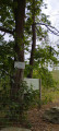
(2) Take this path, then carry on through the woodland. After 400 m, you’ll come to a main track; carry on for a further 200 m until you reach a clearing (there are white markings on the trees). Just before a large tree, a path branches off to the left (when I was there, the entrance was hidden by branches).
(3) Follow this path westwards. You’ll first cross a wide dirt track, then a narrow path, before finally coming to another fairly wide path.
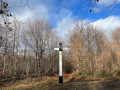
(4) Turn right onto the track and go straight on at the crossroads (signpost 535). The white markings end here. After 300 m, take a track veering slightly to the right, then continue for another 300 m until you reach a crossroads.
(5) Turn slightly left and carry on straight ahead. At one point, yellow markings appear. Keep going straight ahead until you reach a crossroads where you’ll findGR® markings (white and red).
(6) Turn left, heading south-west. The markings are white-red and yellow. There is also a symbol for the Way of St James at the start of the path (this is the Chemin de l’Estelle). Continue straight on, following the edge of the forest to its southern end.
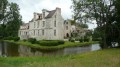
(7) Leave the signposted path heading south and turn right onto the main track that runs along the edge of the forest. Depending on the season, you’ll soon spot Hérivaux Castle on your right through the trees.
(8) The road, now tarmac, turns left in front of the castle entrance and runs alongside the farm buildings. At a junction, turn right and follow the road through the hamlet of La Biche. As you leave the hamlet, the tarmac gives way to a dirt track. Carry on to a crossroads where the red-and-white and yellow markings reappear, coming from the right.
(9) Carry on straight ahead, still following the white-and-red markings, along the edge of the forest. The dirt track turns 90° to the left and continues straight ahead. It then becomes a footpath for a few hundred metres before joining another dirt track. Carry on to a Fork in the road, marked with a sign for 551 (you can see it if you turn round).
(10) Leave the white and red markings, which continue straight on, and turn onto a sandy track that climbs gently to the right (yellow markings). The track is narrow in places and rutted by horses.
At the fork in the road, take the path on the left which climbs steeply, still marked in yellow, and this will take you to the Poteau des Brûlis crossroads, with its … post.
(11) Leave the yellow markings and continue straight on. After a while, the path will begin to descend, winding its way down. At the bottom of the slope, turn right until you reach a sandy path with rocks (on the OpenStreetMap, this final section is poorly marked).
(12) Take the sandy path to the right and continue straight on. The path alternates between ascents and descents for about 700 m, passing the Chaumontel crossroads.
(13) At marker 501 (Carrefour d’Orléans), take the path on the right which descends diagonally. At the first Fork in the road, take the left-hand path downhill and, at the next Fork in the road, take the right-hand path. Then follow a sandy path for 100 m as it descends to the left through the pine trees.
(14) Take a small path that descends to the right towards the south and follow it until you come to a stream and a path (Carrefour des Closeaux). Take the path on the left (east) and continue until you cross a small tarmac road (Carrefour de la Ménagerie).
(15) Carry on straight ahead, following the red and white markings again until the end of the walk. After a climb, you’ll come to a junction (Carrefour des Hautes Coutumes).
(16) Carry on straight ahead, still following the red and white markings, until you reach the Carrefour de Luzarches.
(6) Turn left towards the north and carry on until you reach a crossroads with a Fork in the road (Carrefour des Moines).
(17) Take the right-hand Fork in the road until you come to a very wide path (Carrefour du Chêne Sec). Turn left and carry on until you see a tarmac road (D118).
(18) Just before a barrier, follow the path that branches off to the right and runs parallel to the road. It leads to the station car park. An underpass takes you to the station ticket office, which is on the other side of the tracks (E).

 Visorando Member
 Difficult
  AONB
AONB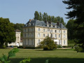
 Easy
Easy