Fosses-Bellefontaine in the Pays de France

On either side of the Ysieux valley, from sun to shade, from fields to villages.

Details

799885
Creation:
Last update:
Last review:
  • Walking
    Activity: Walking
  • ↔
    Distance: 8.15 mi
  • ◔
    Average duration: 4h 05 
  • ▲
    Difficulty: Moderate

  • ⚐
    Back to start: Yes
  • ↗
    Ascent: + 377 ft
  • ↘
    Descent: - 348 ft

  • ▲
    Highest point: 446 ft
  • ▼
    Lowest point: 200 ft
  • ⚐ Country: France
  • ⚐ City: Fosses (95470)
  • ⚑
    Start/End: N 49.099799° / E 2.525103°
  • ❏
    IGN map(s): Ref. 2413OT
  • Hour-by-hour weather

Description of the walk

Starting points: Fosses station or the football ground car park (water tower).

(S/E) With your back to the station, turn right and walk alongside the buildings. Cross the junction and head towards the sign for the ‘Oise-Pays de France Regional Nature Park’. Continue along the avenue past the row of trees. After about 650 metres, cross the avenue at the pedestrian crossing just before the bend. Cross the road opposite and take the path that runs along the right-hand side of the water tower. At the end of the path, cross the car park, keeping to the right. Continue along the fence of the football pitches.

(1) When you reach the end of the fencing, turn left and head downhill. When you reach the road (D922), turn right (yellow and red markings) and cross at the pedestrian crossing. Continue along the Grande Rue and walk past Saint-Etienne Church.

(2) At the traffic lights, turn left onto Rue de la Source.

(3) As you come out of the bend, turn right (Val d’Oise hiking sign) and head uphill through the woodland. Follow the yellow markings. As you leave the woodland, at the junction, turn left and head south along a path through the fields.

(4) At the crossroads (after a small hedge), turn right and head down towards the woods. Ignore the paths branching off to the right.

(5) At the Fork in the road just beyond the woods, turn right and head downhill. Turn left to follow the path. When you reach the houses, turn straight on into Rue de la Source (note the spring on the left).

(6) At the next junction, veer right and enter Bellefontaine. At the small square by the shelter, turn right, continue along the street, cross the small bridge and carry on straight ahead. At the next junction, turn right onto the D922 and cross the road.

(7) Take the wide path (car park) leading off to the left.

(8) At the next junction, turn left uphill. At the junction on the edge of the woods, go straight on uphill. Continue along the path through the fields.

(9) At the junction, turn right. At each subsequent junction, carry on straight ahead towards the east.

(1) Back at the football pitches car park, retrace your steps along the route you took on the way there to reach the station (S/E).


Waypoints

  1. S/E : mi 0 - alt. 377 ft - Fosses RER station
  2. 1 : mi 1.13 - alt. 384 ft - Carrefour of the circular route – Football pitches
  3. 2 : mi 2.17 - alt. 249 ft - Traffic lights – Rue de la Source
  4. 3 : mi 2.38 - alt. 253 ft - On the outskirts of the village
  5. 4 : mi 3.27 - alt. 440 ft - A crossroads in the middle of the fields
  6. 5 : mi 3.93 - alt. 325 ft - Fork in the road
  7. 6 : mi 4.48 - alt. 226 ft - Carrefour - Au-delà-de-l'Eau
  8. 7 : mi 4.86 - alt. 223 ft - To leave Bellefontaine
  9. 8 : mi 5.03 - alt. 299 ft - Crossroads
  10. 9 : mi 5.52 - alt. 371 ft - Crossroads
  11. S/E : mi 8.16 - alt. 377 ft - Fosses RER station

Worth a visit

The Ysieux Valley:
The river was harnessed very early on, particularly by the monks of the abbeys of Hérivaux and Royaumont, to
generate power and supply domestic water. In the valley, watercress beds appeared in the late 19th century, making use of the numerous springs that feed the Ysieux. Unfortunately, they disappeared
during the second half of the 20th century and now lie fallow. The plateaus have always been devoted to cereal farming. Recently, a significant part of the agricultural land in Bellefontaine and Le Plessis-Luzarches has been converted into a golf course. On the south-facing slopes, patches of dry grassland bear witness to the area’s former pastoral traditions. In spring, a variety of orchids bloom there.

(2) The church at Fosses
Old Fosses is nestled at the bottom of a valley carved out by the River Ysieux. Excavations carried out over several
years around the Church of Saint-Étienne have confirmed the extremely ancient origins of human settlement in this valley floor
valley. Indeed, as early as the early Middle Ages (9th century), a thriving pottery industry developed, supplying the whole of Île-de-France with its elaborate wares, thereby enriching local craftsmen and traders. The quality of the church’s architecture and sculptures (rebuilt in the 12th century) remains clear evidence of this, as does the 14th-century reliquary – an exceptional small interior stone structure with flamboyant decoration, which once housed the remains of Saint Stephen

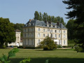
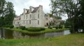
(7) Bellefontaine Castle.
Built by Barnabé Maynard, an adviser to King Louis XIV, it underwent various alterations and became a retirement home in the 20th century. Its dovecote, stables, grounds and reservoir nevertheless give a good idea of the opulence of the lords of yesteryear.
Water is ever-present at Bellefontaine: a spring, a wash house, a pond and the River Ysieux surround the village.

Reviews and comments

4.2 / 5
Based on 4 reviews

Reliability of the description
4 / 5
Ease of following the route
4.3 / 5
Route interest
4.3 / 5
ALouB
ALouB

Overall rating : 4 / 5

Date of your route : Jan 13, 2026
Reliability of the description : ★★★★☆ Good
Ease of following the route : ★★★★☆ Good
Route interest : ★★★★☆ Good
Very busy route : No

A pleasant walk, not too far from Paris if you're coming from the north-western suburbs.
give the name of the first avenue to take after crossing the crossroads.

Machine-translated

jpakh
jpakh

Hello. Looking at it that way, that’s certainly true! But for those who might want to ‘start’ elsewhere, it might also be useful to mention that there’s a free car park from which they can set off. Thank you for your comment.
Best regards from me too. JP

Machine-translated

Netra
Netra ★

Hello jpakh, and thank you for your comments.

Your first comment is: ‘Starting from the station isn’t really worth it (...).’ Wouldn’t the point be to give public transport users the chance to go on this walk?

Machine-translated

jpakh
jpakh

Overall rating : 3.7 / 5

Date of your route : Jun 21, 2020
Reliability of the description : ★★★☆☆ Average
Ease of following the route : ★★★★☆ Good
Route interest : ★★★★☆ Good
Very busy route : No

Hello. Starting from the station isn’t really worth it and there aren’t any proper parking options nearby. It’s easier to start from the LARGE car park on Avenue de Beaumont, very close to the roundabout near the station.
When you arrive ‘opposite’ the water tower, don’t take the little lane that runs to its left: it will lead you into the town and, more importantly, not to point 1. And after that… it’s a real struggle to get to point 2!!! Whereas if you go TO THE RIGHT of the water tower, you’ll easily reach point 1.
Another problem… for us, at least. Before reaching point 6, it says: ‘At the houses, turn into Rue de la Source opposite.’ Can you explain to me how we’re supposed to ‘find ourselves back on’ this Rue de la Source when we left ‘Rue de la Source’ at point 2???
Otherwise, it’s a lovely route, with some lovely stretches through the forest, and it ends at point 9 by the car park with a beautiful view of the whole area.

Machine-translated

garz
garz

Overall rating : 4.7 / 5

Date of your route : May 01, 2018
Reliability of the description : ★★★★★ Very good
Ease of following the route : ★★★★★ Very good
Route interest : ★★★★☆ Good

A practical walk that’s easy to get to from Paris. The villages (Vieux Fosses, Bellefontaine) are lovely. Between points 8 and 9, it’s a bit tricky to spot the path at the junction with the dirt track, especially as the vegetation is really growing at the moment. The path winds its way along the embankment through coppice woodland to point 9.

Machine-translated

THIEFFAINE Jean-Pierre

The route is suitable for mountain bikes.

Machine-translated

romainbretoneiche
romainbretoneiche

Hello, I was wondering if this walk is suitable for cycling.
Thank you in advance for your reply.

Machine-translated

THIEFFAINE Jean-Pierre

Overall rating : 4.3 / 5

Date of your route : Feb 01, 2018
Reliability of the description : ★★★★☆ Good
Ease of following the route : ★★★★☆ Good
Route interest : ★★★★★ Very good

At the start, the route description and the route map do not match (one takes you to the left of the water tower; the other to the right); however, after 500 metres, you end up in the same place.
Points of interest along the route should be highlighted:
- in FOSSES, the Church of Saint Etienne and Saint Vit
- in BELLEFONTAINE: the Pierre Longue dolmen; the spring on Rue de la Source; the boundary stone from 1850 and the castle with its pond on Rue des Sablons; the wash house on Ruelle du Lavoir; Saint Nicolas Church on Rue du Tourneveau; and the castle’s dovecote on the RD 922.
To reach the Pierre Longue dolmen, there is no path; between 4 and 5, just before the Bois Forest (the first wood on the right of the track), simply follow the edge of the wood for about 400 metres and the dolmen is visible from the field.

On the way back to the water tower, you can turn right onto Avenue du Mesnil to reach Avenue Henri Barbusse, which leads to the station. You’ll pass an old Art Deco-style school on the left-hand side of the avenue.

Machine-translated

Other walks in the area

For more walks, use our search engine .

The GPS track and description are the property of this route's author. Please do not copy them without permission.