From Saint-Erme to Montaigu

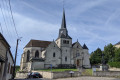
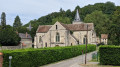
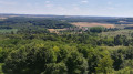
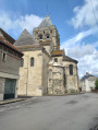
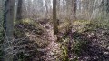
A walk through fields and woods on very quiet paths. Pretty churches, including the one at the start in Saint-Erme Ville.
This walk combines several signposted paths.

Details

3702317
Creation:
Last update:
Last review:
  • Walking
    Activity: Walking
  • ↔
    Distance: 6.65 mi
  • ◔
    Average duration: 3h 35 
  • ▲
    Difficulty: Moderate

  • ⚐
    Back to start: Yes
  • ↗
    Ascent: + 633 ft
  • ↘
    Descent: - 636 ft

  • ▲
    Highest point: 679 ft
  • ▼
    Lowest point: 338 ft

Photos

Description of the walk

Parking in front of the church in Saint-Erme Ville.

(S/E) Leave the church on your left and take the road leading uphill towards Festieux (Rue Haute). After the huge building, take the path on the right which rejoins the road and leads to a crossroads.

(1) Take the path branching off to the right towards a concrete pole and, at the edge of the forest, turn left to keep the forest on your right.

(2) At the crossroads (elevation 201), go straight on into the forest.

(3) After passing a few lovely houses, turn right onto the unmarked path and walk alongside the football pitch on your left.

(4) Turn right and follow this main path towards Montaigu.

(5) Leave Montaigu on your left and continue along Rue du Berceau. As you leave the village, keep heading in this main direction. The road turns into a path and climbs quite steeply for a few hundred metres. Continue south-east.

(6) Head off to the left, then take a small path that veers slightly to the right and leads downhill, following the yellow markings.

(7) Take a hairpin bend to the left. The markings are still visible, as are a few sports facilities

(8) Turn right, taking a hairpin bend onto Chemin du Fond de Restrons, which leads onto Rue des Annois.

(9) When you reach the road (D90), turn right. After the school and before the post office, turn left. At Rue du Marronnier, turn right and then immediately left onto Rue Saint-Paul.

(10) At the main road, turn right then left towards Ferme Saint-Paul. Before reaching the farm, veer to the right. At the crossroads, head towards Saint-Erme to reach the church (S/E).

Waypoints

  1. S/E : mi 0 - alt. 443 ft - Church in Saint-Erme town
  2. 1 : mi 0.46 - alt. 640 ft - Road/path junction at elevation 195
  3. 2 : mi 1.01 - alt. 659 ft - Crossroads
  4. 3 : mi 1.71 - alt. 374 ft - La Rosière; football pitch
  5. 4 : mi 1.94 - alt. 384 ft - La Chambrette crossroads
  6. 5 : mi 2.79 - alt. 404 ft - Montaigu
  7. 6 : mi 3.76 - alt. 633 ft - T-junction after a steep slope.
  8. 7 : mi 4.27 - alt. 397 ft - Hairpin bend
  9. 8 : mi 4.81 - alt. 381 ft - Junction with Chemin du Fond de Restrons
  10. 9 : mi 5.11 - alt. 341 ft - D90
  11. 10 : mi 5.65 - alt. 394 ft - Rue du Moulin la Hotte
  12. S/E : mi 6.65 - alt. 446 ft - Church in Saint-Erme town

Notes

Saint-Erme town. Not to be confused with the commune of Saint-Erme-Outre-et-Ramecourt.
A route on your GPS or mobile phone is essential as some paths are not marked.
Wear suitable footwear and use walking poles.

Reviews and comments

5 / 5
Based on 2 reviews

Reliability of the description
5 / 5
Ease of following the route
5 / 5
Route interest
5 / 5
User 12574041

Overall rating : 5 / 5

Date of your route : Jul 16, 2025
Reliability of the description : ★★★★★ Very good
Ease of following the route : ★★★★★ Very good
Route interest : ★★★★★ Very good
Very busy route : No

Thank you for this very varied, thoroughly enjoyable and well-signposted route… my group really enjoyed the walk.

Machine-translated

marc-educ-pop
marc-educ-pop

Overall rating : 5 / 5

Date of your route : Aug 15, 2021
Reliability of the description : ★★★★★ Very good
Ease of following the route : ★★★★★ Very good
Route interest : ★★★★★ Very good
Very busy route : No

Thank you for this varied, well-signposted route with well-maintained paths! I’m sending some photos to show how much I enjoyed it...
Setting off in the morning (10.30 am), I decided to walk the route in the opposite direction to the one you suggest:
This meant # I could stay in the shade during the hottest part of this exceptionally beautiful day. # I had the sun on my back for most of the time. # I found the climbs easier to manage...
Thanks again!!!

Machine-translated

Other walks in the area

For more walks, use our search engine .

The GPS track and description are the property of this route's author. Please do not copy them without permission.