Country:
 City:
City:


Starting point and access: Saint-Chéron railway station.
- RER – Line C, on the section between Paris and Dourdan.
Take the Rue des Herbages exit on the side of platform 2 (Dourdan to Paris direction). If arriving from the opposite direction (platform 1), use the underpass.
No signposting
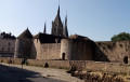
(S) On leaving the station, cross Rue des Herbages and turn into Ruelle Pajadon, a cobbled path that leads uphill. Cross a street, pass a chicane, continue uphill along the path and ignore another path on the left. At the end, cross Rue Lamoignon then diagonally across Place Edmond Vian towards the left. Cross a street, climb a flight of steps and arrive at the foot of the town hall. Leave it on your right, turn left and go through a metal gate (note the church on your left).
Yellow markings
(1) You’ll come out onto a street; follow it to the right as it climbs. When you reach a nursery school, cross the street at the pedestrian crossing and take a narrow path, leaving a music school on your left. At the end, follow a road to the right and pass the war memorial (ignore the Yellow Cross; twoPR® routes split here).
Red and white + yellow + blue markings
(2) Turn into thefirst road on the right, Rue Henri Louin. After about fifty metres, ignore two roads on the right and keep to the left. At the end of the tarmac, continue along a path, ignore a flight of steps and walk alongside the cemetery situated on the right, higher up. Cross a tarmac road and continue along the path opposite. Then cross the D132 at the pedestrian crossing (ignore an arrow indicating a right turn) and continue straight ahead along a stony track. The track gives way to a path that climbs gently through woodland (ignore any side tracks).
(3) At a T-junction, turn left. Keep heading west-south-west, stay on the wide, signposted path marked with double-sided yellow signs, and ignore the paths branching off to the sides. In places, parallel paths allow you to bypass wet sections. After about 1.2 km, look out for a path coming from the left at an acute angle and, barely a hundred metres further on, you’ll reach another junction (a small tree opposite bearing a blue cross and a Yellow Cross).
Yellow markings
(4) Turn left here. After a flat stretch, head down into a sunken track. At the bottom, leave the woodland, ignore a path on the left, and continue straight ahead along a track that climbs between two fields and passes under a power line. Reach the edge of a woodland and note a small information sign marked ‘Route No. 1’.
(5) Take thefirst path on the right at an acute angle, before the sign, and enter the woodland. Climb gently, then, on level ground, alternate between sections within the woodland and along the edge. Walk alongside a field on your right and reach a junction (beautiful oak tree).
(6) Turn left here and enter the woodland. At a fork in the road, veer right and head down a slightly sloping sunken track. Further on, follow a fence on your left and continue downhill.
(7) At a three-way junction, turn right (ignore an arrow indicating a left turn; twoPR® routes split here). Walk alongside the railway line situated below on the left. Come out onto a small road and follow it to the left. Shortly afterwards, when the road bends left to cross the railway line, carry on straight ahead along a path. Follow the railway line on your left until you reach Sermaise station (a gate gives access to the platforms).
Unmarked
(8) Then turn right and follow a grassy path that climbs towards a copse between the fields. Continue along the edge of the copse and follow a field on your right. When the edge of the field veers to the right, turn left onto the main path and descend briefly into a copse. Carry on along a grassy path between the fields. Ignore a fork to the right (not shown on the map) and head down towards the railway line, keeping to the right of a fence. Walk alongside the railway line on your left again and you’ll soon reach a junction (with a railway bridge on the left).
(9) Then follow a track to the right, passing between a dog training ground on the left and private property on the right. Carry on along an uphill path, keeping to the right-hand side of a fence. At the corner of the fence, continue along the edge of the woodland on the left and ignore a turning on the left. Further on, enter the woodland and turn left along the path. Leave the woodland, pass under a power line and continue on level ground alongside a field on your right. You’ll come out onto a small road; follow it to the left (there’s a lovely farmhouse on the right). Shortly after passing the sign marking the entrance to Beauvais, turn right onto a path and walk alongside the houses on your left.
Yellow markings
(10) You’ll come out onto a small road; follow it to the right. When you reach the farmhouse seen earlier, turn left. Pass a shed on the right and continue straight on along a path overgrown with grass (as of May 2023). Walk alongside fields on your right and, on your left, alternate between fields, hedgerows and woodland. You’ll come to a T-junction with a stony path.
(11) Follow the track to the left and, at the Fork in the road that appears shortly afterwards, turn right onto a grassy track that starts between two yellow double-sided signs. After a short stretch through a patch of woodland, continue between the fields along the track, which becomes less clearly marked.
No signposting
(12) At the end (signpost), turn left and enter a woodland (sign asking you to keep your dog on a lead). At a three-way fork in the road (elevation 148), take the path on the right and head down a fairly steep slope. At a three-way junction, keep left and continue downwards. Ignore a path branching off to the left and follow a fence. Emerge onto a wider track; follow it to the right and ignore a path branching off to the left. Walk alongside fenced-in gardens. Return to the railway line and walk alongside it on your left-hand side until you reach a bridge spanning it.
(13) Turn left onto the bridge over the railway line and continue along the road opposite. At the traffic lights, cross the Boulevard des Alliés and continue straight ahead into Rue Étienne Minot. At the next junction, first turn right then left to take a one-way street in the opposite direction. At the end, turn right and you will immediately reach the Place de la Vieille Halle. Go round it on the left and walk past the church on your left.
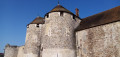
(14) Opposite the castle entrance, turn right then left into Rue de Chartres, running alongside the castle walls. At the opposite corner, turn right – still on Rue de Chartres – and walk past the war memorial. At a junction, carry on straight ahead along Rue du Faubourg de Chartres towards the station. At the next junction, take thesecond right, still heading towards the station. Carry on straight ahead and you’ll soon reach Dourdan station (E).
To get back home:
- RER – Line C, towards Dourdan-la-Forêt or Paris.
- TER – Line towards Tours or Paris-Austerlitz.


 Visorando Member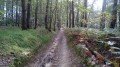
 Very difficult
 Easy
Easy