Country:
 City:
City:



Start from Saint-Chéron station (RER line C, on the section between Paris and Dourdan-la-Forêt). Head for the Rue Racary exit, on the side of platform 1 (Paris-Dourdan direction; if arriving from the other direction, use the underpass).
No signposting
You will come across one or two markers, yellow or red and white, but you do not follow a marked route continuously.
(S) Cross the street and take a path opposite (zigzag). At the end, turn left into a lane at the corner of No. 20. At the roundabout, take the first right, cross the Orge and follow Rue du Gué. At the corner of No. 5, turn left onto a path between two fences. Further on, ignore a path on the right and then a track on the left, and you’ll come to a T-junction at the edge of a field.
Red and white markings
(1) Turn left onto a grassy path (no markings here but further on). Walk alongside a wood on your left, then enter the wood. The path, heading east-northeast, then alternates between sections along the edge of fields and through the undergrowth (note the sound of a waterfall from an old mill on the left). You’ll come out onto a road, level with the sign marking the entrance to Breux-Jouy: turn left onto this road.
No signposting
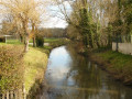
(2) Just before the bridge over the Orge, with green railings, turn right onto a path (forest gate) that runs alongside the river on your left. Finish this short stretch by following the wall of a house and reach Rue des Douves (elevation 60), with another bridge with green railings on the left.
Yellow markings
Cross Rue des Douves and continue along the Orge, first on a tarmac path then on a gravel track. At a junction (level crossing on the left), continue straight ahead. You’ll find the Orge on your left and walk past houses on your right. You’ll reach the old Petit Brétigny mill (waterfall).
Red and white markings
Turn left at a right angle and cross the Orge. Join a main road and turn left to reach Breuillet-Village station.
No markings
(3) Cross the railway tracks at the level crossing and continue straight ahead along Rue de la Gare. Take the first right, Rue de l’Ancienne Poste, and emerge onto a square. Then turn left, cross a street, go up Place de l’Église and pass the entrance to the church on your right. After a few metres, go up a flight of steps on the right and continue along the one-way street, passing a care home on your left. Ignore a street leading down to the right, continue straight ahead uphill and ignore a few side streets.
(4) When the street turns sharply left, leave it and continue straight on along the Sente de la Terre Bonne (zigzag). After a second zigzag, continue straight on, ignore a path on the left and come out onto a street. Follow the street to the right as it goes downhill and cross it at the pedestrian crossing at the start of a right-hand bend. Continue for a few metres on the left-hand pavement of this street and take the first left after the bend (cobbled street; postbox). At a fork, turn right (dead end on the left).
(5) At the three-way junction ahead, head down to the right towards the railway line. At the bottom, first turn right then left to cross the railway line at the level crossing, preferably on the right-hand side. Cross Rue des Prairies at the pedestrian crossing and follow Route d’Arpajon (D192) along its wide right-hand pavement. After a bus stop, turn right onto Avenue Vasco de Gama and enter a housing estate. At the T-junction, turn right onto Avenue Bougainville. Ignoring the side roads, follow this road to a pond and the bridge over the canalised river that feeds it.
(6) Continue a few metres past the bridge, then turn left onto a tarmac path leading towards the edge of the pond. Turn left to pass a chicane and continue along a tarmac path closed to bicycles and mopeds. Follow the path alongside the pond on your left and private gardens on your right, ignoring a few side roads on the right. After a second chicane, continue along a street, then take the first left and reach the bridge over the pond’s spillway. After the bridge, turn left and follow the street which goes round the Maison Saint-Benoît on the left. After a right-hand bend, leave the street and take a covered passageway. Then cross the car park of a shopping centre. At the end, follow a major road (D192) to the right. Cross the road at the first pedestrian crossing you come to and continue to Breuillet-Bruyères-le-Châtel station.
Blue signposting (rare)
(7) Continue along the road and past the station car park. At the T-junction, cross the D82 and follow it to the left towards Bruyères-le-Châtel. Cross the railway line at the level crossing and, at the next junction, turn right onto Route de Bruyères-le-Châtel (still the D82). Pass the sign marking the exit from Breuillet, then a sign warning of a succession of a left-hand bend and a right-hand bend.
Blue + Yellow markings
(8) Shortly after this sign and before the bridge over the Rémarde, turn right onto a narrow path that leads into the woodland (information sign and map of the Bassin de Trêvoix). When you reach the western tip of the basin, turn right onto a wide, compacted track. After a series of left-right-left bends, a path on the left leads to a grassy area with the Pierre de Beaumirault (menhir) on the left. Return to the main path, continue eastwards and follow the entire southern shore of the basin.
(9) At the information sign at the eastern tip of the basin, continue straight on towards Pré Barallon. Very soon after, go round a sort of sentry box on the left and continue eastwards through the woodland with the Orge stream on your right.
No signposting
At the end of the path, follow the road to the right, enter Égly and cross the Orge (with a wash house below on the left-hand side of the road). Head up the Route d’Ollainville to reach Égly station.
(10) Cross the railway line at the level crossing, ignore a dead-end on the left and continue straight on uphill. At a fork, turn left onto Rue d’Ollainville. Pass the church on the left, let the D192 turn left towards Arpajon and continue straight on along Rue de Boissy.
Red and white markings
As the Mare des Bourguignons neighbourhood is currently under construction, the route ofthe GR®655has been re-routed, but on the 1:25,000 map, the purple line intended to represent it has not been updated.
(11) Take the first left, Rue des Champs Fleuris. Cross two streets on the right in succession and, at the three-way junction, turn right into Rue Pierre Corneille. Then take the first left, Rue Jean Racine, and zigzag through a housing estate. At the stop sign, follow Rue Molière to the right. Turn left immediately onto this street and cross Avenue de la Mare aux Bourguignons on the right.
(12) At the next stop sign, turn right onto Rue de la Fausse Clairette. At the end, turn right and take a path between two walls. You’ll come out onto a road (with rugby and football stadiums opposite) and follow it to the left. Pass the concrete bollards and ignore a dead-end on the left. After a left-hand bend, follow the N20 noise barrier on your right. Join a main road and continue to the D192.
(13) Turn right and cross the bridge over the N20. At the next set of traffic lights, continue straight ahead. At the next set of traffic lights, ignore the road on the right and continue, veering slightly to the left. Head downhill, ignoring two dead-end streets on the left. You will reach Arpajon station on the left, with access to the platforms via a staircase on the left: either immediately for a return journey to Dourdan (platform 1), or after taking the underpass for a return journey to Paris (platform 2) (E).


 An interesting hike – a good route
 Visorando Member

 Very difficult
 Easy
Easy