Country:
 City:
City:


The starting point is in Breux-Jouy; there is a small car park in front of the library, under the level crossing on Rue de Rimoron. There is another car park near the town hall, about 150 metres away. As this is a circular route, you can also start and finish at Breuillet-Bruyères station or Breuillet-Village station.
(S/E) Head towards the river and take Rue des Douves immediately on the left. At the end, turn right towards the small bridge and cross it.
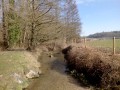
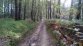
(1) Turn left straight away. The tarmac road turns into a track that runs alongside the River Orge on its right bank.
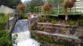
(2) Pass a country lane with a level crossing and a bridge on your left and carry on straight ahead. You’ll return to tarmac and reach a junction with a mill weir on your left. Turn left to walk past the Moulin des Muses, Breuillet’s cultural centre.
(3) Cross the level crossing, take Rue de l’Ancienne Poste on the right, then cross the square.
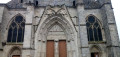
(4) After the square, cross the Grande Rue, then head uphill and walk past the porch of Saint-Pierre Church. At the end of the street, turn right onto Rue de la Tournée and follow this street, then continue along Rue des Bergers. At number 10 on this street, leave it whilst continuing in the same direction towards the Sente de Terre Bonne. Follow this path until you reach the junction with Rue de la Fosse Ronde.
(5) Follow this road to the right for about fifty metres and take Rue de la Badaudière immediately on the left. Continue along Rue des Rochettes. At the end, carry on in the same direction along a well-marked footpath, leaving the cul-de-sac on your left. The path heads north towards a footbridge. Cross the footbridge to reach Rue des Terres Solles.
(6) Follow it to the right for 30 metres, then turn left onto a path leading to Rue des Buttes Réault. Turn right and follow this street to number 51.
(7) Take the path leading down to the right. At Rue Nouvelle, turn left and continue to the station.
(8) When you reach the station, take the stairs on the right, then the underpass beneath the railway lines which leads to Route d’Arpajon. Follow it to the right for about 80 metres, then head left and cross the car park diagonally, heading towards the corner of the shopping centre. You’ll come out onto Avenue Jean Bart; turn left onto it for about 50 metres, then turn right to cross the bridge and reach the car park on Avenue Surcouf, located at the far end of Lac de Port-Sud.
(9) Turn right and take the footpath that runs alongside it. At the other end, join Avenue des Alizés, turn right and continue along Avenue de Bougainville. Take the first street on the left (Vasco de Gama) and you’ll come out onto Route d’Arpajon.
(10) Head left onto this road and keep to the left of the railway line, taking Rue des Prairies, which is flanked by a footpath and cycle path. Continue to the junction near Breuillet-Village station. Cross the D19 carefully and return to a junction you passed on the way there.
(3) Enter the Parc du Moulin Roger Moessner opposite and follow the fitness trail to the west exit. Once outside, turn left and rejoin the route you took on the way there.
(2) Take the path on the right, heading in the opposite direction to the outward journey, following the River Orge. Continue to the bridge. Carry on straight ahead along the riverside path, reach Rue de Rimoron and turn right to return to the car park in front of the library (S/E).

 Visorando Member
 Moderate