Route du Bourg à Quistinic

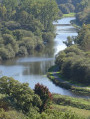
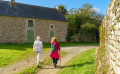
Wander through woods and meadows to explore the rolling countryside of Quistinic, meaning ‘chestnut grove’ in Breton. Walk along sunken paths and follow the streams. Admire the sweeping landscapes of the Blavet Valley and pass through villages that tell the story of rural life past and present.

Details

n°63264396
Creation:
Last update:
Last review:
  • Walking
    Activity: Walking
  • ↔
    Distance: 4.84 mi
  • ◔
    Average duration: 2h 40 
  • ▲
    Difficulty: Easy

  • ⚐
    Back to start: Yes
  • ↗
    Ascent: + 551 ft
  • ↘
    Descent: - 571 ft

  • ▲
    Highest point: 456 ft
  • ▼
    Lowest point: 131 ft
  • ⚐ Country: France
  • ⚐ City: Quistinic (56310)
  • ⚑
    Start/End: N 47.904437° / W 3.135456°
  • ❏
    IGN map(s): Ref. 0820SB
  • Hour-by-hour weather

Photos

Description of the walk

The route starts in the village of Quistinic, at Place Saint-Mathurin. The starting sign is on the corner of Rue d’Hennebont, near the shops.

(S/E) Facing the start sign, turn right, walk past the church and continue straight on along Rue de la Résistance until you reach Chemin des Korrigans.

(1) Take this path on the left between the houses. Cross Rue Pierre de Coubertin and continue straight on along the sunken lane, which bends to the left.

(2) In the woods, carry on straight ahead, then turn left at the next junction. Join the D159 on the right, taking care.

(3) Cross the road and turn left into the woods. Follow the path as it bends to the left, then turn right onto the wide track. Join the D519, follow it to the left for about twenty metres, then take the small road on the left towards Kermoël Bihan.

(4) In the hamlet, turn right and follow the path which skirts the fields to the left and crosses the stream. Join theGR® 38, follow it to the left for a good hundred metres, then leave it and head up to the right towards Hévédic. Turn right at the T-junction, then follow the farm track to the left to reach Hévédic.

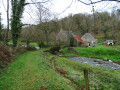
(5) Head straight ahead onto thePR® and cross the hamlet. At the end, follow the path flanked by embankments, then turn right at a 90° angle. Navigate two hairpin bends, then carry on straight ahead: don’t miss the ruins of the Moulin du Bodery on your right. You’ll reach a junction as you approach the Moulin du Glayo.

(6) Turn right, then head uphill to the left. At the first houses in Le Glayo, take the right-hand hairpin bend and carry on for about a hundred metres. Then turn left onto the farm track. Follow it along the ridge overlooking the Blavet Valley, then when it turns left to reach Talhoët Tuchentil.

(7) Don’t miss the wayside cross and carry on straight on towards Nistoir.

(8) As you leave the hamlet, take the path on the right, following the yellow markings. Keep to the right at the first junction, go straight on twice, then turn left to reach the Saint-Mathurin Fountain.

(9) Explore this fountain and the wash house. Walk up Rue de la Fontaine and take the path on the right. At the end, turn left into Rue de la Mairie. Explore the area’s heritage, then cross Place Saint-Mathurin to return to your starting point (S/E).

Waypoints

  1. S/E : mi 0 - alt. 449 ft - Place Saint-Mathurin, Quistinic village
  2. 1 : mi 0.05 - alt. 449 ft - Chemin des Korrigans
  3. 2 : mi 0.36 - alt. 407 ft - Junction: go straight on
  4. 3 : mi 0.64 - alt. 351 ft - Path on the left
  5. 4 : mi 1.06 - alt. 276 ft - Kermoël Bihan
  6. 5 : mi 1.94 - alt. 325 ft - Hévédic
  7. 6 : mi 2.72 - alt. 164 ft - Glayo Mill
  8. 7 : mi 3.6 - alt. 292 ft - Talhoët Tuchentil
  9. 8 : mi 3.86 - alt. 266 ft - Nistoir
  10. 9 : mi 4.55 - alt. 367 ft - Saint-Mathurin Fountain
  11. S/E : mi 4.84 - alt. 449 ft - Place Saint-Mathurin

Notes

This route is organised by Lorient Agglomération

This route is included in the Morbihan Departmental Plan for Walking and Hiking Routes and has been accredited by the French Hiking Federation. You can follow the yellow signposts. There is an information board with a map and details of heritage sites at the start.

Worth a visit

- Saint-Pierre Church (1752) and Saint-Mathurin Chapel (1900).
- Hévédic: 16th- and 19th-century farmhouses.
- Bodery grain mill, first recorded in the 18th century: remains of the mill, the diversion canal and the millstones.
- Glayo Mill: a grain mill first recorded in the 18th century, formerly associated with a windmill.
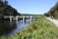
- Blavet Valley: 163 km of river (Nantes–Brest Canal, 1806–1825, and towpaths, navigation and freight transport).
- Talhoët Tuchentil wayside cross.
- Le Nistoir: 17th- and 19th-century farmhouses.
- Saint-Mathurin Fountain (1678) and Saint-Pierre washhouse (19th century).
- Rue de la Mairie: Town Hall and school (1882), houses (17th–20th centuries), wayside cross (1721).

Always be cautious and plan ahead when you're outdoors. Visorando and the author of this route cannot be held responsible for any accidents occurring on this route.

The GR® and PR® markings are the intellectual property of the Fédération Française de Randonnée Pédestre.

Reviews and comments

5 / 5
Based on 1 review

Reliability of the description
5 / 5
Ease of following the route
5 / 5
Route interest
5 / 5
User 4394074

Overall rating : 5 / 5

Date of your route : Jun 17, 2026
Reliability of the description : ★★★★★ Very good
Ease of following the route : ★★★★★ Very good
Route interest : ★★★★★ Very good
Very busy route : No

A lovely route, rated as easy, but I’d say it’s moderate because after point 4 and crossing the bridge, it’s all uphill and the path is far from flat; on the other hand, there’s a lovely view of the Blavet.

Machine-translated

Other walks in the area

For more walks, use our search engine .

The GPS track and description are the property of this route's author. Please do not copy them without permission.