Country:

 City:


Parking near the Raddon-et-Chapendu sports hall.
(S/E) Leave the sports centre via Rue du Stade. Continue straight ahead until you cross the Breuchin via the bridge on Rue du Moulin.
(1) Carry on straight ahead until you reach the Route de Saint-Bresson (D136). Turn right onto this road, then, a little further on, left into Rue du Rang de Fahys. Follow this street until you come to a signposted path on your left marked ‘Pierre aux Sacrifices’ (you won’t actually see this stone!).
(2) Turn left at the edge of the woods. This path climbs quite steeply. Turn right at the first Fork in the road. Continue climbing straight ahead, ignoring a path entrance on the right (Blue Ring), which leads to the Pierre aux Sacrifices, and then a second entrance on the right. The path takes a long bend to the right (ignore two turnings on the left), then becomes a straight stretch leading you to a forest track. The junction is signposted ‘variante du Grand Ban’. You are now at the Grand Ban d’Amage.
(3) Turn left onto the forest track and follow it until it takes a right-angle bend to the right, which you should not take. Take the track that opens up straight ahead and follow it straight on, ignoring any side tracks on either the right or the left. The track takes a very wide bend to the right, then to the left. Follow it until it ends where it meets a track coming from the right.
(4) Turn left onto this path and follow it to a four-way junction. You are now above Muse (on your left).
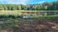
(5) Take the path leading uphill on the far right and follow it straight ahead until you reach a small tarmac road. A little further on, you’ll arrive at the Étang des Grandes Fouillies.
(6) Continue along the small road until you come to a wide track on your left that descends quite steeply.
(7) Follow this track straight ahead, ignoring the various turnings to the right and left. At the end of a virtually straight stretch, take a sharp bend to the right. Carry on and, at the first Fork in the road, turn left towards the Route de Saint-Bresson, which you can see below on your left.
(8) When you reach the road, turn right towards Saint-Bresson. Take the third street on the left to pass between Saint-Bresson Town Hall, on your left, and Saint-Brice Church on your right.
(9) Walk past the town hall and go round it, keeping it on your left. Turn immediately left into a street, then, at the next junction, turn right. Turn left at the next junction, then right at the next Fork in the road. Carry on straight ahead, ignoring a path entrance on your right (yellow arrow). Turn right into a path marked ‘La vallée du Raddon et ses ressources’ and a green arrow.
(10) Carry on straight ahead along this path, which passes by La Noz du Pin and then leads to Au Pradin. Carry on straight ahead until you reach a small road. Turn right uphill and, a few metres further on, you’ll find a path on your left that climbs quite steeply. Take this path and you’ll soon reach a junction where three paths meet. Take the path furthest to the left, which continues almost level (the other two climb or descend steeply).
(11) Follow this path, which takes you along the hillside above Les Maires d’Avaux, offering lovely views of the valley in places. You’ll pass an information sign and continue until you reach a small tarmac road.
(12) Take the road on your right, and, about a hundred metres further on, turn left into a path running perpendicular to the road. At the first junction, turn right onto a path that winds gently until you come to a fairly wide path, which you take on your right.
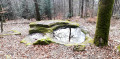
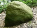
(13) This track takes a wide bend to the left and passes the Pierre du Mouton.
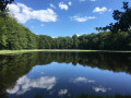
(14) Shortly after the megalith, take a small forest track on your left. It descends gently and leads you to the Étang Trésurier.
(15) After a well-deserved short break by the pond, take the first path on the left at the far end of the pond, then turn left again onto a wide path which you follow straight ahead. It leads you, descending quite steeply in places, to the Raddon-et-Chapendu sports hall (S/E).

 Visorando Member


 Tourist office
 Easy

 Difficult