Country:

 City:
City:


Park in the car park next to the tennis courts.
(S/E) Head north and take the wooden footbridge over the Citelle. Immediately cross the Chemin du Gat and continue straight ahead along a grassy path between the fields. After about 250 m, turn right with the path.
(1) At the letterboxes, turn left onto the Chemin des Condamines (tarmac road). At the Fork in the road, keep right and follow the Chemin de Serre Pointu. Walk alongside a fence on your left.
(2) At the junction, turn right. Join a stony track and follow it as it continues. You’ll come out onto a small tarmac road; follow it to the left at a sharp angle.
(3) You’ll come out onto a tarmac road; follow it to the right and ignore the turn-off to the hamlet of Monge on your right. Cross a ford (often dry in summer). Join the Route d’Espeluche, cross it carefully and follow it to the left for about 50 metres.
(4) At the Grel signpost, turn right towards Jamot. Follow a track that climbs in a south-south-westerly direction and ignore the side paths.
(5) At the Jamot signpost, take the track on the right towards Moïse. The track climbs gently, winding its way up.
(6) When the track splits in two, take the right-hand branch. Then ignore the paths branching off to the left and head for the Moïse signpost.
(7) Then turn right towards Espeluche. At a Fork in the road, follow the track that descends to the left.
(8) At the crossroads, take the track that goes down to the left. Join another track and follow it to the left as far as the Fontaine d’Artur.
(9) Then turn left. At the next junction, follow the path on the right. You’ll come to a crossroads.
(10) Carry on straight ahead to reach the entrance to a property (Refuge ASPAS).
(11) Turn right onto a path that descends at the corner of a fence (be careful, the path may be slippery due to a spring).
(12) Turn right onto a path that climbs back up through the woods. Continue along the hillside (a GPS may be useful on this stretch). The area gradually opens out. Head down to the left.
(13) Head diagonally left and go down the Chemin du Château d’Eau. At the junction, turn left onto the Chemin du Clos and, at the next junction, go straight on (no entry sign). At the T-junction, turn right onto the Chemin des Hochettes and walk past the cemetery and the school. Follow the Boulevard de la République to the right and, immediately on the left, take the Rue du Donjon.
(14) At the seigneurial bench, turn right onto Rue de l’Église and walk past the church. At the end of the street, turn left onto Boulevard du Levant. Take the first right onto Chemin du Moulin. At the corner, head down to the left towards the well and make your way to the car park (S/E).


 Visorando Member

 Local authority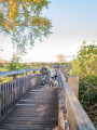
 Easy
Easy