Country:

 City:


(S) From the campsite, head south to join the D678.
(1) Turn right, cross the River Ain and continue north-west before entering the village of Pont-de-Poitte. Stay on the D678 and remember to stock up on supplies as you pass through the village towards Nogna. Carry on until you reach the village outskirts, near the petrol station.
(2) Turn right towards Mesnois. Continue north-west on the D151 until you reach the village of Mesnois, where you’ll find yourself opposite the Beauregard Jura campsite.
(3) Turn right onto the D151E, pass the Lodge Beauregard and carry on until you reach the first track on the left.
(4) Turn left, then, at the Fork in the road, veer right towards the north-west. Continue across fields and meadows until you reach the Fork in the road.
(5) Carry on until you reach a wood at a crossroads.
(6) Head slightly to the right (north) and walk along the edge of the woodland until you reach the next crossroads.
(7) Head north, then north-west through the woods. Carry on until you reach an isolated farm, then turn left onto the Chemin Derrière l’Andrisiat before arriving at a T-junction.
(8) Turn right towards the north-east and follow the edge of the woods, then carry on until you reach the Route de la Chapelle.
(9) Turn slightly left, cross a small bridge over a greenway and stay on the road until you join the GR®559 Échappée Jurassienne.
(10) Stay on the tarmac road, pass the hamlet of Les Montaigniers, and follow the greenway towards Perrigny. Continue until you reach the Fork in the road.
(11) Take the left-hand track and carry on until you reach the Stop sign.
(12) Head straight on along the greenway; then, about ten metres further on, you have the choice of staying on the greenway or, as shown on the route map, turning right onto the GR®559. Continue along the GR® until you rejoin the greenway.
(13) Here, as at the previous waypoint, you have the choice of staying on the greenway or, as shown on the route map, turning slightly right onto the GR®559. Continue along the GR® until you rejoin the greenway.
(14) Turn right onto the cycle path and carry on to the ‘Stop’ sign at the junction with the D4 at a place called La Gare.
(15) First turn left then right, and carry on south-west along the greenway and the GR®559. Continue until you reach the crossroads.
(16) Carry on straight ahead and continue to the Fork in the road just before the Galerie du Faite.
(17) Turn left onto the GR®559 and carry on to the signpost at the T-junction.
(18) Turn right (north-west) and carry on until you reach the junction on the left with a gravel path.
(19) Take the path on the left, signposted for the Belvédère de la Guillotine and the Cent Marches. Continue to the signpost marked ‘La Guillotine’.
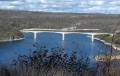
(20) After a break at the Belvédère de la Guillotine, which offers views of the tunnel exit, the viaduct and the cliff-top road, follow the signs for the Cent Marches.
(21) Turn right and follow the signs for ‘En Dodon’ and then ‘Le Chemin du Facteur’, initially staying on the road by turning left until you reach a junction. Take the left-hand side of this junction until you reach the Stop sign.
(22) Follow the signs for the Belvédère des Tilleuls. Following the red and white signposts, you’ll reach this viewpoint, which offers a superb view of Lons-le-Saunier and the Bresse plain.
(23) Continue north-east along the path which descends above the road linking Conliège to Briod. You’ll reach the signpost marked ‘Le chemin du facteur’.
(24) Turn right onto the path and follow it up to the Croix des Équinoxes via a lovely climb of a few hundred metres.
(25) At this point, turn left, heading towards the Hermitage along a steep slope. Following the red and white markings, you’ll reach the Croix de Charney.
(26) Head north, pass under the high-voltage power line and continue along the GR® to the crossroads.
(27) Carry on south-west towards the Sainte-Anne Hermitage. Staying on the GR®, pass under a high-voltage power line before reaching the Sainte-Anne Hermitage.
(28) After a well-deserved break, head north-east towards Camp de Coldre. After a hairpin bend, continue north-west until you reach a signpost at a Fork in the road. To reach the Roman camp at Coldre, turn right. Apart from a lovely view of Lons-le-Saunier, there isn’t much else to see.
(29) Continue north-west on the GR®59, cross the Bois Champ Chambard and carry on to the junction with Rue du Moulin Neuf.
(30) Turn left onto the small, slightly downhill tarmac road to enter the town of Perrigny and carry on until you reach the signpost in front of the Church of Saint-Jean-Baptiste.
(31) Turn right onto Rue Saint-Jean-Baptiste, which continues as Rue du Vieux Mont, a slight uphill stretch, and carry on to the signpost at the Fork in the road.
(32) Leave the tarmac road and continue north-east along the stony track towards Beaumes-les-Messieurs. Pass under a high-voltage power line before reaching a junction with a forest track.
(33) Turn north and continue to the forest hut situated at a crossroads in the hamlet of La Plaine.
(34) Head east towards Beaumes-les-Messieurs. Pass under a high-voltage power line before reaching a Fork in the road.
(35) Stay on the GR®59, which heads north-east, and continue to the Fontaine en Serein, a vast clearing planted with hundred-year-old lime trees in the heart of the forest. Follow the signposts carefully as they lead you to the fountain.
(36) Continue south-east, following the GR®59 signposts, until you reach a T-junction.
(37) Turn left and walk to the junction with the D471.
(38) Cross the road carefully and continue straight ahead north-east towards Baumes-les-Messieurs. You’ll come to a T-junction.
(39) Turn right, walk on until you reach the Eva Jura agricultural co-operative and head left past it, heading north-east. Continue past the Montbéliarde du Jura cattle farm and carry on to the hamlet of Champ du Poirier.
(40) Turn right onto the tarmac road and carry on through the deciduous woodland until you reach the Fork in the road. Turn slightly right and then, on the D70E2, carry on to the Crançot - Baume-les-Messieurs viewpoint.
(41) Carry on along the D70E2, pass the picnic area and continue to the signpost.
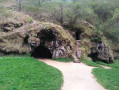
(42) Turn left onto the small path towards the Caves via the Échelles de Crançot. Please note: there is a 200-metre drop between this viewpoint and the Dard, the small river flowing at the bottom of the valley. The path known as the Échelles de Crançot consists, at least in its first section, of a series of limestone steps. Descend carefully to the Baumes-les-Messieurs Caves.
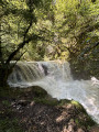
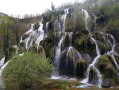
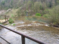
(43) Continue along the path that runs to the left of the lake, cross the Passerelle des Tufs footbridge and go down the stairs. At the bottom, head right to discover the superb Cascade des Tufs waterfall, one of the most beautiful in the Jura.
(44) Retrace your steps to rejoin the GR®59 at the foot of the steps and head right onto the stony path. Follow the River Le Dard to the chapel known as the Oratoire Saint-Roch.
(45) Here you’ll join the D70E1. Follow the road north-east to the village of Baume-les-Messieurs. Carry on to the crossroads.
(46) Turn right, cross the Seille and head towards the abbey.
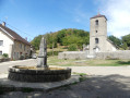
(47) Turn left onto the D70E3. Ride past the abbey on your right, then through the village to reach the fountain. Turn left towards Voitteur and stay on the D70 for about 1 km. After a left-hand bend, you’ll come to a small chapel. Cross the small bridge behind the chapel, then turn right to find the entrance to the campsite (E).
 Association / Club / Walk leader
 Easy
 Visorando Member
 Moderate
 Difficult