Along the Goulue

Starting from Cussey-sur-Lison, this lovely circular walk combines heritage, woodland and Jura landscapes. After exploring the village and its Saint-Christophe church, the path leads to the Croix and Chaux viewpoints, offering beautiful views of the valley, the cliffs and Mont Poupet. The walk then descends into the heart of the Goulue gorge, following the stream and its small waterfalls. A varied and peaceful walk, taking in limestone cliffs, woodland and rural heritage.

Details

104572307
Creation:
Last update:
Last review:
  • Walking
    Activity: Walking
  • ↔
    Distance: 3.81 mi
  • ◔
    Average duration: 2h 15 
  • ▲
    Difficulty: Easy

  • ⚐
    Back to start: Yes
  • ↗
    Ascent: + 554 ft
  • ↘
    Descent: - 558 ft

  • ▲
    Highest point: 1,558 ft
  • ▼
    Lowest point: 1,050 ft

Photos

Description of the walk

Car park in Cussey-sur-Lison, in front of the church. Yellow-and-blue signposting and a ‘Circular Trail’ signpost featuring a hare. Some sections are unmarked.

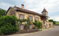
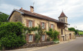
(S/E) Enter the churchyard to admire the beautiful Saint-Christophe Church up close. The porch door is open, so you can take a peek inside. Go round to the back for a glimpse of the old vicarage. Walk round the church and return to the street. Continue to the right towards the village centre, passing a beautiful turret with its slate roof. On the house opposite is a wooden sundial dating from 1869.

Turn right into Rue du Chalet, stopping at the house on the corner to admire its beautiful old doors and stone lintels, one dating from 1775 and the other from 1789. You’ll leave the village and climb up this small road, sheltered from the sun, which becomes a stony track towards the top and leads to a fork.

(1) Carry on to the left. Stay on this stony track until you reach an open area. Continue for a further sixty metres or so and turn left onto a forest track. Carry on without leaving this wide track – which is moderately maintained but very passable – until you come to a marked path branching off to the right.

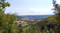
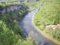
(2) Carry on straight ahead to the Croix viewpoint, overlooking the Cussey-sur-Lison valley: to the left, Mont Mahoux; opposite, the ever-imposing silhouette of Mont Poupet; and to the right, the beautiful cliffs of the Reculée.

(3) Turn back to the previous junction.

(2) Turn left towards the Belvédère des Chaux. Ignore the nearby path leading down to the left and carry on straight ahead. You’ll cross an open stretch, continuing along the path opposite which, much further on, joins a wide, beautiful stony track.

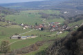
(4) Turn left. Then left again at the nearby fork. About 700 metres further on, don’t miss the short path on the left leading to the Chaux viewpoint, which overlooks the entire valley and the village.

(5) Continue on to the open area and the picnic tables. Walk round them to reach a junction.

(6) Head down to the left along the lovely stony path. After about 500 m, just before a pasture, look out for a small wooden staircase on the right leading down to some small waterfalls. A signpost featuring a hare will point the way.

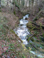
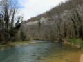
(7) Go down the wooden steps on the right. Make your way back to the village through the valley, following the stream known as the Goulue. Cross it via a footbridge and enjoy a lovely view of the cliffs. The Goulue rises at the far end of the Cussey-sur-Lison valley and flows through the village via a small canal spanned by several little bridges.

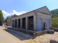
At the entrance to the village, note the farmhouse which still has its slate roof. You’ll arrive at the wash house and the town hall. Turn left towards the centre, then right to reach the church. (S/E)

Waypoints

  1. S/E : mi 0 - alt. 1,053 ft - Saint-Christophe Church, Cussey-sur-Lison
  2. 1 : mi 0.87 - alt. 1,512 ft - Les Troubleaux
  3. 2 : mi 1.42 - alt. 1,483 ft - Fork in the path. Return to the viewpoint
  4. 3 : mi 1.52 - alt. 1,490 ft - Belvédère de la Croix (Cussey-sur-Lison)
  5. 4 : mi 2.15 - alt. 1,486 ft - Gravel path
  6. 5 : mi 2.56 - alt. 1,427 ft - Belvédère des Chaux
  7. 6 : mi 2.7 - alt. 1,398 ft - Picnic tables
  8. 7 : mi 2.95 - alt. 1,211 ft - Along the Goulue
  9. S/E : mi 3.81 - alt. 1,053 ft - Saint-Christophe Church

Worth a visit

The Church of Saint-Christophe is thought to have been founded between the 5th and 10th centuries, bearing witness to the long history of Christian settlement in the Lison Valley. Its belfry retains, at its base, Romanesque features recognisable by its narrow windows, designed more for the building’s structural integrity than to let in light. It was subsequently raised during the Gothic period, with wider openings that brought more light into the upper part of the tower.

Cussey-sur-Lison, a small village in the Doubs, is situated in the Lison Valley, at the heart of a landscape of wooded hills, meadows and limestone cliffs typical of the Besançon Jura. With the river running through it, the village retains a distinctly rural character, with a few old houses clustered around its church. Look out for the roofs covered with lauzes (stone tiles), which required sturdier roof structures to support their weight – four to six times that of a traditional tile. Its covered washhouse was a place of work and socialising for the village women right up until the 1960s.

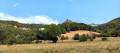
The Reculée de la Goulue opens up near Cussey-sur-Lison, in a landscape typical of the Outer Jura where the River Lison has carved its way through the limestone plateaus. This small, steep-sided valley, flanked by cliffs and wooded slopes, offers a wild and peaceful setting. The landscape, shaped by erosion and groundwater, reflects the geological richness of the Jura’s reculées.

The Ruisseau de la Goulue:likely derived from the Latin *gula*, the word ‘goule’ – now obsolete in dictionaries – referred to a gaping opening, a spring of water gushing from the ground, and also the entrance to a valley, a narrow valley, a gorge, a defile, and so on. It is in these various senses that this word and its derivatives have been used to describe and name the landscape.

Other walks in the area

For more walks, use our search engine .

The GPS track and description are the property of this route's author. Please do not copy them without permission.