Country:

 City:
City:





Car park on the right-hand corner of the D476, just past the hamlet of Chiprey ( coming from Myon), at the hiking car park. Yellow-red, yellow-white and yellow-blue markings. Some sections are unmarked.
(S/E) Head towards the far end of the car park and take the stony track (towards Fontaine de Brue). Shortly after the footbridge, leave this track and take a wide, lovely path (signposted ‘Les Îlotes’) which branches off to the left. You’ll climb through a beautiful, light-filled fir forest until you reach a junction.
(1) Head up to the right until you reach a large, striking rock. Look out for a small, unassuming path that climbs to the right and goes round it. The path soon reaches the ledges, offering lovely views of the valley through the trees. You’ll rejoin the wider path at a beautiful old pile of stone gathered from fields, marked with yellow and blue signposts. Continue to the right, crossing a lovely mossy forest until you come to a path on your right.
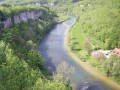
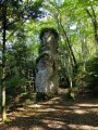
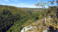
(2) Turn right, despite the Yellow Cross and Blue Cross, onto this narrower but well-defined path. You’ll soon descend to the foot of some beautiful rocks and arrive at the ‘Chandeliers’, impressive large standing stones. Carry on to soon discover an unsecured viewpoint (take care!) overlooking the wild gorges of the Lison.
(3) Carry on, keeping away from the ledges, until you reach the picnic area. Walk past the tables on your right until you reach the rather unremarkable Source de Brue.
(4) Return to the stony path and turn sharp left onto a wide grassy track. At the nearby fork, carry straight on (right-hand path). This wide farm track soon becomes a picturesque little path winding through moss-covered sharp limestone pavements to the Lison. You’ll emerge onto a wide stony track (signpost ‘Les Frattes’).
(5) Turn right, accompanied by the murmur of the river, and climb up through a beautiful fir forest; you’ll soon be walking alongside the Lison. After a short climb past the rocks, you’ll reach the car park. (S/E)
 Visorando Member
 Moderate