Country:

 City:
City:


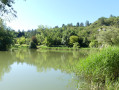
Park in the car park by Lake Monieux. From the D942, turn left at the end of the village of Monieux, following the sign for ‘Plan d’eau’.
(S/E) Walk along the lake on your left, then take the path on the right which climbs steeply to reach the RD96.
(1) Follow the departmental road to the left for about 200 metres.
(2) Leave the road when you come to a faded sign, attached to a tree and marked ‘canalisation’. Take a path on the right, cutting across the PDIPR track that leads to Gaveau: a cairn marks the path that descends opposite into the Vallat du Loup valley. You’ll reach a junction marked by a cairn.
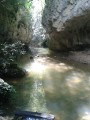
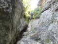
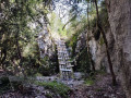
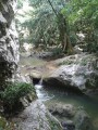
(3) Turn right; from here on, there are no further signposts. The Vallat du Loup leads to Saint-Jean-de-Sault; simply stay at the bottom of the valley, where the rock faces close in and magnificent caves come into view. You will now have to negotiate some rocky outcrops: the first is equipped with sloping beams, on which battens serve as steps and a synthetic rope helps you haul yourself up. The second and third are equipped with short metal ladders. You emerge back into the light and the path becomes increasingly grassy and flower-strewn all the way to Saint-Jean-de-Sault, which you reach at a chapel situated at a crossroads.
(4) Don’t forget to take a look at the washhouse and the fountain on the other side of the road before taking Rue de la Pétanque towards the village. Once you reach the four-way junction, turn left onto Rue Sainte-Marguerite to reach the Church of Saint-Jean, with its two apses and square bell tower topped by a balcony.
(5) Walk back a few dozen metres, then turn left twice to take Rue des Prés de la Caille for about a hundred metres, until you reach a crossroads.
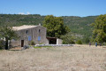
(6) Head towards Monieux at the sign for Saint-Jean-de-Durefort. Stop off near the ruined old windmill – a lovely spot for a picnic break – amongst the mounds of stones, remnants of the hard work of our ancestors to reclaim a few arpents of fertile land. Continue straight on, then turn left before reaching a junction marked by the sign for “Champ de Courruoux”.
(7) Turn right, towards Monieux. Carry on straight ahead until you reach the next junction marked by the sign for “Le Défens”.
(8) Turn left, still heading towards Monieux, and reach the end of a tarmac track.
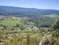
(9) Turn right and walk a short distance along the tarmac before turning left, as indicated by the yellow arrow painted on the ground . As you head downhill, admire the village of Monieux opposite, dominated by its ruined watchtower. The Chapel of Saint-Roch, built after the Great Plague of the 17th century, appears on the right-hand side of the path, amongst the cedars. Don’t miss a visit to admire the restoration work carried out by the “Anesca” association.
(10) Turn back and rejoin the route by turning right. Cross the Nesque and join the D942 at the bottom of the village of Monieux.
(11) Cross the departmental road and take the Chemin Romain opposite. Then climb the steps on the right towards the church. Turn left opposite the cemetery and walk alongside it, then past the church.
(12) Keep left to follow the Grande Rue. Once at the end, turn left to reach a street which you follow down to the right until you reach the junction with the Rue de la Bourgade. Continue straight ahead to come out onto the D942 (Route de la Nesque).
(13) Cross the D942 and head straight on, following the sign for “Plan d’eau”, to reach the car park directly (S/E).

 Visorando Member
 Easy
Easy 
 Difficult