Country:
 City:


Starting point and access: Melun station.
- Transilien – Line R, on the sections between Paris-Lyon and Montargis or Montereau.
- RER – Line D, on the sections coming from Paris or Corbeil-Essonnes.
- TER – Line between Paris-Lyon and Laroche-Migennes.
Take the Place de la Gare exit, on the side of platform 1, which is the platform for trains travelling from Paris-Lyon to Melun via Line R (otherwise, use the underpass).
Red and white markings
(S) On leaving the station, cross the bus station diagonally to the right and take Rue Dajot. Follow this street straight on until you reach a junction where it becomes a no-entry road. Then take thesecond left onto Boulevard Henri Chapu. Pass Rue Armand Chassagne on your right, then go round the roundabout on the right. Cross Rue Augereau at the pedestrian crossing and take the bridge towards the city centre (ignore a parallel road further down on the right). Cross a branch of the River Seine and note the Collégiale Notre-Dame opposite. You will arrive at the foot of this church.
(1) Continue straight ahead and cross the Pont Jean de Lattre de Tassigny over a second branch of the River Seine.
No signposting
On the other side, unless the Seine is in flood, turn right towards the war memorial (if the river is in flood, follow the red and white arrow, turn left and stay on higher ground along Quai Pasteur). Before reaching the memorial, go down a ramp on the right leading to the banks of the Seine. Then turn right, go under the bridge and follow the Seine on your left along a footpath. Go under a second bridge (Pont Jeanne d’Arc) and ignore a flight of steps on the right. At the end of the path, climb a flight of steps to return to Quai Pasteur.
Red and white markings
(2) Join theGR®2again and follow the quai straight ahead. At a roundabout, keep left, stay on the quai and pass under the D606 bridge. Enter Le Mée-sur-Seine and from here follow Quai Étienne Lallia. After a wooden railing on the left-hand side, you’ll come to a wide, well-maintained path.
No signposting
(3) At a ‘Stop’ sign, carry on straight ahead along the banks of the Seine (let theGR® branch off to the right). Pass a memorial stone and, after about 300 m, cross the quay at the pedestrian crossing (red and white arrow – a remnant of an oldGR® route?). Follow the quay to the left (ignore a path that branches off after a forest gate). At the traffic lights, continue along a path reserved for cyclists and pedestrians. Go under the railway bridge and follow Rue du 8 Mai 1945. Cross this street at thefirst pedestrian crossing, then follow it along the left-hand pavement. Pass Chemin des Praillons on your left and head uphill along Rue Creuse.
On the section that follows, the purple route on the 1:25,000 map suggests that you’ll rejoin theGR®2. However, this route hasn’t been updated… there are only a few faded signposts.
(4) Shortly after No. 100 and just before No. 105, turn left onto a path between two walls. At the end, follow another path to the left which immediately turns right. Further on, cross a narrow lane and continue straight ahead along a winding path. After a right-hand bend, at a T-junction (old signpost), turn left. Then turn right and climb for about twenty metres. At the junction (not shown on the IGN map), turn left and continue on level ground. Cross a short tarmac section (gate at No. 198), continue along a track (gate at No. 224) and carry on along a path.
Red and white markings
(5) You’ll come out onto a wide path; follow it to the left as it descends. Pass through a forest gate and turn right onto the Chemin des Praillons (a quiet tarmac road). Further on, you’ll reach the banks of the Seine; note the large, beautiful houses on the right-hand side. Pass through a metal gate and continue along the banks of the Seine on a tarmac track closed to motorised vehicles.
No signposting
(6) Pass through a second metal gate and continue straight on along the banks of the Seine (ignore theGR® path branching off to the right into a street). When you reach a gate, turn right and head up Rue Paul Gillon. You’ll emerge onto Place de Verdun, opposite the church at Boissettes.
Red and white markings
(7) Then turn left. Next, take thefirst right onto Rue des Sables. This street bends left then right. Pass Rue des Roches on your right and continue along Rue des Sables.
(8) At the ‘give way’ sign, cross the road and take a gravel path reserved for cyclists and pedestrians (this path is not shown on the IGN map). Stay parallel to the road, keeping a safe distance to the right. At a T-junction, turn right and follow the road closer than before. Pass under a high-voltage power line and enter Boissise-le-Bertrand. Cross Rue des Sables on the left-hand side and pass the war memorial on your right.
Red and white + mauve signposting
(9) At the roundabout, take thefirst left onto Chemin aux Loups. When the road bends to the right, carry on straight ahead along a gravel track and pass through two wooden barriers in succession. At the end, turn right and rejoin the tarmac road. At the Stop sign, turn left onto Chemin des Pavillons. Carry on straight ahead, ignoring a dead end on the left and then a narrow lane on the right.
No signposting
N.B. The Vives Eaux dam was rebuilt between 2014 and 2018 and, at the same time, moved about sixty metres further upstream. The IGN map has not been updated on this point, but my GPS track, the satellite view and the OSM map confirm the route shown here.
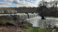
(10) At the end of the street, ignore the arrows directing you to follow a path on the right and climb the access ramp to the footbridge at the Vives Eaux dam. Cross the Seine via this footbridge. On the other side, walk down the access ramp.
Yellow markings
(11) At the bottom, continue straight ahead along a tarmac road, with the Seine on your right. When the road curves slightly to the left, continue straight ahead along a path as close as possible to the river. Pass an information sign about the Prairie Malécot on your left, stay along the banks of the Seine on a shaded path and ignore all turn-offs to the left.
No signposting
There are a few yellow signposts, but they are not placed at regular intervals.
(12) When you reach a small bridge on the left-hand side, carry on straight ahead. Stay as close as possible to the river on the shaded path. After about 600 m (near the sewage treatment works shown on the map), cross a tarmac road and continue along the path beside the Seine. Walk alongside the fence of a leisure area on your left.
(13) Take a footbridge to cross a channel. At the T-junction just beyond the footbridge, turn right and continue along the banks of the Seine. Further on, join a tarmac road and follow it along a path, keeping behind a row of wooden posts and then behind the crash barrier. Pass under a road bridge and join a road.
Red and white + yellow markings
(14) Then turn left and walk alongside the road on your right. After about thirty metres, cross the road at the pedestrian crossing and continue in the same direction as before. At the roundabout, take thefirst right onto Rue Pasteur. When the street bends to the left, take the underpass beneath the railway line. On the other side, turn right onto Rue Isidore Leroy. You will soon reach Ponthierry-Pringy station on your right (E).
To get back home:
- RER – Line D, towards Corbeil-Essonnes and Juvisy (direct access) or Melun (take the underpass).


 Visorando Member
 Easy
 Difficult