Country:
 City:
City:


Start of the walk at Melun station, see Practical Information.
(S) From the station, take Rue Dajot opposite. Walk straight on at the first three junctions, then, at the fourth, turn left onto Rue de la Rochette. At the end of the street, take the second street on the right towards Place Chapu. Go round the square, which forms a sort of roundabout, on the right and take the first exit onto a road that crosses a branch of the Seine. You’ll arrive in front of the Collégiale Notre-Dame
(1) Turn sharply left onto Rue Notre-Dame. This street heads towards the Seine before making a 90° right-hand bend. At the end of the street, turn right onto Rue Saint-Étienne at a historic building. Cross the second branch of the Seine, staying on the same street. Once on the other bank, continue along the same street until the fourth street on the left (Rue du Miroir). Take this street to see the Church of Saint-Aspais.
(2) Turn right onto Rue des Cloches. Turn left at the end of the street onto Rue Saint-Aspais. Turn right at the next Fork in the road to pass in front of the town hall, and continue to Place Saint-Jean.
(3) Walk along the south side of the square and leave via Rue de l’Abreuvoir, passing near the tourist office. Cross the Almont. Once on the other bank, turn right onto a path that runs alongside the river. Cross the river a second time via a footbridge and keep to the left along the river. You will then reach a main road (Quai Maréchal Foch). Turn left to cross the Almont again. Go straight on at the next two junctions, continuing to the first steps on the left.
(4) Take these steps. Cut across a path to start another flight of steps. Continue along a path and, after a right-hand bend, turn sharply left onto a lane leading to the Church of Saint-Pierre-et-Saint-Paul in Vaux-le-Pénil. Take your time to admire the church.
Return to the crossroads via the same route and turn left onto Route de Chartrettes. Ignore the first lane leading to houses on the left. You’ll reach a junction with a second lane.
(5) Turn onto this lane, which becomes a footpath known as the Sentier des Pigeons. Follow it and turn right onto the first footpath. Take the first path on the left with steps. You will reach Rue de la Baste, which you should follow to the right. Turn onto the first street on the left (Rue des Mezées). Stay on the same street until you reach the first path coming from the right (Ruelle Thienot). Take this lane, then, at the first junction, take the path opposite and follow it to its end on Rue du Bois Moissy.
(6) Turn right onto Rue du Bois Moissy. Turn right at the end of the street and begin a short descent. Take the first path on the left and follow it to Rue du Pet au Diable.
(7) Take this on the left. Follow it to Livry-sur-Seine station.
(8) Take the Sentier Pouligny opposite. At the junction with the next path, continue straight ahead. You’ll reach Rue des Chanois; follow it to the left for a few metres before turning sharply right onto the first path (Sentier de la Gare). Follow it to its end and turn right onto Rue des Vaux. Pass Rue des Juifs on your left to reach a square and a church.
(9) Take the narrow lane running south of the church towards a post office. Take the first path on the right (Sentier des Dragées). Follow the same path to Rue des Prés, which you must cross to rejoin the path opposite. Before the next road, ignore a small path coming from the left. At the road, turn right onto Rue des Mardelles. At the end of the street, turn left onto Rue du Four à Chaux. Follow this street to the first 90° right-hand bend.
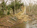
(10) Take the track that continues straight ahead and enters the forest, passing close to some building ruins. Continue straight ahead until this is no longer possible: then turn right to stay on theGR®®. Join the D39 and follow it to the left until the first track on the left.
(11) Follow this track before turning immediately right onto a path. This path runs alongside fields before entering the forest and skirting the walls of the Château des Bergeries park. Follow the track running alongside the wall until it turns south-west at the Bois des Bergeries: at this point, take a sharp right to continue following the wall. Return to the D39.
(12) Turn left and walk for a few metres. Take the first street on the right (Rue du Pont). At the next roundabout, take the left-hand exit onto Rue Carnot. This leads onto Avenue Gallieni: walk along this for a few metres, turning right, then immediately take the first path on the left. First turn left then right to reach Rue Blanche Vitte: continue to the right. At the end of the street, turn right onto Rue Georges Clemenceau. Turn left at the first junction and pass in front of the Church of Saint-Corneille-et-Saint-Cyprien in Chartrettes.
(13) Turn right to stay on Rue Édouard Bengeon. Continue straight on until the fourth road on the right (Rue Luiggi): follow this to reach Avenue du Général de Gaulle and, almost opposite, take a path downhill which then passes under the railway line. Continue straight on at every junction until you reach the next stream. Once you reach it, turn right to stay along the right bank and join a road. `
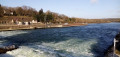
(14) Take the path opposite leading to the footbridge over the Seine. Once on the other side of the river, turn right onto Quai Olivier Metra. Leave this quickly to stay on the banks of the Seine, first along the riverbank and then on a path. Turn left at the next junction to find a narrow lane and follow it to the right until the first crossroads.
(15) Turn left. Continue straight on at the first junction and, at the second, turn left onto Allée Barbeau. Pass Allée de la Source.
(16) A few metres further on, turn right onto a path leading into a park. Very soon after, turn right onto a forest path. Cross the park, following the red and whiteGR®® markings, until you reach the town hall in Bois-le-Roi. Once at the town hall, cross Rue Louis Périn and take the path opposite, which runs beneath a wooded area. Follow theGR®® markings at every junction until you reach the next road, which you should follow to the right (Avenue Foch). At the next junction, turn left to go under the railway line, then immediately afterwards turn right. Stay on this street until you reach the station (E).

 Visorando Member
 Easy
Easy 
 Difficult