A loop walk between Vitré and Ecoulois

A pleasant walk across the plain with varied scenery and peaceful natural surroundings. As well as beautiful views, particularly of Conzais Castle, this route allows you to discover the different crops grown on this plain near Celles-sur-Belle. Along the way, you’ll come across fine examples of historic architecture.

Details

n°2104272
Creation:
Last update:
Last review:
  • Walking
    Activity: Walking
  • ↔
    Distance: 7.04 mi
  • ◔
    Average duration: 3h 20 
  • ▲
    Difficulty: Moderate

  • ⚐
    Back to start: Yes
  • ↗
    Ascent: + 131 ft
  • ↘
    Descent: - 135 ft

  • ▲
    Highest point: 489 ft
  • ▼
    Lowest point: 348 ft

Photos

Description of the walk

(S/E) Head round the back of the town hall to reach the small road leading to the hamlet of La Bertamerie. Follow this road with care until you reach La Bertamerie and go round the houses on the left. Continue to the next crossroads.

(1) Cross the junction carefully and continue straight ahead along the path heading west. Carry on straight until you reach the crossroads after passing under a high-voltage power line.

(2) Turn left onto the path running alongside a tree-lined hedge. Carry on straight ahead until you reach a small road. Cross it carefully and continue straight ahead (there are lovely views of Conzais Castle directly ahead). Continue until you reach a tree-lined hedge on the right, just before the D948.

(3) Turn right onto the path running alongside the hedge on the north side. This path is currently ploughed. If the current crop allows, follow the hedge along the edge of the field until you reach the farm track about one hundred and fifty metres further on.
If not, continue straight on until you reach the D948. When you get there, turn right and walk carefully along the road, keeping to the grassy verge (which is quite wide). Please note that this is a very busy road. Take the first path on the right. About 150 metres further on, you’ll rejoin the main route.
When you reach the track, turn left and follow it to a crossroads with a family cemetery.

(4) Continue straight ahead along a small road called ‘le Chemin de l’Éolienne’. Walk to the junction with the Route du Puits. Cross the junction carefully and continue straight ahead. Carry on straight until you reach the Route de la Chambaudière, passing a path on your right about 400 metres after crossing the Route du Puits.

(5) At the bend in the Route de la Chambaudière, turn right onto a track heading east. Continue to the junction with a north-south track. Turn left and follow this for about twenty metres.

(6) Turn right onto a path heading east. Further on, cross a small road with care and continue straight ahead to a Y-junction (inverted Y).

(7) Carry on, turning left towards the north-east. Continue straight on until you reach the second track on the right.

(8) Turn right onto a track heading south-east. Carry on until you reach a T-junction. Turn left and continue along the track until you reach another T-junction.

(9) Turn right onto the track heading east. Continue until you reach a crossroads.

(10) Turn left onto the track, which now heads north. The track eventually leads to a three-way junction. Turn right and follow the road carefully until you reach the second junction with the Route de La Touche.

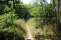
(11) At this point, turn right onto the path heading south. Caution: this path is overgrown and poorly maintained, with some stinging nettles from about halfway along (this section isn’t too long). It leads onto a small road: cross it carefully and continue straight ahead towards the south-east until you reach the junction with the D103.

(12) Turn right and follow the D103 carefully (there is a small pavement). Continue until you reach Vitré Town Hall. Walk past it and turn right to reach the car park (S/E).

Waypoints

  1. S/E : mi 0 - alt. 443 ft - Vitré Town Hall car park
  2. 1 : mi 0.4 - alt. 423 ft - Crossroads
  3. 2 : mi 1.18 - alt. 420 ft - Crossroads
  4. 3 : mi 2.16 - alt. 351 ft - Crossroads
  5. 4 : mi 2.73 - alt. 354 ft - Chemin de l’Éolienne
  6. 5 : mi 3.42 - alt. 354 ft - Bend in the Route de la Chambaudière
  7. 6 : mi 3.62 - alt. 371 ft - Crossroads
  8. 7 : mi 4.55 - alt. 423 ft - Inverted Y-shaped junction
  9. 8 : mi 4.76 - alt. 436 ft - Path on the right
  10. 9 : mi 5.4 - alt. 423 ft - Path on the right
  11. 10 : mi 5.66 - alt. 453 ft - Path on the left, heading due north
  12. 11 : mi 6.27 - alt. 482 ft - Grassy path on the right
  13. 12 : mi 6.94 - alt. 459 ft - Junction with the D103
  14. S/E : mi 7.04 - alt. 443 ft - Car park at Vitré Town Hall

Notes

The car park is situated next to Vitré Town Hall

This walk takes place over varied terrain and requires suitable footwear.

The route is unmarked but it is easy to find your way. Consequently, it is advisable to follow the map and route description carefully, whilst paying close attention to the landscape.

Hike undertaken by the author on 15 May 2019

Worth a visit

Vitré
Vitré is a former French commune, situated in the Deux-Sèvres department and the Nouvelle-Aquitaine region. On 1 January 2013, it merged with Beaussais to form the new commune of Beaussais-Vitré.
Sights
Château de Champrond: This is a former nobleman’s residence.

Écoulois
Écoulois is part of Thorigné, which comprises 22 hamlets, the largest of which are Écoulois, Le Bouchet, Conzais and Les Touches

Château de Conzais
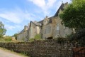
The main building’s front façade, comprising six bays, faces the side wall. The roof windows above the central bay and two other symmetrical bays feature arched pediments. This layout suggests that this façade was originally symmetrical. The rear façade has four bays, and the two towers adjoining this façade each have two superimposed windows. The main building is divided by four partition walls: two on either side of the entrance corridor containing the staircase, and two others between the first and second bays on the left and after the last bay on the right. The vaulted cellar is situated beneath part of the first room to the left of the front door. The upper part of the south tower, the interior of which is circular at the base and square from the first floor upwards, and in which the flue of a tall chimney remains, has been converted into a dovecote. At some unknown point in time, a small spiral staircase, now lost, was built in the east tower. These towers, now without their roofs, were once covered with flat-tiled roofs. Inside the main dwelling, all the rooms feature fireplaces dating from different periods (early and late 18th century, first half of the 19th century). The trumeau of the fireplace in the first room on the right on the ground floor is painted with a floral motif. The stone spiral staircase with a stone balustrade leads to the first floor; from there, a wooden spiral staircase leads up to the attic.
Private property; not open to the public.
For further information:
Source: The canton of Celles-sur-Belle: 1,620 heritage features studied

Reviews and comments

4.7 / 5
Based on 1 review

Reliability of the description
5 / 5
Ease of following the route
5 / 5
Route interest
4 / 5
larochenet
larochenet

Overall rating : 4.7 / 5

Date of your route : Mar 24, 2021
Reliability of the description : ★★★★★ Very good
Ease of following the route : ★★★★★ Very good
Route interest : ★★★★☆ Good
Very busy route : No

A lovely walk in the countryside, along paths that are a bit hilly in places. I wouldn’t attempt this walk in July or August when it’s at its hottest – but early in the morning, why not?
There’s just one bit that isn’t very pleasant (the noise from the cars) when we pass close to the main road, but it really doesn’t last long
It took me 3 hours and 10 minutes, including a short break.
Thanks for this route – the description is top-notch!

Machine-translated

Other walks in the area

For more walks, use our search engine .

The GPS track and description are the property of this route's author. Please do not copy them without permission.