Country:

 City:


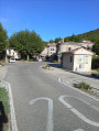
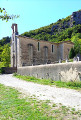
The route starts from the church at La Roche-Saint-Secret.
GR® signposting
(S) With your back to the church forecourt, head right, then, after 50 m, take the first road on the right, Chemin du Rastelet. Walk for about 1.5 km along this pleasant, often shaded little road, which climbs gently towards the Chapelle de la Roche.
(1) Continue along the track on the right, towards Montagne de Lance and the Refuge de Fontlargias.
(2) At the junction, turn right, head down to the valley and continue along the path until you reach a small road. Follow it uphill and you’ll arrive at the Lodge de Fontlargias.
(3) Take the path on the left which climbs towards Montagne de Lance. The slope is quite steep. You’ll reach a crossroads (at an altitude of around 1,000 metres) with a sign indicating that the original path is closed.
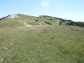
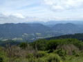
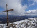
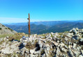
(4) Turn left, then, after about 200 m, take the path on the right. Climb until you emerge from the forest, then follow the grassy path along the top of the ridge. The view opens out over the surrounding mountains. Climb up to the cross marking the highest point. Enjoy a magnificent 360° panorama, as well as the sight of vultures in flight.
(5) Continue along the path and begin your descent, following the ridge to the next fork.
(6) Take the path on the left, which is very steep, and head for the Col de Lachaud.
(7) Carry on straight ahead and, along a slope that becomes more manageable, head towards Les Audries. Just before the hamlet, head up to the left towards the Col de la Pause and reach it.
(8) Head down to the left until you reach the D544, near the old village of Teyssière.
(9) Take the road on the right, cross the Lez, then turn left straight away, heading towards the church until you reach it.
(10) Take the path that climbs to the left between the cemetery and the chapel. This climbs and then descends to the bottom of a small valley. At the fork, turn left and, after crossing the stream, you’ll come to a road.
(11) Head left along the road for 200 m, then take the path that climbs to the left. This path generally follows the edge of the woodland, passing above the hamlet of Le Pradier before entering the forest. Cross a gully and, about 300 m further on, join a path on the right.
(12) Continue along this path and walk to the Col de Marot.
(13) Turn right and head down to a road. Follow it to the left, then turn right onto the D330. Cross the bridge over the Lez and arrive at the small square in the village of La Paillette (E).
 Local authority
 Moderate
 Visorando Member