


De La Bégude-de-Mazenc à Dieulefit par la Montagne de la Lance

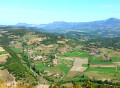
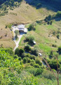
Ce circuit de 3 jours, rejoignant La Bégude à Dieulefit, en passant par la montagne de Lance est assez sportif. Les paysages sont variés, alternant passages en forêt, passages dégagés, très beaux points de vue (montagne de la Lance,...). L'essentiel du trajet évite les routes goudronnées.
Details
Creation:
Last update:
-
 Activity: Walking
-
 Distance: 45.19 mi
-
 Average duration: 3 days
-
 Difficulty: Difficult
-
-
 Back to start: No
-
 Ascent: + 10,256 ft
-
 Descent: - 9,724 ft
-
-
 Highest point: 4,337 ft
-
 Lowest point: 702 ft
-
 Country:
France
-

-
 City:
La Bégude-de-Mazenc (26160)
-
 Start: N 44.54478° / E 4.934845°
-
 End: N 44.523488° / E 5.06322°
-


 Hour-by-hour weather


Photos


Stages of the route
This route needs several days, find the details below:
Other walks in the area
From La Bégude-de-Mazenc to La Roche-Saint-Secret-Béconne
 Visorando Member
 12.40 mi
+1,988 ft
-1,552 ft
7h 25
Difficult
Departure from La Bégude-de-Mazenc (Drôme)
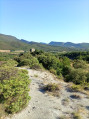
The first stage is a day to get your legs going, with much of the route taking place in the forest.
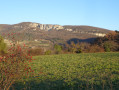
Châteauneuf de Mazenc - Souspierre circular
 4.07 mi
+272 ft
-262 ft
2h 05
 Easy
Departure from La Bégude-de-Mazenc (Drôme)
Between the undergrowth and agricultural land, a short, easy hike allows you to enjoy the landscapes at the edge of the Valdaine plain.
Les Châtelards - Dieulefit-Bourdeaux region
 Local authority12.23 mi
+1,985 ft
-2,005 ft
7h 20
Difficult
Departure from La Bégude-de-Mazenc (Drôme)
A circular route offering a chance to discover the varied landscapes around La Bégude-de-Mazenc as well as the old village of Châteauneuf-de-Mazenc. With a route mainly through woodland, this long but technically easy hike will be very pleasant on hot summer days.
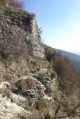
Around Souspierre
 9.80 mi
+2,638 ft
-2,638 ft
6h 50
Difficult
Departure from Souspierre (Drôme)
For experienced hikers, this is a beautiful hike, partly through the woods on unmarked trails. After a very beautiful passage along the ridge, they lead to cliffs followed by a dizzying descent into a rocky ridge to the Grotte de l'Ermite, a natural excavation in the rocks. Above, stand the summit of Châtelard and the ruins of an ancient watchtower dating from the Middle Ages, destroyed during the Wars of Religion. The panoramic view over the valley is superb.
The Portoise plain
 4.44 mi
+197 ft
-171 ft
2h 15
Easy
Departure from Portes-en-Valdaine (Drôme)
This route, with very little elevation gain, winds along the narrow roads of Portes-en-Valdaine, offering a 360° panoramic view of the village: its characteristic bell tower, its old village centre and the Serre de Mirabel in the background.
Around Mastaize between La Bâtie-Rolland and La Touche
 4.52 mi
+469 ft
-492 ft
2h 30
Easy
Departure from La Touche (Drôme)
Through wooded and agricultural areas in the Drôme Provençale between Montélimar and Dieulefit.
From Aleyrac to Serre de Forillon
 4.99 mi
+561 ft
-551 ft
2h 45
Easy
Departure from Aleyrac (Drôme)
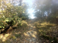
This walk follows wide forest tracks, leading to a viewpoint offering a 180° panorama of the Valdaine plain below, which is partly agricultural and partly wooded. A short circular route adds variety to the round trip.
The ridges of Rochefort-en-Valdaine
 6.96 mi
+1,020 ft
-1,004 ft
4h 05
 Moderate
Departure from La Touche (Drôme)
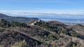
This lovely loop along the ridges of L'Izard and Mont Laroche offers magnificent views of the Roubion valley as far as the foothills of the Vercors and the 3 Becs.
Starting from the pretty village of La Touche, the route passes the castles of Rochefort-en-Valdaine, then the truffle fields of Janeston.
The hike also crosses the pretty little hamlet of Moulin de Bay on the riverbank, via a succession of varied paths and trails, which are sometimes steep but only for short distances.
For more walks, use our search engine .
The GPS track and description are the property of this route's author. Please do not copy them without permission.

