La Roche-Saint-Secret via the Combe du Four and the Col de la Ruche

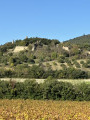
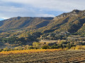
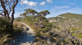
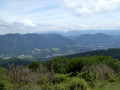
A walk that alternates between forest trails and historic sites. The panoramic views from the ridge line offer glimpses of Dieulefit and the Montagne des 3 Becs to the north. To the south, you’ll find the peaks of La Lance and the ruins of the old village of Béconne. In autumn, you can even pick delicious milk caps and other wild mushrooms, and in spring, you’ll walk alongside magnificent fields of lavender.
Please note: there is a very steep slope on this route.

Details

65588663
Creation:
Last update:
Last review:
  • Walking
    Activity: Walking
  • ↔
    Distance: 10.00 mi
  • ◔
    Average duration: 6h 10 
  • ▲
    Difficulty: Difficult

  • ⚐
    Back to start: Yes
  • ↗
    Ascent: + 1,841 ft
  • ↘
    Descent: - 1,864 ft

  • ▲
    Highest point: 2,201 ft
  • ▼
    Lowest point: 1,109 ft

Photos

Description of the walk

When you arrive at the village of Roche-Saint-Secret-Béconne, park in the large car park right next to the church, at the foot of the community hall.

(S/E) Walk downhill, cross the road to Dieulefit and turn right, heading through the village. Take the small tarmac road, Chemin d’Alençon, on the left, cross the River Lez and carry on.

(1) Turn right at the junction, keep to the right at the Fork in the road, and walk past the Château d’Alençon; stay on this small road, ignoring the road on the left.

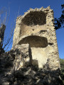
(2) Leave the road a few dozen metres after the car park sign and take the path on the left; you can go through the small wire fence and continue uphill. You can get close to the old ruins of the Tour d’Alençon.

(3) Shortly afterwards, turn right onto the narrow path marked in yellow; take care not to slip in places. You can take a short break by the banks of the Lez, as the path runs alongside it.

(4) Head to the left, follow the path uphill, pass the signpost for “La Combe du Four” and carry on.

(5) Don’t be tempted by the narrow path ahead; turn left onto the wide, stony path, which is very steep. This is the most challenging part of the route – take a deep breath, as the gradient is 29 per cent. At the top, you’ll join theGR®429.

(6) Turn right towards the 627-metre mark; the path is very pleasant. Stay on theGR®, pass under the power line and you’ll reach a junction.

(7) At the 587-metre mark, leave theGR® and continue straight on towards the Col de la Ruche.

(8) Turn right onto the shaded path that descends and runs alongside the Ravin de Bramefaim, then you’ll come to the little farm known as La Ruche and the start of the tarmac road.

(9) Follow this road until you reach the Dieulefit departmental road. Turn right and cross the bridge.

(10) A few dozen metres further on, take the small path on the left. Follow this path uphill; it branches off to the left at a 45° angle (do not mistake it for the one immediately after the bridge). Join theGR®9and continue to the right until you reach the ruins of the village of Béconne.

(11) Carry on for about a hundred metres to explore the ruins, then retrace your steps to the Y-junction.

(11) Turn right and you’ll reach a small tarmac road.

(12) Turn right, passing the former Béconne town hall on the D545.

(13) Leave the tarmac road and take the path on your left; it is marked with a yellow line. Stay on thisPR® path.

(14) Take the small path on the left; if you like, stop to admire the lavender fields. Turn right onto the Chemin du Rastelet, and head towards the departmental road, the church and the car park (S/E).


Waypoints

  1. S/E : mi 0 - alt. 1,175 ft - Car park near the church
  2. 1 : mi 0.5 - alt. 1,165 ft - Turn right towards the castle
  3. 2 : mi 1.53 - alt. 1,270 ft - Climb the path towards the tower
  4. 3 : mi 1.79 - alt. 1,447 ft - A nice little viewpoint
  5. 4 : mi 2.56 - alt. 1,289 ft - The Combe du Four
  6. 5 : mi 2.77 - alt. 1,434 ft - A steep, stony path
  7. 6 : mi 3.45 - alt. 1,955 ft - GR 429
  8. 7 : mi 4.4 - alt. 1,896 ft - Elevation 587
  9. 8 : mi 5.73 - alt. 1,929 ft - Col de la Ruche
  10. 9 : mi 6.51 - alt. 1,411 ft - Ferme de la Ruche
  11. 10 : mi 7.07 - alt. 1,362 ft - Path leading to the GR 9
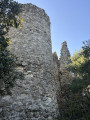
  12. 11 : mi 7.65 - alt. 1,535 ft - Ruins of Béconne
  13. 12 : mi 8.15 - alt. 1,421 ft - D 545
  14. 13 : mi 8.6 - alt. 1,316 ft - Return via the PR
  15. 14 : mi 8.93 - alt. 1,243 ft - Short path along the lavender fields
  16. S/E : mi 10 - alt. 1,168 ft - Car park at the community hall

Notes

Make sure you’re wearing suitable footwear, as it can be stony or slippery near the River Lez. You can bring your dog; there are three watering points.

IBP: 72

Worth a visit

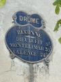
The Alençon Tower and the Ruins of Béconne.

Always be cautious and plan ahead when you're outdoors. Visorando and the author of this route cannot be held responsible for any accidents occurring on this route.

The GR® and PR® markings are the intellectual property of the Fédération Française de Randonnée Pédestre.

Reviews and comments

4.1 / 5
Based on 4 reviews

Reliability of the description
4 / 5
Ease of following the route
3.5 / 5
Route interest
4.8 / 5
User 4133759

Overall rating : 3.3 / 5

Date of your route : May 18, 2026
Reliability of the description : ★★★☆☆ Average
Ease of following the route : ★★☆☆☆ Disappointing
Route interest : ★★★★★ Very good
Very busy route : No

Impossible to complete without GPS tracking
A magnificent hike
Varied and very wild landscapes. Saw a herd of goats roaming free
No Patou.
Did it with my dog
No problem

Machine-translated

ALEX84100
ALEX84100

Overall rating : 4.3 / 5

Date of your route : Apr 27, 2026
Reliability of the description : ★★★★★ Very good
Ease of following the route : ★★★★☆ Good
Route interest : ★★★★☆ Good
Very busy route : No

A lovely walk; we hesitated before the climb, so we didn’t lose our route but we did shorten the route by continuing straight on (GR 9), which rejoins the trail further up. This was due to a loss of signal, which prevented us from using the route map and GPS. Beautiful scenery.

Machine-translated

kakie
kakie

Overall rating : 5 / 5

Date of your route : Jul 07, 2025
Reliability of the description : ★★★★★ Very good
Ease of following the route : ★★★★★ Very good
Route interest : ★★★★★ Very good
Very busy route : No

A varied hike with beautiful panoramic views and a very steep section.

Machine-translated

Bubud
Bubud

Thank you! Enjoy your future hikes!
Kind regards

Machine-translated

Jacky Anx
Jacky Anx

Oh yes, without a smartphone, that’s quite a feat. Well done. A paper map, though? As for the rest, I’ll add the
your clarifications. Thank you

Machine-translated

Bubud
Bubud

Hello,
I realise I’m doing these walks without a smartphone, which may be why I’m having problems, as GPS and altitude readings – for those who have one – should prevent any mistakes along the route.
For stage (2) of this walk, I would say: Leave the road a few dozen metres after the ‘Parking’ sign and take the path on the left (blocked by a simple wire that can be removed and put back in place); head uphill; the path goes round the ruins on the right – you can visit them.
(6) When you reach a junction, turn left.
(11) Returning to the Y-junction after visiting the superb ruins of Béconne, if you turn ‘right’, you’ll go down the path which leads directly to the RD 538 – which is what I did. Perhaps I hadn’t studied the map carefully enough…
Kind regards

Machine-translated

Jacky Anx
Jacky Anx

Hello

Please could you point out where we might be going wrong?

Thank you

Machine-translated

Bubud
Bubud
• Edited:

Overall rating : 3.7 / 5

Date of your route : Dec 02, 2024
Reliability of the description : ★★★☆☆ Average
Ease of following the route : ★★★☆☆ Average
Route interest : ★★★★★ Very good
Very busy route : No

Hello, this route is very interesting and we had a brilliant time, but the directions aren’t detailed enough at the junctions, so it’s easy to take a wrong turn several times (which is what I did).
Thank you, however, for all the work you put in beforehand.
Bubud

Machine-translated

Other walks in the area

For more walks, use our search engine .

The GPS track and description are the property of this route's author. Please do not copy them without permission.