Country:
 City:
City:



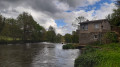
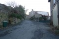
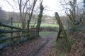
Park in the village of La Poinsetière, which lies to the north-east of the commune of La Bruffière, not far from the River Sèvre.
(S/E) To start the walk, walk back along the road you took when arriving by car until you reach the crossroads with a large wayside cross.
(1) Turn right onto theGRP® Hucheloup variant, marked in red and yellow, and head west.
(2) When theGRP® turns right at a 90° angle, carry on straight ahead. When the path bends to the right, continue straight ahead to reach the green and yellow angled gate.
(3) Turn sharply left, then left again. Follow a path (not shown on the map) to join a path (shown on the map) leading to the hamlet of La Coindelière.
(4) On reaching the hamlet, take the road to the left, crossing the village until you come to the first pond, which you pass by; then turn right, leaving a second pond on your left. When you reach the road, turn right, with your back to Les Grandes Fontaines; walk past the wayside cross by about forty metres, then take the farm track on the left and follow it to Le Recredy, ignoring any turn-offs to the left. As you pass, note the curious almond-green building with a single-pitched tiled roof, which shelters a spring catchment.
(5) Cross Le Recredy, which lies directly in front of you. The route continues along a wide farm track which quickly turns at a right angle to the left and then veers to the right (south-east). Pass under a high-voltage power line.
(6) At the next fork, turn left (east) towards La Morinière. Walk through La Morinière, keeping roughly the same direction. Leave the road and take the path branching off to the left. There is a sign indicating that the Bas Charbonneau mill is 1.9 km away.
(7) Less than 200 m after leaving the road, leave the main track on your left and take the right-hand Fork in the road. You will then walk alongside a poultry farm (chickens, geese, guinea fowl and turkeys… on my visits, the only ones missing were the ducks). Reach a road, cross it and rejoin theGRP® Hucheloup here. Follow it down towards the Sèvre Nantaise.
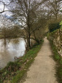
(8) Leave theGRP®, go through the wooden archway and head left to walk alongside the Sèvre Nantaise. You’ll reach the Moulin du Bas Charbonneau (marked by an information sign).
(9) Join theGRP® again and continue along the path which follows the river for a short while. At La Penneraie, take the road directly in front of you (south-west). After a bend to the right, pass under the high-voltage power line once more. You will reach the hamlet of Le Plessis.
(10) Follow theGRP® as it descends to the right.
(11) Cross the D102 (leaving theGRP®) and take the path opposite (not shown on the map) which runs parallel to the road. At a junction of paths with a farm gate, head left. A little further on, there is a short climb before descending towards the Sèvre. Head up to the left to reach the hamlet of La Poinsetière (S/E).




 Visorando Member
 Moderate

 Tourist office