


 Country:

 City:


Access: on the Remiremont bypass, take the Moulin exit, then head towards Raon aux Bois. At Ranfaing, turn right onto Route de Raon aux Bois, then right onto Rue de Montiroche and continue straight on until the road ends.
Parking: continue straight on along the track, which follows on from Rue de Montiroche, until the tarmac turns to dirt track. There is space on the left-hand side along the road.
Green Ring signposting
(S/E) Carry on straight ahead, due north, towards the Étang de Huchère.
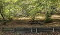
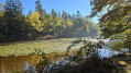
(1)Ignore the path that climbs slightly to the left and start on the right, passing through the gate, around the Étang de Huchère, following the signposting. A realm of water lilies and a feast for the eyes. Cross the small bridge at the far end of the pond, turn left to follow the other bank, passing a shaded picnic table.
(2) Before completing the full circular loop around the pond, turn right, heading due north, onto an uphill forest track. Continue left at the next path junction and rejoin the forest track.
(3) Follow it to the right until you reach a small road, ignoring the path on the left signposted ‘Croix de guerre 150 m’.
(4) Turn left, walk alongside the car park and pass the ‘Rond Caillou ’ (which can serve as a natural picnic table . Carved out of the rock, it measures approximately 3 m x 2 m and is engraved with the date 1880). Take the wide, vehicle-accessible track on the left, still marked with the Green Ring. Continue along this track until you reach a junction where three paths meet.
(5) At the junction, in the bend, turn right and then, immediately afterwards, take the path on the left heading due south, signposted ‘Green Ring’ and marked ‘Montiroche – Climbing site’ on a wooden sign.
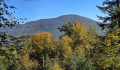
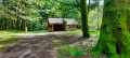
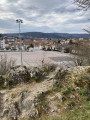
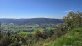
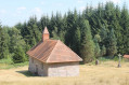
(6) At the next signpost, located at Montiroche, you have the option of a round trip by turning left towards “Pique-nique – Point de vue”. There is a shelter here , without a table, but with logs where you can take a break. Continue up a challenging rocky climb to reach the summit of the Roche de Montiroche. There is a bench here offering sweeping views over Remiremont.
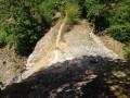
Back at the signpost, turn left towards the climbing site to begin the descent (marked with the Green Ring), which is quite steep at the start. Take care on the descent, as some sections are quite steep and rocky (slippery).
(7) Turn left onto a path that is not very visible: look out for the ‘Green Ring’ markings. Continue along this path, which runs behind the gardens of several houses and leads back to the track at the starting point (S/E).
 Visorando Member
 Moderate

 Very difficult
 Difficult

