


 Country:

 City:
City:


Park at the Saint-Mont car park.
(S/E) From the car park, head back to the small road.
Blue Triangle signposting
Head up to the right towards the Fardeau de Saint-Christophe. Follow the road to the end, ignoring the paths branching off to the right and left, and passing close to the houses at Gaingoutte and Pré des Gouttes.
(1) At the end of the track, carry on straight ahead onto the Jean Picard Forest Road. Pass a track leading down to the left to reach another Y-junction. Keep to the right, then ignore a track coming up from behind. Ignore another grassy track on the right as well as a dirt track coming up from the same side. You’ll arrive at the Fontaine des Charbonniers.
(2) Continue along the track and ignore a path starting on the left. Ignore the next two paths on the right and pass close to a tree trunk with decorations. You will then reach a junction.
(3) Take the path leading uphill to the right. Keep to the left and reach the Carrefour de la Boulée.
(4) Keep to the right, then carry straight on along the track opposite. Ignore a path leading downwards and then two others branching off to the right. Again, ignore the path to the left and then a crossroads to reach another major junction.
Red Cross signposting
(5) Turn left towards the Fardeau de Saint-Christophe. Follow the track to the right and turn right at the junction to reach the rock.
(6) Return to the main white track via the same route.
Blue Triangle Markings
(5) Then turn left onto the track. At the bend, keep left and ignore a track on the right. Ignore a junction on the right, then another on the left and a third on the right.
No markings
At the next fork in the road, turn left to go and see a boulder.
(7) Return to the track.
Blue Triangle signposting
Head down to the left to reach a junction.
Yellow Triangle signpost
Carry on to the left towards the Roche du Thin. Ignore a path on the left, then another grassy one on the right, to reach the Celtic boundary stone.
(8) Continue along the path, keeping straight ahead on the clearest route to the Roche du Thin and its viewpoint.
(9) Return to the Celtic boundary stone.
(8) Carry on straight ahead until you rejoin the wide white track.
Blue Triangle signposting
Turn left, then keep straight ahead at the junction until you reach a bend.
Red Triangle signpost
(10) Turn right towards the Chapel of Sainte-Sabine. Stay on the same track until you reach the sign about the wolf. Continue along the path, ignoring a discreet junction on the left, then another on the right, until you reach a Y-junction.
(11) Keep left, then do the same again before reaching a wide track. Turn right, pass a cross and a house, and reach the Sainte-Sabine Chapel and a junction.
Yellow Diamond markings
(12) Take the path that runs closest to the chapel. Enter the forest, ignore one junction, then a second. Then ignore all the more or less inconspicuous paths on the left. Pass near the Borne du Fossard and come to a wide track.
(13) Turn right and follow this track, ignoring two crossroads. Shortly afterwards, turn left to reach the Pierre Kerlinquin.
(14) Continue towards Saint-Mont, ignoring a grassy path leading off to the left. At the Fork in the road, in a bend, turn right before continuing to the left. At a small clearing, turn right before reaching a junction.
(15) Turn right and continue along the path to the Croix de Saint-Arnould and its rock.
(16) Head left towards the Pont des Fées. Shortly afterwards, you’ll reach a rocky outcrop offering a fine view; continue downwards. At the flat section, ignore the junction. Ignore the path leading off to the left towards the Stèle du Pilote and continue down to the track. Turn left to reach the Pont des Fées.
(17) Continue along the track to the next Fork in the road. Turn sharp right before climbing steeply to the left at the next junction. You will then reach the Fork in the road for Saint-Mont.
Unmarked
(18) Climb up to the right until you reach the track. Turn left onto it. Ignore a shortcut on the right and take the next path on the right to reach the Fontaine Sainte-Claire.
(19) Continue climbing along the path and, at the junction, turn left then immediately right to reach the summit of Saint-Mont.
(20) Descend via the same route until you reach the Yellow Diamond signpost.
Yellow Diamond signpost
(18) Keep to the right before continuing to the left all the way to the Chapel of Vieux Saint-Amé.
(21) Walk past the chapel to the right and take the path that runs past the old cemetery. At the first two junctions, head up to the right twice. At the third, cross the scree slope to the left. When you reach the Fork in the road, continue to the left to pass in front of the Borne du Saint-Mont. At the next junction, turn left and then repeat this to reach a large crossroads.
(22) Turn left, then take a right-hand bend. Keep going straight on until you reach the road.
(23) Walk down this road very carefully. Continue to the sign marking the entrance to Saint-Etienne-lès-Remiremont. Carry on to the Miraumont junction.
Blue Triangle signposting
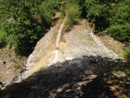
(24) Turn right into the cul-de-sac. At the end, continue along the track on the left before keeping to the right alongside the stream. You’ll soon reach the Miraumont Waterfall.
(25) Climb steeply to the left of the waterfall via two hairpin bends. Cross the stream and rejoin the road.
Red Triangle markings
(26) Walk up the road before taking the first path on the right. At the end of the path, follow the track to the left until you reach the car park (S/E).
 Visorando Member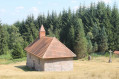
 Average
 Very difficult
 Easy
Easy 
