


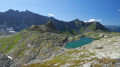
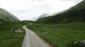
The start/finish point is in the hamlet of Les Prioux.
Four days in the Vanoise


This four-day summer circular route is designed for independent hikers who do not wish to stay in or near mountain huts. Consequently, the bivouac sites are located outside the Vanoise National Park and the Plan de Tuéda Nature Reserve.
Details
Creation:
Last update:
Last review:
-
 Activity: Walking
 -
 Distance: 33.67 mi
 -
 Average duration: 4 days
 -
 Difficulty: Difficult
 -
-
 Back to start: Yes
 -
 Ascent: + 12,995 ft
 -
 Descent: - 12,972 ft
 -
-
 Highest point: 9,534 ft
 -
 Lowest point: 5,089 ft
-
 Country:
France
Country:
France
-

-
 City:
Pralognan-la-Vanoise (73710)
City:
Pralognan-la-Vanoise (73710) -
 Start/End: N 45.34681° / E 6.70134°
 -


 Hour-by-hour weather
Photos
Stages of the route
This route needs several days, find the details below:
Notes
Reviews and comments
4.8 / 5
Based on 2 reviews
Reliability of the description
5 / 5
5 / 5
Ease of following the route
4.5 / 5
4.5 / 5
Route interest
5 / 5
5 / 5

User 29842067
Overall rating : 4.7 / 5
Date of your route : Jul 05, 2026
Reliability of the description : ★★★★★ Very good
Ease of following the route : ★★★★☆ Good
Route interest : ★★★★★ Very good
Very busy route : No
A really lovely little hike!! We did it in early July 2026. We explored the valley in all its glory, with plenty of varied scenery, passing by numerous lakes and spotting loads of marmots and ibex. There were a few technical sections over scree and snowfields, but nothing insurmountable. We had no trouble finding a stream or spring to fill our water bottles. We’d brought a water filter, but given how clear the water was, we could have done without it. The route is fairly easy to follow if you have it on a watch or a map, but much harder if you’re just trying to follow the points of interest. Be careful if you’re planning to camp for half a night – the park boundaries aren’t very clear.
A big plus: the route is very quiet; we felt as though we were alone in the world
If you’re in good physical shape, the route can easily be done over a weekend; we set off on Friday at around 7 pm and by midday on Sunday we were at a restaurant, without pushing ourselves any harder than that 
Machine-translated
tzouintzouin
Overall rating : 5 / 5
Date of your route : Jul 15, 2019
Reliability of the description : ★★★★★ Very good
Ease of following the route : ★★★★★ Very good
Route interest : ★★★★★ Very good
Hello,
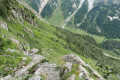
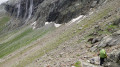
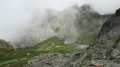
Thank you for this route! It’s a magnificent trek through the Vanoise. We set off on 15 July 2019 and enjoyed lovely weather throughout the four days. At that time of year, there were snowfields at the Col du Râteau, making the ascent slightly more challenging. Cairns and the orange markings make it easy to find your way through the scree.
Warning!!! The bivouac site for the second night is located outside the Vanoise National Park but within the Plan de Tueda Nature Reserve. Bivouacking in this area is prohibited (Decree No. 90-629 of 12 July 1990). Inspections are carried out in this area. As we were leaving the bivouac area, two people reminded us of the reserve’s rules  . You should therefore opt to stay at the Saut refuge.
@Moderator: could you please update this route to reflect this point?
There are plenty of water sources along the route.
Enjoy your hike, everyone!
Machine-translated
Other walks in the area
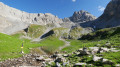
From the hamlet of Les Prioux to Lac du Rateau
 Visorando Member
 6.02 mi
+4,019 ft
-1,617 ft
6h 15
Difficult
6.02 mi
+4,019 ft
-1,617 ft
6h 15
Difficult
 Departure from Pralognan-la-Vanoise (Savoie)
First day of a 4-day route in the Vanoise massif.
A very pleasant climb along the ‘100-bend’ path to reach the summit of the Petit Mont Blanc and its orientation table. A lovely end to the day in the Combe du Rateau.
Le Petit Mont Blanc via the Sentier des cent virages
7.61 mi
+3,425 ft
-3,425 ft
6h 30
Difficult
Departure from Pralognan-la-Vanoise (Savoie)
A must-do hike in the commune of Pralognan-la-Vanoise. Bucolic setting, magnificent views. Grande Casse and Mont Blanc, among others.
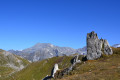
Lac de la Valette
 6.66 mi
+3,606 ft
-3,589 ft
6h 10
Difficult
Departure from Pralognan-la-Vanoise (Savoie)
6.66 mi
+3,606 ft
-3,589 ft
6h 10
Difficult
Departure from Pralognan-la-Vanoise (Savoie)
A hike beneath the Vanoise Glaciers towards the lovely Lac de la Valette, with the Grande Casse as a backdrop. The ascent follows an excellent path and includes a section off the beaten track, with magnificent views throughout.
The Chalet des Nants and the balcony trail
 5.85 mi
+1,886 ft
-1,857 ft
4h 20
5.85 mi
+1,886 ft
-1,857 ft
4h 20
 Moderate
Departure from Pralognan-la-Vanoise (Savoie)
Moderate
Departure from Pralognan-la-Vanoise (Savoie)
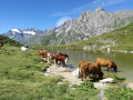
An easy walk in the Vanoise that is suitable for children or as a warm-up walk at the start of your stay. The circuit allows you to discover the Cirque des Nants and the Chavière valley from the balcony trail. There is a small lake on this trail that is a nice place to stop for the children.
La Valette Refuge
6.12 mi
+2,979 ft
-2,969 ft
5h 25
Moderate
Departure from Pralognan-la-Vanoise (Savoie)
In the heart of the Vanoise National Park, discover the Refuge de la Valette, perched at an altitude of 2,585 m. An essential stop on multi-day hikes or simply a little corner of paradise for a well-deserved break at the foot of the Vanoise glaciers. Make the most of your hike to explore the old refuge and the nearby lake. The slope’s exposure encourages updrafts, ideal for birds of prey (golden eagles, bearded vultures, etc.) to soar – a truly spectacular sight!
Le Pommier Blanc crossing
 5.88 mi
+2,628 ft
-2,605 ft
5h 00
Difficult
Departure from Pralognan-la-Vanoise (Savoie)
5.88 mi
+2,628 ft
-2,605 ft
5h 00
Difficult
Departure from Pralognan-la-Vanoise (Savoie)
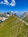
This summit is the end of a ridge descending from the Vanoise glaciers and allows you to immerse yourself on this slope of the right bank of the Torrent de Chavière overlooking the Prioux, without too much elevation gain or real technical difficulty, but at the cost of part of the route being off-trail.
Saut and Péclet-Polset mountain huts from Les Prioux - Chavière Valley
 16.18 mi
+5,794 ft
-5,794 ft
More than 12 hrs
16.18 mi
+5,794 ft
-5,794 ft
More than 12 hrs
 Very difficult
Departure from Pralognan-la-Vanoise (Savoie)
Very difficult
Departure from Pralognan-la-Vanoise (Savoie)
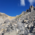
Two beautiful glacial valleys, two passes, two refuges, a lake... and views of glaciers and peaks rising to over 3,000 metres. The Alps as we love them, with vast panoramas and well-marked trails that allow you to rack up kilometres and elevation gain for a variety of views. Magnificent panoramas are guaranteed and, with a little luck, marmots and ibex will be there to greet you.
Lakes of Mont Coua via Col Rouge and Col du Soufre
 14.02 mi
+5,636 ft
-5,623 ft
11h 20
Very difficult
Departure from Pralognan-la-Vanoise (Savoie)
14.02 mi
+5,636 ft
-5,623 ft
11h 20
Very difficult
Departure from Pralognan-la-Vanoise (Savoie)
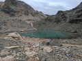
This hike takes you to the Lacs du Mont Coua and Lac Blanc, passing through the Col Rouge and Col du Soufre. Please note that at the start of the season there may still be a lot of snow, and some sections may be tricky.
For more walks, use our search engine .
The GPS track and description are the property of this route's author. Please do not copy them without permission.

