


 Country:

 City:
City:


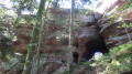
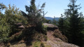
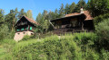
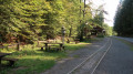
Park in Grand Soldat, near the old sawmill – which is also the terminus of the Abreschviller tourist train – on the Route Forestière de Wellerst.
(S/E) From the wooden buildings of the old sawmill, head down to the centre of the hamlet; then, with your back to Alexandre Chatrian’s birthplace, take the small path between the houses which crosses the stream
Marked with a Red Ring
(1) The Calice circular trail is marked on a concrete electricity pole by the stream. It winds gently uphill through the woodland and crosses the Calice Forest Road. Continue to the right along the road for 50 metres, then turn left onto a steep path leading to the magnificent Rocher du Calice. See ‘Practical Information’ for details regarding the closure of the path.
(2) Follow the very pretty path to the left, which climbs gently and is lined with large boulders in its first section; this begins at the spectacular rock near the Rocher du Calice. The second section is flatter and leads to the Rocher du Grand Rommelstein viewpoint.
(3) Descend along the steep path to the foot of the Grand Rommelstein, then, on level ground, make your way to the Place du Bon Dieu.
Marked with Yellow Saltire
(4) Turn right onto the Route Forestière du Petit Rommelstein, which descends towards the former Canceley Forest House.
(5) After the hairpin bend behind the former forest ranger’s house, continue straight on along the tarmac forest road of La Canceley for about a hundred metres.
(6) Continue to the junction with the grassy Gorge aux Sangliers forest track on the left.
(7) Follow this, turning left, until you reach the junction of the two Gorge aux Sangliers forest tracks (upper and lower).
(8) Turn right onto the Upper Gorge aux Sangliers Forest Road and follow it for about 50 metres.
Blue Cross signposting
(9) Turn left onto the forest path towards the Rocher du Canceley. Continue along the winding uphill path until you reach the junction with the Gorge aux Sangliers Forest Road; cross it and take the path opposite which leads to the Rocher du Canceley.
(10) To reach the summit of the Rocher du Canceley, turn right and take the sandstone steps.
(11) Leave the summit of the Rocher du Canceley by the same route you came up.
(10) Turn right at a large rock, heading towards Abri Fourman Blue Cross. After about 100 metres, you’ll reach the foot of the Canceley, which is pierced right through by a vast cavity.
Return along the same route to the junction of the two forest tracks in the Gorge aux Sangliers.
(9) Head towards the Canceley Forest House, marked on the trunk of a pine tree on the right, 30 metres past the junction of the two forest roads in the Gorge aux Sangliers.
(8) A narrow path, hidden by tall grass, leads to a metal footbridge crossing the Ruisseau d’Abreschviller, then to the Route Forestière de la Canceley.
Follow this forest road to the right for 50 m, then turn left onto the path leading uphill to reach the forest road, behind the two buildings known as the ‘former Canceley Forest House’.
(6) From the rather overgrown path, turn right towards the hairpin bend, behind the former Canceley Forest House
Yellow Saltire signpost
(5) From the two buildings of the former forest ranger’s house, follow the forest road uphill to the Place du Bon Dieu and turn right.
Markings: Green Ring and Red Ring
(4) Follow the Route Forestière du Bon Dieu to the right for 100 m (indicated by a wooden forest sign), then turn left onto the grassy path and pass the white ‘private property’ gate.
Continue along the sloping Route Forestière Circulaire du Calice until you reach the tarmac Route Forestière de Wellerst. Follow this for 50 m to the left.
(12) Turn right onto the path that crosses the Ruisseau de Grand Soldat. Continue along the pleasant path that runs alongside the stream and the tarmac Wellerst Forest Road, towards Grand Soldat, and turn left at the old sawmill to cross the stream via the wooden footbridge and return to the nearby car park (S/E).

 Visorando Member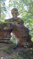

 Easy
Easy 
 Difficult
