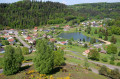
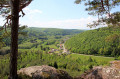
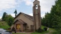
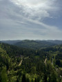
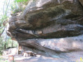
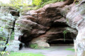
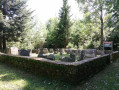
The three rocks around the Grand Soldat as seen from the Saint-Léon Chapel

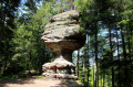
This easy circular walk starting from the Saint-Léon Chapel in Walscheid allows you to take in all three landmarks around the Grand Soldat in a single go: the Rocher de la Salière, the Rocher du Calice and the Rocher du Diable, culminating in a unique view of Walscheid from the viewpoint.

Details

n°21750936
Creation:
Last update:
Last review:
  • Walking
    Activity: Walking
  • ↔
    Distance: 11.23 mi
  • ◔
    Average duration: 6h 30 
  • ▲
    Difficulty: Average

  • ⚐
    Back to start: Yes
  • ↗
    Ascent: + 1,568 ft
  • ↘
    Descent: - 1,568 ft

  • ▲
    Highest point: 1,696 ft
  • ▼
    Lowest point: 1,017 ft

Photos

Description of the walk

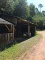
(S/E) From the Saint-Léon Chapel, cross the road and take the small path to the right of the metal shed; at the small clearing, turn right for 20 m.

(1) Head straight ahead towards Dabo and follow the red-white-red Red Rectangle markings until you reach a crossroads.

(2) At the crossroads, go straight on, then turn right and follow the Red Triangle markings to the Col du Bloecherplatz.

(3) Turn right and follow the Yellow Ring markings from here, passing the Rocher de la Salière, go down the steps and continue to the right to reach the hamlet of Grand Soldat.

(4) Turn right and walk past the houses to the fountain and the junction with the railway line.

(5) Head left and walk alongside the railway line to the terminus. Please note that during the summer season, a tourist train runs on this line.

(6) At the station, look out for the ‘Red Ring’ signposted path which heads left into the forest and follow it to the Place du Bon Dieu.

(7) Turn right and walk for about 1 km along the forest track.

(8) Leave this forest road on the right and follow the ‘Yellow Saltire’ markings to reach the Rocher du Calice.

(9) From the Rocher du Calice, head towards Abreschviller. When you reach the track, follow it for about fifty metres and then take the path on the left, following the ‘Yellow Saltire’ signposts.

(10) At the three-way junction, keep to the left towards l’Ermitage, reach the departmental road and follow it to the right for about 150 metres.

(11) Turn right onto the Route de Grand Soldat and, at the Fork in the road, turn left towards Wassersoupe.

(12) Immediately turn left onto the path marked ‘Red Cross’.

(13) At the shelter, continue to the left. Walk for about 1 km, staying on this track the whole time.

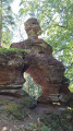
(14) At the junction, turn right twice to reach the Rocher du Diable.

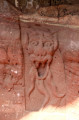
(15) Look for the sculpture of the devil beneath the rock, retrace your steps and head immediately to the right, go round the rock and climb the steps to enjoy the view from the gazebo. Set off again following the Red Rectangle-White Rectangle-Red Rectangle markings.

(16) At the junction, head to the right; after 50 m, turn left and follow the path marked with red-white-red Red Rectangles.

(17) Leave the track to the left and follow the path to the crossroads you passed on the way there.

(2) Turn left onto the path marked with a Red Triangle, which leads to the village.

(18) Head to the right for a round trip to the viewpoint. Here you’ll find the remains of the original chapel’s wall and a breathtaking view of Walscheid.

(19) Retrace your steps.

(18) Head down to the right, towards Saint-Léon Chapel (S/E).

Waypoints

  1. S/E : mi 0 - alt. 1,457 ft - Chapelle Saint-Léon (Saint-Léon)
  2. 1 : mi 0.06 - alt. 1,490 ft - Towards Dabo
  3. 2 : mi 0.38 - alt. 1,558 ft - Common junction for both outward and return journeys
  4. 3 : mi 1.4 - alt. 1,663 ft - Col du Bloecherplatz (507m)
  5. 4 : mi 2.68 - alt. 1,138 ft - Grand Soldat
  6. 5 : mi 2.87 - alt. 1,079 ft - Fountain junction
  7. 6 : mi 3.09 - alt. 1,102 ft - Station
  8. 7 : mi 4.32 - alt. 1,562 ft - Place du Bon Dieu
  9. 8 : mi 4.92 - alt. 1,506 ft - Junction
  10. 9 : mi 5.02 - alt. 1,552 ft - Rocher du Calice
  11. 10 : mi 5.89 - alt. 1,263 ft - Three-way junction, the Ermitage route
  12. 11 : mi 6.41 - alt. 1,017 ft - Route du Grand Soldat
  13. 12 : mi 6.74 - alt. 1,066 ft - Wassersoupe
  14. 13 : mi 7.09 - alt. 1,119 ft - Shelter
  15. 14 : mi 7.81 - alt. 1,191 ft - Crossroads
  16. 15 : mi 7.98 - alt. 1,296 ft - Rocher du Diable (430m)
  17. 16 : mi 8.68 - alt. 1,417 ft - Intersection
  18. 17 : mi 9.95 - alt. 1,486 ft - Junction
  19. 18 : mi 10.35 - alt. 1,512 ft - Return trip to the viewpoint
  20. 19 : mi 10.66 - alt. 1,381 ft - Saint-Léon Viewpoint
  21. S/E : mi 11.23 - alt. 1,457 ft - Chapelle Saint-Léon (Saint-Léon)

Notes

Shelters at Grand Soldat station, at the Rocher du Diable (gloriette) and at (13)

Worth a visit

(5) At Grand Soldat, on the right, the birthplace of Alexandre Chatrian, better known by his pen name Erckmann-Chatrian.
(S/E) Near the Saint-Léon Chapel, the cave of the same name, approximately 500 metres away, is 32 metres deep, 24 metres wide and 8 metres high.

Reviews and comments

4.3 / 5
Based on 2 reviews

Reliability of the description
4 / 5
Ease of following the route
4.5 / 5
Route interest
4.5 / 5
Viso54che
Viso54che

Overall rating : 4.7 / 5

Date of your route : Aug 16, 2026
Reliability of the description : ★★★★☆ Good
Ease of following the route : ★★★★★ Very good
Route interest : ★★★★★ Very good
Very busy route : Yes

A lovely walk, part of which I was already familiar with – I’d done the ‘Grand Soldat’ section before.
We couldn’t find the kiosk above the Devil’s Rock.

Machine-translated

gmj
gmj

Overall rating : 4 / 5

Date of your route : Aug 21, 2022
Reliability of the description : ★★★★☆ Good
Ease of following the route : ★★★★☆ Good
Route interest : ★★★★☆ Good
Very busy route : No

A lovely forest, a lovely walk; at the little train station on the way to Grand Soldat, there’s a nicely laid-out area with plenty of picnic tables.
At the Hermitage, the Abreschwiller narrow-gauge railway passes by

Machine-translated

Other walks in the area

For more walks, use our search engine .

The GPS track and description are the property of this route's author. Please do not copy them without permission.