Country:
 City:
City:


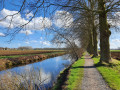
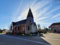
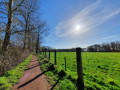
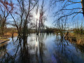
(S) With your back to the station, turn left, cross Rue du Général de Gaulle and take Rue de la Libération. At the end of the street, continue straight on along Sentier Brognard, then turn right into Rue des Résistants. At Rue Faidherbe, turn left and continue to the German military cemetery.
(1) Turn right onto Chemin du Bois de la Lodge. Take the first right onto Chemin de Laromé, then turn left onto Chemin de Beussignies and continue straight on until you reach the sewage treatment works.
(2) Turn right onto Chemin de la Gîte to enter the lodge site. At the first junction after the bridge over the Tortue, turn right onto the “Les Prés” path (marked with a silhouette of a heron). Follow it to a flight of steps at the entrance to the southern bend.
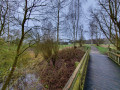
(3) Climb the steps to join the “Les Hauts de Santes” path (marked by an owl silhouette) on the hill and head off to the left. At the entrance to the second bend, take “Le Perchoir”, a wooden footbridge on the right, which zigzags upwards through the trees. At the end of the footbridge, continue to the right, staying on the embankment. Pass “L’Observatoire” and carry on to the first crossroads.
(4) At the junction, head downhill to the left towards the Relais Nature (Maison Monblond). Walk past the building to reach the D63. Turn right to cross the Canal de la Deûle via the bridge. After the bridge, head downhill to the right and pass underneath it again to reach the entrance to the Parc Mosaïc car park.
(5) Cross the car park via the central path, then take Rue du Bon Blé to enter the Canteraine nature reserve. At the edge of the woodland, on Chemin des Wedres, turn left, then right onto Chemin de Noyelles. Cross the tarmac road straight ahead and walk for 600 m along the edge of the Bois d’Emmerin on the Chemin des Longs Tours.
(6) Turn left onto Care Prévost, then right onto Chemin de la Carperie, then right again onto Chemin Vue Madame to rejoin Chemin des Longs Tours, which you follow to the left as far as La Becque.
(7) Turn right, then cross La Becque to the left to take Rue des Marais to the end. Turn left onto Rue d’Ancoisne, then, after 60 metres, follow the country lane to the right as far as Voie des Chats.
(8) Turn right onto the Voie des Chats, then left at the first junction. Cross the D1952 straight ahead. The path takes a 90° bend, then runs alongside an embankment. At the end of the embankment, turn right to walk alongside the Fort d’Houplin (a hillock overgrown with vegetation; no visible fortifications) and continue to the end of the path. Turn left to join Rue Georges Lampin.
(9) Follow Rue Georges Lampin to the right. At the junction with traffic lights, continue straight on along Rue Jean Baptiste Lebas.
(10) About 130 metres after the traffic lights, you can take Rue Pasteur for about sixty metres to admire the unusual Église Saint-Martin d’Houplin. Then return to Rue Jean Baptiste Lebas and continue towards the Canal de Seclin. Cross the canal.
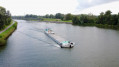
(11) Turn left to follow the canal towards Seclin until you reach the arched concrete bridge.
(12) Cross the canal and turn right, then take the few steps immediately on your left to join the Seclin Greenway. Follow it as far as Rue Jean-Baptiste Lebas.
(13) Turn right onto Rue Jean-Baptiste Lebas and continue to Place Saint-Piat. There, turn left onto Rue Gabriel Péri and head towards Seclin SNCF station (E).

 Visorando Member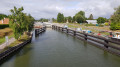
 Easy
Easy