From station to station: Marquillies – Don-Sainghin via Chico Mendès

Would you prefer to use public transport, or do you not have your own transport to get to the start of the walk?
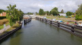
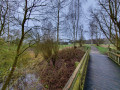
This walk from Marquillies station to Don-Sainghin station will take you through the typical agricultural landscapes of the Weppes region before following the canals that have contributed to the region’s economic growth. Not to mention the Chico Mendès nature reserve.

Details

12411772
Creation:
Last update:
Last review:
  • Walking
    Activity: Walking
  • ↔
    Distance: 9.53 mi
  • ◔
    Average duration: 4h 25 
  • ▲
    Difficulty: Moderate

  • ⚐
    Back to start: No
  • ↗
    Ascent: + 16 ft
  • ↘
    Descent: - 23 ft

  • ▲
    Highest point: 92 ft
  • ▼
    Lowest point: 66 ft
  • ⚐ Country: France
  • ⚐ City: Marquillies (59274)
  • ⚑
    Start: N 50.548086° / E 2.86701°
  • ⚑
    End: N 50.551708° / E 2.914656°
  • ❏
    IGN map(s): Ref. 2405E, 2505O
  • Hour-by-hour weather

Description of the walk

Departure from Marquillies station

(S) Head towards Rue Jean Jaurès and turn left. After 200 m, turn left onto a country lane. Follow this lane to the right to reach Rue du Moisnil.

(1) Cross this street straight ahead to take a path through the fields.

(2) At Chemin du Cheminet (water pumping station), take the sharp left-hand bend. Cross Route de Willy straight ahead and follow the path to Rue de la Ferme des Mottes.

(3) Turn right and follow Rue de la Ferme des Mottes until you reach Rue du Moisnil. Cross it at the pedestrian crossing to join Rue de Franquise. Follow this street and continue straight on.

(4): Cross the level crossing and continue for about 800 m.

(5): Turn right onto Chemin de la Marquise and continue towards Chemin des Loups (tarmac road). Follow this path to the right until you reach the wayside shrine at the entrance to Hantay.

(6) At the oratory, turn left onto the Voie des Morts, a path that runs alongside the gardens at the rear of the houses.

(7) At the end of the path, turn right onto Rue Jean Jaurès, then immediately left onto Rue Rouget de Lisle. When you reach Rue Mirabeau, turn right, then immediately left. The street turns into a country lane; continue to the end.

(8) At the end of the track, turn right and continue straight ahead along the path until you reach the Canal d’Aire.

(9) Follow the canal to the left until you reach the bridge. Turn left onto Rue du Lieutenant Folliet, then right onto Chemin de l’Abbaye until you reach the entrance to the Espace Chico Mendès.

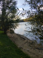
(10) Enter the Espace Chico Mendès and follow the path to the left. Walk round the Espace Chico Mendès in a clockwise direction until 100 metres past the pond (information board).

(11) Turn left onto a narrow path which leads to the towpath through the wooded edge. Follow this to the left until you reach the gate (near the entrance to the boat landing stage).

(12) Leave the towpath on the left and follow the country lane to the woods. At the T-junction, take the path on the right. Walk past the Masure farm until you reach a tarmac road.

(13) At the first junction, take the road on the right to reach the Canal de la Deûle.

(14) Follow the towpath to the left and continue straight on until you reach the multi-storey car park on the left-hand side of the road. Walk to Don-Sainghin station, located behind the multi-storey car park (E).

Waypoints

  1. S : mi 0 - alt. 75 ft - Gare de Marquillies
  2. 1 : mi 0.51 - alt. 79 ft - Rue du Moisnil
  3. 2 : mi 0.88 - alt. 92 ft - Hairpin bend
  4. 3 : mi 1.39 - alt. 75 ft - Rue de la Ferme des Mottes
  5. 4 : mi 2.05 - alt. 75 ft - Level crossing
  6. 5 : mi 2.55 - alt. 72 ft - Chemin de la Marquise
  7. 6 : mi 3.24 - alt. 79 ft - Oratory
  8. 7 : mi 3.68 - alt. 72 ft - T-junction on Rue Jean Jaurès
  9. 8 : mi 3.96 - alt. 69 ft - Saint-Martin Gully
  10. 9 : mi 4.51 - alt. 72 ft - Canal d'Aire
  11. 10 : mi 5.42 - alt. 75 ft - Espace Chico Mendès
  12. 11 : mi 5.97 - alt. 82 ft - Espace Chico Mendès
  13. 12 : mi 6.45 - alt. 72 ft - Barrier
  14. 13 : mi 8.09 - alt. 75 ft - Crossroads - Deûle (rivière)
  15. 14 : mi 8.56 - alt. 75 ft - Deûle (rivière)
  16. E : mi 9.53 - alt. 69 ft - Gare de Don Sainghin

Notes

Check train timetables on the SNCF website before setting off on your walk. If no trains are available at your preferred times, visit the Ilévia website; bus 61 also runs between the two stations. It is also possible to book a bus up to one hour in advance. In this case, it is the 61R service.

If you’re driving there yourself, it’s best to leave your car at the station you arrive at and travel to the starting point by train or bus. That way, you won’t be tied to a specific timetable on arrival.

In wet weather, some sections of the route can become quite muddy.

Worth a visit

From (S) to (8), you’ll be walking through the typical countryside of Les Weppes. Do feel free to return at different times of year to discover its many facets.

From (8) to (9), if you look carefully, you can still see the old Rigole Saint-Martin on the left-hand side of the path. This is the predecessor of the Canal d’Aire, which used to supply the businesses in Hantay. You’ll find an information board at the entrance to the path.

From (10) to (11), you’ll pass through the Espace Chico Mendès. This former sludge depot was developed with the help of schoolchildren from Billy-Berclau and serves an educational purpose. It’s very interesting.

Reviews and comments

4.7 / 5
Based on 2 reviews

Reliability of the description
4.5 / 5
Ease of following the route
5 / 5
Route interest
4.5 / 5
BaudouinB
BaudouinB

Right, I see.
I don’t know this woodland well enough to be able to answer your question, sorry.
I’d have suggested you go and have a look, but I’m not in the area this week.

Machine-translated

joorange
joorange

Good evening, BaudouinB,
This is the small wooded area on the left-hand side of the path between points 8 and 9.
I saw several paths leading off from there and I reckon there’s one that joins the towpath.
Thanks for your reply. I’ll try to map it out this week.
Have a good evening.

Machine-translated

BaudouinB
BaudouinB

Hello Joorange,
Of course, you can use my description 👍
As for the Bois d’Hantay, I’m really not sure how to answer you, as even after looking at the map, I can’t see which woodland you’re talking about… Could you be a bit more specific?

Machine-translated

joorange
joorange

Overall rating : 4.7 / 5

Date of your route : Sep 04, 2026
Reliability of the description : ★★★★★ Very good
Ease of following the route : ★★★★★ Very good
Route interest : ★★★★☆ Good
Very busy route : No

I’ve combined your walk with the Libaude trail to make a 22-kilometre route.
So I set off from Marquillies Town Hall to join your route and followed it from point 2 to point 13 (actually, a little before that).
I was very pleasantly surprised: you’re walking on good paths almost the whole time, and the stretch through the Espace Chico Mendès is very pleasant. Of course, it’s very flat!
Do you think it’s possible to reach the canal by crossing the Bois d’Hantay? There are a few paths leading off, but the one I took brought me back onto the path between points 8 and 9.
If you’ll allow me, I’d like to use your description to outline the whole walk.

Machine-translated

BaudouinB
BaudouinB

Please note that, following Storm Eunice and the damage it caused, the local council has issued a closure order for the Chico Mendès area. It is closed to the public until 20 March 2022.

Machine-translated

BaudouinB
BaudouinB

All right, but I do hope you did follow the railway line along the way 👮

Machine-translated

laviveyvette
laviveyvette

It wasn’t difficult, but we followed the tracks until we joined the path on the right, which led us to the gate and then to the right, as indicated 😉

Machine-translated

laviveyvette
laviveyvette

A pleasant walk without too many difficulties. You need to read the route details and, above all, look at the map. It’s not straightforward at the start of the route – you need to follow the railway tracks and look carefully to find the path again
Very happy with this walk – thank you
Hello, we followed the railway tracks for a while before reaching the path that led us to the gate, and then we turned right as indicated. I didn’t find walking alongside the tracks particularly difficult 😉

Machine-translated

BaudouinB
BaudouinB

Hello Yvette,

Thank you for your report!

However, I don’t understand when you write ‘at the start of the route, you have to follow the train tracks’… At no point on this route do you need to follow the train tracks… Could you please explain where you encountered these difficulties?

Kind regards,

Baudouin

Machine-translated

laviveyvette
laviveyvette

Overall rating : 4.7 / 5

Date of your route : Jan 17, 2022
Reliability of the description : ★★★★☆ Good
Ease of following the route : ★★★★★ Very good
Route interest : ★★★★★ Very good
Very busy route : No

A pleasant walk without too many difficulties. You need to read the details of the walk and, above all, check the map. It’s not straightforward at the start of the route – you need to follow the railway tracks and keep a close eye out to get back on the path
Very pleased with this walk – thank you

Machine-translated

Other walks in the area

For more walks, use our search engine .

The GPS track and description are the property of this route's author. Please do not copy them without permission.