Refine your search for walks in Diéval
Diéval walks
 The source of the Lawe from Bajus

This hike will take you from the plains to the woods via Thieuloye and Rocourt en l'Eau, where the Lawe river has its source. Bajus was a village where French troops rested before going to the front during the First World War
 Path from the keep starting from Bours

This hike starts at the Bours keep and takes us along paths and through woods to the top of a hill with remarkable views. You will descend via Les Eguerguettes towards the village. Please note: the descent is difficult in wet weather. The hike ends with a short tour of the narrow streets of Bours.
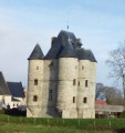
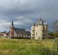
 Bours keep

The walk starts from the Donjon de Bours (Bours keep) and takes you up to the plateau with its remarkable views. You'll then head back down to the village, finishing with a stroll through the narrow streets of Bours.
 In the footsteps of the Bours family
From the Bours Keep, passing by the Fontaine de la Baloche fountain, then through the Bois de Lanoy woods and past Antigneul Castle, the hike follows grassy paths offering beautiful views.
 La source de la Lawe

Randonnée au départ de La Comté qui nous mène près de la source de la Lawe.
Paysage très agréable et quelques vallonnements.
 The hills of Faux
A beautiful, undulating trail on the Ternois hillsides. Donjon de Bours (keep).
 The upper Lawe valley

A very pleasant trail, between river, forest and valleys.
 The valleys of Ourton

A long route that takes us from the mining landscape to the Artesian countryside.
 La Divionnaise
This hike, between town and countryside, will take you through towns and parks. You will walk along the Biette river and then climb the slag heap. You will discover pits 5, 5 bis, 1 and 1bis, which is the deepest in the mining basin at 1,186 metres.
 Trail along the little paths of Houdain via Mont de la Comté

Admittedly, the trail may seem a little monotonous, but what a beautiful path! It takes you gently up to the heights before dropping back down into the valley to climb Mont de la Comté.And at the end of the trail, the church awaits you.
 On the Plateau des Atrébates, starting from Frévillers
This is a long route without any major difficulties, apart from the distance. It follows a succession of wide paths and small roads, making it safe to walk even in wet weather. It is therefore ideal from October onwards.
 La Lawe in Bruay-la-Bruissière

This walk will take you on a tour of Bruay-la-Buissière, starting from Parc de la Lawe and passing by the Miners' Memorial and the Corons.
This young commune owes its name to the merger of Bruay-en-Artois and La Buissière, which took place in 1987.
 Around Cuvigny

A short walk on good paths in the hills above La Comté. On a clear day, the panorama is superb, and if you're luckier than me, you'll spot a few deer.
 In the footsteps of Saint Benedict

The Ternois is a beautiful region in northern France. There used to be an abbey where good cheese was made, and there is still a shop selling local products.
 La Creuse de Boyaval
In the Ternois, after a loop on the small roads of Sains-les-Pernes, head towards Fiefs, before descending to Boyaval via a wild hollow and returning to Sains-les-Pernes via the Chemin Vert, which would benefit from regular maintenance.
It is best to walk this route in dry weather, as some sections are difficult.
This is a difficult route because the paths are tricky and you need to be careful not to miss the entrances to some of the trails.
 The two woods and the Coqueline

A very pleasant nature trail in dry weather, but becomes more challenging in wet weather: grassy sections (a good test for your shoes, deep ruts, muddy sections).
Warning: October 2024. While it's relatively easy to get through the ruts, the last part of the path out of the wood (before point 9) is in a terrible state. The path has been broken up by machinery and you can only pass along the sides, which are themselves very difficult. It's very slippery and sometimes you have to change sides, which is a real challenge. This used to be a signposted mountain bike trail, is it still?
 La Buissière - Ourton loop following the Biette, then the Lawe

This is a long walk in an urban area, but 90% of it is on paths. Start at the old bridge and its steps, then follow the Biette (a beautiful footbridge restored last year) to Ourton. Next, climb back up (unfortunately on the road) before descending to Beugin. Follow another bridge to the Divion Viaduct. There, a slightly tricky descent takes you back to the banks of the Lawe. Follow it first on the left bank, then on the right bank before following the bus route. And to finish in style, the Bois de la Volville, with a nice climb at the end.
 Woods, footpaths and mining heritage around Lapugnoy

Long route through the Bois de Roquelaure, the Poulouches d'Allouagne and the Vallée Carreau d'Auchel. Return via Lozinghem and Mont Éventé before finishing at the Terril de Lapugnoy and a beautiful path on the edge of the Bois des Dames.Relatively little tarmac (but we are still in an urban area), but in wet weather, some paths can become difficult.
 Le Chemin des Voyettes Poulouches

The Chemin des Voyettes Poulouches, which you will take, will lead you from one voyette (small lane) to another and allow you to discover or rediscover our village.
 Two woods, a slag heap and a charterhouse to digest it all
Up to the entrance to the Bois des Dames, the route is much the same as this hike (there aren't many options in the Bois de Roquelaure), but I took other paths to cross the Bois des Dames. The end of the route passes behind Emmaüs before reaching the Chartreuse des Dames and joining the Bois des Sablières.It's long, winding, almost entirely unpaved and with a significant elevation gain. Very difficult in wet weather.The use ofthe Visorando app is strongly recommended.
