From Cheylade to Le Claux: exploring the waterfalls and lakes

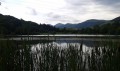
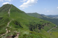
This walk is all about heritage and discovery. Visit Cheylade Church, Lac des Cascades and its waterfalls, the Pic du Christ with its observation tower, and Lascourt Pond.

Details

n°45543856
Creation:
Last update:
Last review:
  • Walking
    Activity: Walking
  • ↔
    Distance: 6.34 mi
  • ◔
    Average duration: 3h 55 
  • ▲
    Difficulty: Moderate

  • ⚐
    Back to start: No
  • ↗
    Ascent: + 1,148 ft
  • ↘
    Descent: - 656 ft

  • ▲
    Highest point: 3,839 ft
  • ▼
    Lowest point: 3,018 ft

Photos

Description of the walk

(S/E) Set off from the Hôtel de la Vallée on the right. Continue to the junction and take the first road on the right.

(1) Take the second right towards Cheylade Church and follow the road down to the left. Cross the bridge over the river and continue straight on at the next two junctions to reach a third junction near the Waterfall de la Roche.

(2) Turn left towards Lac des Cascades. Ignore the turn-offs to the lake on the right until you reach a Fork in the road.

(3) Take the road on the right. At the next junction, you can walk round Lac des Cascades; otherwise, carry on straight ahead until you reach the junction with thePR® (yellow markings).

(4) Turn right towards the Pic du Christ, then turn left a few dozen metres further on towards the summit and its tower.

(5) Climb up to the observation tower, then head back down to continue the walk to the next junction.

(6) Leave the Sentier des Cascades and head straight south towards the D262: Puy Mary is in sight.

(7) Cross the road and carry on straight ahead towards Lascourt and its lake.

(8) Go through the gate and take theGR®400(red and white markings) to the left. Walk round the Étang de Lascourt, keeping it on your left: enjoy the view of Puy Mary to the south and the Sancy to the north. Then head left, towards Le Claux. Follow theGR®400to the village. Keep left along the track, then take the second right towards the post office.

(9) Carry straight on towards Lavialle and the Gîte du Puy Mary, continuing straight ahead the whole way (E).

Waypoints

  1. S : mi 0 - alt. 3,159 ft - Hôtel de la Vallée
  2. 1 : mi 0.09 - alt. 3,153 ft - Junction - Église Saint-Léger (Cheylade)
  3. 2 : mi 1.58 - alt. 3,173 ft - Junction
  4. 3 : mi 1.79 - alt. 3,166 ft - Fork in the road, turn right
  5. 4 : mi 2.19 - alt. 3,366 ft - PR towards the Pic du Christ
  6. 5 : mi 2.65 - alt. 3,688 ft - Observation tower
  7. 6 : mi 3.01 - alt. 3,645 ft - Crossroads
  8. 7 : mi 3.22 - alt. 3,678 ft - D262
  9. 8 : mi 4.65 - alt. 3,835 ft - Etang de Lascourt
  10. 9 : mi 5.57 - alt. 3,402 ft - Le Claux, Post Office
  11. E : mi 6.34 - alt. 3,652 ft - Gîte du Puy Mary

Notes

(3) You can take a short detour to the right to see the Sartre Waterfall: about 5 mins.

At the junction after (3), you can walk round Lac des Cascades via the discovery trail: approx. 30 mins.

Worth a visit

Always be cautious and plan ahead when you're outdoors. Visorando and the author of this route cannot be held responsible for any accidents occurring on this route.

The GR® and PR® markings are the intellectual property of the Fédération Française de Randonnée Pédestre.

Reviews and comments

5 / 5
Based on 1 review

Reliability of the description
5 / 5
Ease of following the route
5 / 5
Route interest
5 / 5
Gerroq
Gerroq

Overall rating : 5 / 5

Date of your route : May 22, 2025
Reliability of the description : ★★★★★ Very good
Ease of following the route : ★★★★★ Very good
Route interest : ★★★★★ Very good
Very busy route : No

A pleasant walk starting from the church in Cheylade, which is an absolute must-see for its remarkable ceiling. The route is easy to follow, starting off along a quiet little road. You’ll walk alongside pastures, attracting the curiosity of the Salers cows. There are plenty of points of interest along the way, including waterfalls, a lake, and local flora and fauna. Please note that this route is not a circular route.

Machine-translated

Other walks in the area

For more walks, use our search engine .

The GPS track and description are the property of this route's author. Please do not copy them without permission.