From Cheylade to Le Claux: the Quirous path and the Limon Plateau

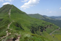
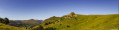
Come and discover the Quirous trail, the Limon Plateau and the Puy de Niermont, offering a 360° view of the Cantal mountains, the Sancy and the Cézallier.

This walk is part of a multi-day hike: From Cheylade to Le Claux and back

Details

n°45545815
Creation:
Last update:
Last review:
–
  • Walking
    Activity: Walking
  • ↔
    Distance: 11.11 mi
  • ◔
    Average duration: 7h 20 
  • ▲
    Difficulty: Moderate

  • ⚐
    Back to start: No
  • ↗
    Ascent: + 2,533 ft
  • ↘
    Descent: - 2,031 ft

  • ▲
    Highest point: 5,282 ft
  • ▼
    Lowest point: 3,156 ft

Photos

Description of the walk

(S) At the Hôtel de la Vallée, with the town hall opposite, turn left towards the campsite. Ignore one junction and carry on until the next one on the right.

(1) Turn right, still heading towards the campsite, then take the road on the left until you reach the entrance to the fir forest.

(2) Take the path on the right before the house and enter the pine forest (be careful, it’s uphill). Carry on straight ahead until you come out of the woods, at a track.

(3) Follow the path which climbs to the left and then keep to the right until you reach the Buron de Fontrouge.

(4) Go round to the right. Keep to the right at the next Fork in the road and carry on, passing the Buron des Cavounes, until you reach the next crossroads on the Sentier des Quirous.

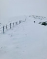
(5) Turn left (this path, which crosses the Plateau du Limon, is dotted with cairns or piles of stones. Placed every 20 metres, they helped travellers find their way, particularly in bad weather.) Continue to the junction with theGR®4

(6) Leave the path and join theGR®4(marked in red and white) by turning sharply to the right. Then carry on straight ahead until you reach the top of a hill, where there is a possible shortcut to the right.

(7) Continue along theGR®4to reach the Puy de Niermont.

(8) Follow theGR®4southwards. Pass a path on the left to reach theGR®400on the right.

(9) Take this path (also marked in red and white) and head into the Bois Nolly-Lavialle until you reach a Fork in the road.

(10) Turn left (signposted ‘Lodge of Puy Mary’). Keep to the right until you reach the road and the sign for Le Claux.

(11) Turn left towards Le Claux and continue to the Lodge du Puy Mary (E).

Waypoints

  1. S : mi 0 - alt. 3,156 ft - Hôtel de la Vallée
  2. 1 : mi 0.13 - alt. 3,202 ft - Path on the right (pine forest)
  3. 2 : mi 0.7 - alt. 3,484 ft - Entrance to the fir forest
  4. 3 : mi 1.46 - alt. 4,026 ft - Track
  5. 4 : mi 2.81 - alt. 4,551 ft - Ruins of the Buron de Fontrouge
  6. 5 : mi 3.82 - alt. 4,547 ft - Quirous Trail
  7. 6 : mi 4.55 - alt. 4,675 ft - GR4
  8. 7 : mi 5.75 - alt. 5,069 ft - Possible shortcut
  9. 8 : mi 6.69 - alt. 5,282 ft - Puy de Niermont
  10. 9 : mi 8.49 - alt. 4,449 ft - GR400 - Col de Serre (1331m)
  11. 10 : mi 9.64 - alt. 4,452 ft - Fork in the road, signs for the Puy Mary Lodge
  12. 11 : mi 10.93 - alt. 3,770 ft - ‘Le Claux’ signpost
  13. E : mi 11.11 - alt. 3,642 ft - Gîte du Puy Mary

Notes

(7) You can shorten the route (by about 2 hours) by cutting across to the right towards Chabraire. Then follow the forest path to the radio masts and then the road to the Puy Mary Lodge

Worth a visit

Always be cautious and plan ahead when you're outdoors. Visorando and the author of this route cannot be held responsible for any accidents occurring on this route.

The GR® and PR® markings are the intellectual property of the Fédération Française de Randonnée Pédestre.

Other walks in the area

For more walks, use our search engine .

The GPS track and description are the property of this route's author. Please do not copy them without permission.