Country:
 City:




Departure from Breuillet-Village station, RER C line; during the day, a train runs every 30 minutes.
From Paris: board at the rear of the train.
(S) From Paris: walk along the platform towards the rear of the train, turn right, then take the first right until you reach the church. Head back down the main street, turn right, then left to return towards the station.
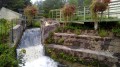
Cross the railway line, continue straight ahead past the “Moulin des Muses”. Turn left at the junction and walk for 50 metres.
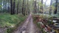
(1) Turn right onto the dirt track that climbs through the fields. Go over the hill and head down towards Breux.
(2) At the crossroads, turn right to visit the charming little church, then return to the crossroads.
GR® signposting
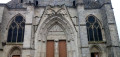
(2) Turn right onto Rue du Moulin. Cross the D82, reach Saint-Yon, and take the road on the right for 50 metres. At the pedestrian crossing, cross the road, climb the few steps, then turn left and follow the path which climbs quite steeply. Pass under the Porte des Bourdeaux (a remnant of the Château de Saint-Yon), and make a short detour towards the church.
(3) Retrace your steps and take the path directly opposite heading due south; after 100 m, it turns left towards due east. Leave the woods, turn right at a right angle, then re-enter the woods.
(4) At the crossroads, take thesecond path on the right uphill, then thefirst on the left. You’ll come to a sort of junction where several paths meet.
(5) Turn right, continuing to follow the red ‘private property’ signs spaced at regular intervals on your right-hand side. Continue down a fairly steep and rocky slope. You’ll reach a good path: turn left. 100 metres further on, take a hard-surfaced path on the right; as you pass, you’ll catch a glimpse of Château de Segrez on your right. You’ll arrive at Saint-Sulpice de Favières.
YellowPR® markings
(6) Walk round the church, pass the town hall and turn right. After 300 m, when the road curves to the left, carry on straight ahead along the path. Cross the D82, cross the Renarde stream, then head uphill.
(7) At the junction just before the top, turn left. Cross a small road, then continue straight ahead along the path which runs alongside the Renarde. The path becomes a track, then a road. You’ll arrive at the esplanade in front of Souzy-la-Briche town hall (two picnic tables).
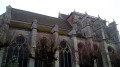
(8) Continue for about a hundred metres, then turn right onto a narrow path that climbs to the Church of Saint-Gilles and Saint-Martin.
Unmarked
Walk down Rue des Roches, turn left to catch a glimpse of the Château de la Chapelle de Souzy (the Republic’s country residence). Retrace your steps and take the path that climbs alongside the residence’s boundary wall.
GR® signposting
(9) At the corner of the wall, turn left. After 200 metres, ignore thePR® path branching off to the left and take the path opposite. Continue along the main path, which turns right, then left, and climbs through the forest before emerging onto the plateau amongst the farmland.
(10) At the crossroads, take the path leading down to the left. At the bottom, take the road to the right, then immediately left (briefly leaving the signposting). Just before the bridge, take the narrow track on the right, which then veers to the right. Rejoin the road and theGR®: turn left. You’ll reach the church at Villeconin. Turn left and cross the bridge over the Renarde.
(11) Ignore the two streets branching off to the left, then take the first on the right.
Unmarked
After 300 m, take a path on the right that runs alongside the castle fence. Pass the Source de la Renarde, a wash house, and rejoin the D148. Turn left. At the junction, take the road that climbs steeply to the right, which becomes a track. On leaving the forest, you’ll reach a junction.
(12) Turn right. Just before reaching the crossroads you passed on the way there, look out for a section of a tower from the ruined Château de la Grange.
(10) At the crossroads, turn left onto the farm track.
(13) Pass the first junction and continue straight ahead, then turn right at the second junction. After a left-hand bend, rejoin theGR®1and follow it straight ahead for about 100 metres.
YellowPR® markings
(14) Leave theGR® on your left and continue straight on northwards through the fields, then turn left at the entrance to the woodland onto a path which becomes narrow and descends quite steeply. The path becomes a track and then a narrow lane.
(15) At the crossroads, turn right, then, 200 metres further on, turn left onto Rue du Coteau Sud.
Unmarked
After 80 m, take the first lane on the right, which quickly turns into a path. Pass under the power lines, then emerge from the woodland to reach a clearing (fitness trail).
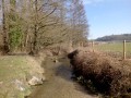
(16) Turn left, then right just before the culvert. Follow the River Orge until you reach a road.
(17) Take the passage under the bridge; after 50 m, turn left, then right before the culvert to follow the River Orge again. When you reach a road, turn left, cross the bridge, then immediately left (Rue de l’Orge). When the street bends left between the tennis courts, take the path on the right which leads to Saint-Chéron station (E).

 Visorando Member

 Easy