Country:
 City:
City:


Start from Breuillet-Village station (RER C). Car parks in the immediate vicinity.
(S/E) With your back to the station, follow Rue de la Gare D19 north-north-west towards the town centre. Take the second street on the right, Rue de l’Ancienne Poste, pass a bar-tobacconist, then opposite, up a small hill, pass the war memorial, then the church porch. Cross Rue de la Tournée, then pass between the post office and a care home.
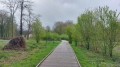
(1) Just past the post office, turn right into Parc des Larris, a pleasant little park with clearly marked paths. Walk uphill for about 40 metres and take the path on the right at a right angle, leaving a building on your left; continue in the same direction for 120 metres and turn sharply left, continuing uphill. 100 metres further on, turn left again and you will reach Rue des Écoles.
(2) Follow this street to the right, then turn left into Rue du Bassin Fossé.
(3) At the junction with Rue des Buttes Réault, first turn right then left to join a path opposite. At the end, turn right into a small housing estate. You’ll come out onto Rue des Longchamps and follow it to the left towards the gendarmerie.
(4) Cross the D116 with care (very busy road). Take the path opposite, which then runs between two gardens in the hamlet of La Savalerie. Cross Rue Beaulieu and continue straight on downhill.
(5) At the T-junction, turn right and walk alongside a fence on your left. Continue straight on until you reach the entrance to the Parc du Colombier.
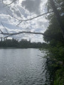
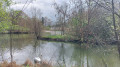
(6) Turn left and enter the park (note: open from 9am to 5pm in winter, and from 9am to 7pm the rest of the year; closed on Mondays; if it is closed, return via (5) directly). After a short descent, take a path partly paved with wooden decking, which goes round the pond and, via a small detour to the right at the far end of the pond, allows you to reach La Rémarde. Then exit via the park entrance. On leaving the park, turn right, go through a forest gate and continue straight on along the path you took earlier.
(5) Continue straight on along a small road and pass through the hamlet of Malassis. At the junction, follow the road to the right (Rue de Courte Pluche) for a good fifty metres, then turn left into Rue du Bois Véri.
(7) Walk along the edge of the woods and then through them to the next small road. Cross it carefully by veering right then left and continue along the main path opposite.
(8) When you reach a gate on the path, turn left onto an uphill path. At a Fork in the road, take the left-hand branch. At the next junction, go straight on and pass between some pretty houses, until you reach Rue de la Tuilerie.
(9) Follow this street to the right for about fifty metres. Then turn left into a side street. Ignore a street on the right and then another on the left.
(10) Just before the main road, take a path on the left and enter the forest. Turn right onto this path and follow the wall of a property on your right. Stay on this path, marked in yellow, until you reach the D116.
(11) Cross the road very carefully and turn slightly left into the street opposite. Turn right immediately. Cross Rue Gabriel Péri (D19) and continue straight on to the level crossing. Cross the railway tracks then turn left onto Rue de Rimoron.
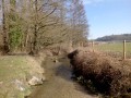
(12) Take the first left, Rue des Douves. After about 250 m, turn right, ignore two streets on the left and take a footbridge over the Orge.
(13) On the other side of the river, turn left onto a path and follow the river on your left. Further on, the path moves away from the Orge and leads to a junction.
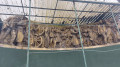
(14) Turn left here and cross the Orge again. On the other side, turn right and enter the Parc du Moulin through a gate (you can also stay on the other side of the river and reach the station via the small street on the left). Walk through the park; don’t miss the “Frise du travail” 100 metres from the park exit. At the exit, turn left to return immediately to Breuillet-Village station (S/E).

 Visorando Member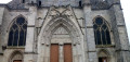

 Easy
Easy