


 Country:
 City:
City:


Starting point and access: Boutigny railway station.
- RER – Line D, on the section between Paris and Malesherbes.
Take the ‘Centre-ville’ exit on the side of platform 1 (travelling from Paris to Malesherbes; if arriving from the opposite direction, use the underpass).
Red and white + blue signposting
(S) Cross the square at the station exit, then turn right onto Rue de Lans towards Maisse and Milly. Pass the war memorial on your left and continue straight on for about a hundred metres.
Red and white markings
Turn into thefirst left, Rue de Cheval Rue, towards the sports hall. At the Stop sign, carry on straight ahead and head gently uphill.
Red and white + blue markings
At the next stop sign, carry on straight ahead uphill. After about 250 metres, ignore the access road to the sports hall on your right and carry on straight ahead along the cul-de-sac. The tarmac soon gives way to a stony track at the edge of the woods.
Red and white + blue + orange markings
(1) At the junction at the top of the hill, take the path on the right running alongside the fields. Pass between a shed on the left and a reservoir on the right, then enter the Bois de Débat. Stay on the wide main path and ignore all the side tracks. Begin the descent through the woods.
(2) On the descent, when you reach a metal gate on the right-hand side, turn left onto a path that climbs slightly. Further on, leave the woods and immediately ignore a path on the left (not shown on the map). At the next junction, turn right and head downhill, first along the edge of the woods and then into the woods.
(3) At the corner of an excavation on the right-hand side, turn right. Continue straight ahead (south-south-east) and ignore any paths branching off to the sides. Leave the woods and continue along the edge.
Red and white + blue markings
(4) At the signpost, carry on straight ahead between the fields. Then ignore a path coming from the left and continue along the edge of the woodland on your left. After the path bends to the right, walk alongside a long building. At the corner of the building (no. 13), turn left. You’ll soon come out onto the D105 (Rue du Pressoir) and follow it to the left for about 200 metres.
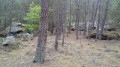
(5) Shortly after the sign marking the exit from Le Pressoir, cross the road (with care) and pass under the metal gantry of a small car park. At the far end, take the path leading off to the right. Keep heading south for 1 km and, at every junction, go straight on. Under a beautiful pine forest, the sandy path begins with a gentle climb followed by a descent and a long flat stretch.
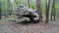
(6) At the junction with a signpost, follow theGR®1to the left. The path remains sandy and climbs gently. Ignore a turn-off to the left (not shown on the map) and note a few small boulders on the left. The slope then becomes steeper. Continue uphill on the main path, which has become stony, and ignore a turn-off to the right followed by one to the left.
Red and white + blue + yellow markings
(7) At the next junction, carry on straight ahead on roughly level ground. Ignore all turn-offs to the left until you reach a crossroads at the boundary of plots nos. 3, 4 and 8. Then turn right (south-south-east) and follow the path as it winds through the woods. Note a marker on the right indicating theGR®1.
Red and white markings
(8) Shortly afterwards, leave the main track and take a path on the right that descends quite steeply. Zigzag beneath the pine trees through lovely heather-covered undergrowth. Ignore a turn-off on the right (elevation 103) and turn left. At the bottom, you’ll come to a wider, very sandy track.
(9) At a sort of crossroads, carry on straight ahead, noting the boulders on the right. Walk south-west through the pine forest, which gradually opens out, and ignore all the side paths.
(10) At the fork in the road, take the left-hand path, still following the GR®. Leave the woods and, when you reach the first houses, you’ll come to a gravel track.
(11) At the signpost, follow a street to the left (Rue de Malabry on the map) and immediately ignore the Chemin des Bruyères, which branches off to the right. Walk through a residential area, ignoring a path branching off to the left and all the side streets on the right.
(12) Cross the Allée des Tilleuls on the right-hand side and continue along the main road (see a shortcut in the practical information).
Red and white + yellow + orange markings
Cross the D837 at the pedestrian crossing (traffic lights) and first turn left then right onto a path closed to motor vehicles which leads into the woods. Ignore a vague path branching off to the right and walk alongside a fence a short distance to your right. At a junction, turn right and head uphill with the fence on your right.
Red and Yellow + Blue + Orange markings
(13) At the junction, follow a wide path to the right towards Maisse (let theGR®1continue straight ahead). Walk along a gently sloping path and note the boulders clinging to the steep slope on the left. Further on, walk alongside the fence of the Comble quarry.
(14) Pass through a forest gate, leave the entrance to the Comble quarry on your left and rejoin the tarmac road. At the end of the access road, turn right and walk alongside the railway line on your left. Continue along the cycle path marked out on the left-hand side of the road. At the end, turn left onto the D837. Just before the level crossing, turn right and cross the road to reach Maisse station straight away (E).
To get back home:
- RER – Line D, towards Malesherbes (access before the level crossing) or Paris (access after).

 Visorando Member
 Difficult
  Association / Club / Walk leader
 Easy
Easy 
