From Belcastel to the Moulin de Cougnaguet

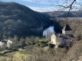
An incredibly peaceful and easy walk which, following the River Ouysse, allows you to discover a place that feels somewhat removed from the hustle and bustle of modern life. To begin with, there is a beautiful viewpoint overlooking Belcastel Castle. Then, after Les Bertoux, the River Ouysse winds its way through a canyon with no human habitation apart from the few mills that dot the route on the opposite bank. Shaded for almost the entire route, in summer you can enjoy the cool breeze from the river, and finally, you arrive at the fortified mill of Cougnaguet, which you may wish to visit.

Details

103702976
Creation:
Last update:
Last review:
  • Walking
    Activity: Walking
  • ↔
    Distance: 6.16 mi
  • ◔
    Average duration: 3h 00 
  • ▲
    Difficulty: Easy

  • ⚐
    Back to start: Yes
  • ↗
    Ascent: + 194 ft
  • ↘
    Descent: - 177 ft

  • ▲
    Highest point: 407 ft
  • ▼
    Lowest point: 325 ft
  • ⚐ Country: France
  • ⚐ City: Lacave (Lot) (46200)
  • ⚑
    Start/End: N 44.84309° / E 1.551855°
  • ❏
    IGN map(s): Ref. 2136ET, 2137O
  • Hour-by-hour weather

Description of the walk

The start is on the edge of the D43: parking is available just before the bridge over the Ouysse when coming from Lacave, near the Chemin des Bertoux.

This walk follows the entire route of the GR®6, but the red and white markings are rather faint.

(S/E) Take the Chemin des Bertoux, which climbs gently towards the hamlet.

(1) Follow the GR®6 route to the right, which runs along a very narrow road situated between a large stone house on the left and a walnut grove on the right; it serves a few houses on either side.

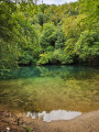
(2) Keep to the right to follow a limestone path that winds up the Ouysse valley, which has carved acanyon into the limestone plateau with magnificent cliffs on either side.This path presents no difficulty; it is shaded for the most part and occasionally veers slightly away from the river.

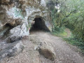
(3) Of note at this point is a geological feature known as the Fontaine du Truffé, which acts as an overflow for the underground water system; it spills into the Ouysse, cutting across the path in the event of very heavy rain. Continue on to the fortified mill at Cougnaguet, enjoying the peace and shade, except for a few hundred metres towards the end. The mill is open to visitors: check the opening times.

(4) Turn back and follow the outward route in the opposite direction to return to the starting point (S/E.

Waypoints

  1. S/E : mi 0 - alt. 335 ft - Car park - Grottes de Lacave
  2. 1 : mi 0.14 - alt. 364 ft - The hamlet of Les Bertoux
  3. 2 : mi 0.36 - alt. 325 ft - Junction
  4. 3 : mi 1.7 - alt. 341 ft - Fontaine du Truffé - Ouysse (rivière)
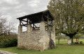
  5. 4 : mi 3.07 - alt. 358 ft - Fortified Mill of Cougnaguet - Moulin fortifié de Cougnaguet (Calès)
  6. S/E : mi 6.16 - alt. 335 ft - Car park

Notes

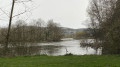
The Ouysse is a river fed by an upstream resurgence (the Saint-Sauveur and Cabouy chasms). Throughout the route, it is quite wide and deep and cannot be crossed on foot.

A very accessible route with no difficulties whatsoever.

There are no refreshments or drinking water along the route, except at the fortified mill (4) if it is open to visitors.

Pleasenote:

  • Much of the route is outside mobile phone coverage.
  • The Fontaine de la Truffé (4) is an access point for cave diving; it is therefore the start of a siphon. Take care with children.

Worth a visit

Always be cautious and plan ahead when you're outdoors. Visorando and the author of this route cannot be held responsible for any accidents occurring on this route.

The GR® and PR® markings are the intellectual property of the Fédération Française de Randonnée Pédestre.

Other walks in the area

For more walks, use our search engine .

The GPS track and description are the property of this route's author. Please do not copy them without permission.