Saint-Sozy circular

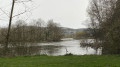
A flat, easy route passing through the pretty village of Saint-Sozy and the walnut groves, with part of the route running alongside the Dordogne.

Details

28937397
Creation:
Last update:
Last review:
  • Walking
    Activity: Walking
  • ↔
    Distance: 3.98 mi
  • ◔
    Average duration: 1h 55 
  • ▲
    Difficulty: Easy

  • ⚐
    Back to start: Yes
  • ↗
    Ascent: + 131 ft
  • ↘
    Descent: - 131 ft

  • ▲
    Highest point: 472 ft
  • ▼
    Lowest point: 328 ft
  • ⚐ Country: France
  • ⚐ City: Saint-Sozy (46200)
  • ⚑
    Start/End: N 44.8773° / E 1.57289°
  • ❏
    IGN map(s): Ref. 2136ET
  • Hour-by-hour weather

Photos

Description of the walk

After crossing the bridge over the Dordogne coming from Meyronne, heading towards Saint-Sozy, take the first road on the right which leads down to the banks of the Dordogne and leads to a car park.

(S/E) With your back to the car park, take the path on the left, then turn left onto the track and continue along the path near the harbour. At the end of the path, turn left onto the D114 and you’ll soon reach the Chemin des Combes on the right.

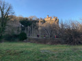
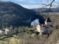
(1) Follow this road to the end. Note the château on your left.

(2) Turn left onto the Chemin des Granges. Pass through the hamlet of Les Granges, cross the Route des Pages and, almost directly opposite, slightly to the left, take the Chemin du Pech. Pass through the hamlet of Pagès and continue left onto the Chemin du Pech Grand. At the end, turn right onto the Route des Pages, then immediately left onto Rue du Coustalou and follow it to the end.

(3) Turn right onto Rue du Docteur Couygou and, at the four-way junction, turn left onto Rue de l’Occitane. Then take the first path on the right, just after No. 3.

(4) At the end of this, turn right onto Rue de la Curade, pass through the hamlet of La Curade and continue to a four-way junction.

(5) Turn right towards the hamlet of Les Monges, pass through it and carry on straight ahead. Continue along a grassy track, on the edge of the forest, until you reach the River Dordogne. Turn left and follow the river on your right for about 600 metres until you reach a sharp left-hand bend.

(6) Turn left and join a small cross-road, Rue de la Fournière. Turn right, then a few metres further on, turn left onto Rue de la Rivière. Pass through the hamlet of La Plaine, then the hamlet of La Rivière, and continue along Rue de la Rivière until you reach Rue de l’Occitanie (D15).

(7) Turn right and head for the car park (S/E).

Waypoints

  1. S/E : mi 0 - alt. 341 ft - Car park - Dordogne (fleuve)
  2. 1 : mi 0.36 - alt. 364 ft - Chemin des Combes
  3. 2 : mi 0.71 - alt. 390 ft - Chemin des Granges
  4. 3 : mi 1.12 - alt. 364 ft - Rue du Docteur Couygou
  5. 4 : mi 1.47 - alt. 358 ft - No. 3, path on the right
  6. 5 : mi 1.87 - alt. 338 ft - Four-way junction
  7. 6 : mi 3.02 - alt. 335 ft - Sharp left-hand bend
  8. 7 : mi 3.69 - alt. 354 ft - Rue de l’Occitanie
  9. S/E : mi 3.98 - alt. 341 ft - Car park

Notes

This route is suitable for children.

Reviews and comments

4.3 / 5
Based on 2 reviews

Reliability of the description
4.5 / 5
Ease of following the route
4.5 / 5
Route interest
4 / 5
cajoba
cajoba

Overall rating : 4.7 / 5

Date of your route : Aug 05, 2024
Reliability of the description : ★★★★★ Very good
Ease of following the route : ★★★★★ Very good
Route interest : ★★★★☆ Good
Very busy route : No

A very pleasant and easy walk, often in full sunshine.

Machine-translated

Celineetfrederic
Celineetfrederic

Overall rating : 4 / 5

Date of your route : May 11, 2024
Reliability of the description : ★★★★☆ Good
Ease of following the route : ★★★★☆ Good
Route interest : ★★★★☆ Good
Very busy route : No

An easy walk around Saint Sozy.

Machine-translated

Other walks in the area

For more walks, use our search engine .

The GPS track and description are the property of this route's author. Please do not copy them without permission.