Through the vineyards of Concourson-sur-Layon

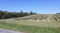
A lovely, easy walk through the vineyards on the hillsides of Concourson-sur-Layon.
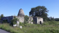
A few windmills and vineyard huts can be seen along the way, and the walk ends at a lovely spot near the river, the Layon, which has given its name to the local sweet wine: Coteaux du Layon.

Details

3232317
Creation:
Last update:
Last review:
  • Walking
    Activity: Walking
  • ↔
    Distance: 5.47 mi
  • ◔
    Average duration: 2h 45 
  • ▲
    Difficulty: Easy

  • ⚐
    Back to start: Yes
  • ↗
    Ascent: + 289 ft
  • ↘
    Descent: - 279 ft

  • ▲
    Highest point: 295 ft
  • ▼
    Lowest point: 157 ft

Photos

Description of the walk

The car park is near the village church.

(S/E) Head eastwards along the main road and turn slightly left onto Rue de la Seigneurie, which turns into a track through the vineyards. Continue to the road, turn right, then take the first road on the left to the Carrefours des Morts.

(1) Turn left onto a wide, winding track and follow it until you reach a small road. Pass a track on the right, then three others on the left.

(2) Follow the road to the left, then take a path that climbs up to the right. Pass through a partly shaded section before reaching a T-junction where you turn left, then left again to return to the road.

(3) Take the road on the right which runs alongside a pond, hidden by a hedge.

(4) A few metres past the pond, head up to the right onto a small road which turns into a track. You’ll reach a crossroads from where you can see the ruins of the “Moulin des Mines” on the right.

(5) Retrace your steps and turn right, then immediately left, and head down the path to the road. Follow it for a few metres to the left.

(6) At the Stop sign, turn right, then left onto a grassy, steep path that climbs towards the vineyards. As you emerge from the woods, first turn right then left and continue for about 400 metres.

(7) Turn left onto a path, then right towards a telecoms mast, and join the Chemin des Mines.

(8) Turn right to return to the village. At the bottom of the road, veer left onto the Route de Saint-Georges, then right onto the Chemin du Pont Vieux, which leads to a picnic area on the banks of the Layon. At the D960, turn left towards the car park (S/E).

Waypoints

  1. S/E : mi 0 - alt. 167 ft - Car park near the church
  2. 1 : mi 0.97 - alt. 295 ft - Carrefour des Morts
  3. 2 : mi 2.03 - alt. 187 ft - Road on the left
  4. 3 : mi 2.63 - alt. 184 ft - Road on the right
  5. 4 : mi 2.91 - alt. 184 ft - Road on the right
  6. 5 : mi 3.5 - alt. 276 ft - The Moulin des Mines
  7. 6 : mi 4 - alt. 197 ft - Stop sign
  8. 7 : mi 4.55 - alt. 269 ft - Go round the field on the right
  9. 8 : mi 4.93 - alt. 266 ft - Antenna. Turn right towards the - Layon (rivière) à compléter
  10. S/E : mi 5.47 - alt. 167 ft - Car park near the church

Reviews and comments

4.8 / 5
Based on 2 reviews

Reliability of the description
5 / 5
Ease of following the route
5 / 5
Route interest
4.5 / 5
mvaban
mvaban

Overall rating : 4.5 / 5

Date of your route : Aug 31, 2020
Reliability of the description : ★★★★★ Very good
Ease of following the route : Not used / Not applicable
Route interest : ★★★★☆ Good
Very busy route : No

A rather monotonous route. The steady ascent and descent of the hills may present difficulties for family walks.
Few shaded sections

Machine-translated

R18Vab13Z
R18Vab13Z

Overall rating : 5 / 5

Date of your route : Jul 20, 2020
Reliability of the description : ★★★★★ Very good
Ease of following the route : ★★★★★ Very good
Route interest : ★★★★★ Very good
Very busy route : Yes

A very pleasant route with no particular difficulties.

Machine-translated

Other walks in the area

For more walks, use our search engine .

The GPS track and description are the property of this route's author. Please do not copy them without permission.