Country:
 City:




Park at the car park by the town hall in Le Puy-Notre-Dame
(S/E) Take Rue de la Mairie on the left; cross it carefully at the roundabout to follow Rue des Écoles. Once at the end, turn right onto Rue du Perdreiau, go round the Rénoval buildings on the left and continue to the end of the street.
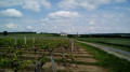
(1) Carry on straight ahead along the path that leads into the vineyard and joins the GRP® Saumur-Val de Loire (yellow and red markings) near the 62nd elevation at La Brosse. Follow this GRP® to the right, turn left at a 90° angle at the junction and arrive at Les Mousseaux.
(2) Turn left, following the signposts, then turn right at the next junction to join the D374 north-west of Vauldenay. Cross the road carefully to rejoin the GRP® almost directly opposite, then carry on straight ahead at the Vigneaux junction.
(3) Opposite a vineyard, turn right, following the signposts, and continue straight on towards the Bois des Garennes to reach the Carrefour de Taconnet at the edge of the woodland.
(4) Go straight on to cross the Bois des Garennes, cut across a cross-country path and continue to a T-junction.
(5) Turn right towards the outskirts of Montreuil-Bellay, go under the bridge on the D347 and continue straight on along Rue Chèvre.
(6) Take the very steep Chemin des Hautes Rues on the left, which leads to Rue de Doué. Turn right onto this road, staying on the pavement, go past the roundabout and arrive at Place du 14 Juillet.
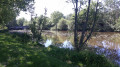
(7) Carry on straight ahead, cross the bridge over the Thouet and, as soon as you come out, turn right onto Rue du Boelle, which leads to the landscaped meadow by the Thouet. In summer, a jetty and a chain ferry allow you to reach the left bank.
(8) Alternatively, continue the walk by returning via Rue de Boelle to the bridge over the Thouet and head back to Place du 14 Juillet.
(7) Turn left onto Avenue Paul Painlevé, keeping to the left-hand pavement. Then turn left onto Impasse des Îles and continue along the path which runs alongside the banks of the Thouet before veering off to the right to return to Avenue Paul Painlevé.
(9) Cross the road carefully and head left, following the pavement on the right-hand side of the road.
(10) Just before the fork, cross the avenue with great care and take the path leading downwards alongside the flyover. Go through the tunnel to pass under the ring road, then continue until you reach the path starting on the right, which takes you back to the avenue, now the D77.
(11) Cross it with care, turn left until you reach the T-junction and continue right onto the road leading back up towards La Guenetière. After skirting the lower edge of the Bois des Garennes, leave the road and follow the path on the left into the vineyard. You’ll reach the Moulin de Dîne-Chien, which has recently been restored.
(12) Aftertaking in the view, head left and make your way to the Bonne Dame crossroads by first turning right then left through the vineyard. Cross the Route de Montreuil-Bellay (D77) with care , turn left at the cross and continue for 200 m.
(13) Take the small road on the right leading to the Moulin de Thuet. Once you reach the hamlet, first turn right then left to take the path towards Sanziers.
(14) Carry on straight ahead to reach the hamlet via Rue des Clos. Turn left onto Rue du Château, then right onto Rue Saint-Vincent: take a moment to admire the restored buildings.
(15) Head to the right to follow the Chemin des Vignes and cross the vineyard until you come out onto the D178.
(16) Turn right and walk carefully alongside the D87, which becomes the D87 after the junction. Pass the highest point of the hillside (98 m), then the silos and the water tower.
(17) Turn right at the entrance to the park to return directly to the Town Hall car park (S/E).
 Tourist office

 Easy

 Moderate
 Visorando Member