Country:
 City:
City:


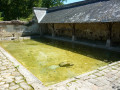
The starting point is near the Saugré washhouse. There is only space for a few cars to park there. This washhouse is a very pleasant spot, with even a picnic table.
(S/E) With your back to the wash house, head back towards the road. Turn left onto it. At the first junction, near the Domaine de la Garenne, turn right and follow the path – which is partly tarmacked – all the way up the slope.
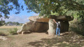
(1) Once at the top, on your right is the Pierre Péteuse dolmen. Take a quick look around and continue along the path to the junction, about 300 m away. Turn right and continue for 200 m.
(2) At the Carrefour de l’Aiguillette junction. Head right-hand side and continue across the plateau, then down the slope.
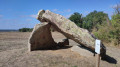
(3) At the bottom of the descent, there is a sign on the right pointing to the Saugré dolmen. Take a round trip to this dolmen, which is spectacular in size. On your return from this visit, continue along the path opposite the one leading to the dolmen, then turn right at the next junction. When you reach the edge of the forest, turn right to walk alongside the forest, keeping it on your left.
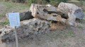
(4) At the Échallier crossroads, turn left onto the path that leads into the forest. Follow the path to the Pierre Couverte dolmen, which you’ll see on your left as you reach the top. Then cross the partially tarmac-surfaced road and continue straight on to the D213. Follow it to the right towards the houses in the hamlet of Chavais. Note that, after a few buildings, a gravel path on the left leads down to the entrance of a cave dwelling, situated below the grounds of the house on the left.
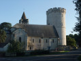
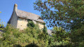
(5) At the next crossroads, turn left to catch a glimpse of the former Chavais Abbey. It is about 300 metres away, on the left, just past a gate. Approach it via a small path that branches off to the right of the gate when facing it. Unfortunately, overgrown vegetation prevents you from getting close enough.
(6) Retrace your steps back to the Chavais crossroads.
(5) Carry on straight ahead.
(7) In the hamlet of La Carte, turn left, then right at the next crossroads. Follow this small road, ignoring any roads or paths branching off to the right or left, to return to the starting point (S/E).
Along the way, note the cave dwellings that can be seen below almost every house.
 Visorando Member
 Moderate
 Tourist office