Country:

 City:
City:


How to get to the centre of the welcoming village of Girmont-Val-d’Ajol (Vosges): From the Haute-Saône via Fougerolles on the RD83, then the RD23 through the Val-d’Ajol. You can also get there from Remiremont via the Route des Forts (RD57). Park in the car park behind the church.
(S/E) On leaving the car park, turn left onto the RD23 and take the first left (Rue du Moulin Picard – Green Ring). About a hundred metres past the last houses, turn left onto the path that winds down through the trees.
(1) At the junction with a path coming from the left, carry straight on and you’ll soon come out onto a road. Turn right and cross a bridge
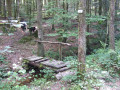
(2) At thefirst bend, just after this, take the path on the right (Red Ring). Continue straight on (Green Ring) and cross the sturdy footbridge over the Ruisseau du Plain Pré. After a gentle climb, you’ll reach a lovely crossroads.
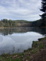
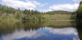
(3) Turn left towards Barres de la Vignotte (Blue Ring). You’ll pass an old farmhouse dating from 1779. A little further on, leave the farm access track by taking a simple footbridge on the left and climb the small hill to rejoin the road. Turn left to reach the Étang le Villerain. Walk to the spillway and go up the footbridge to reach an area with a table and benches available for use.
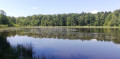
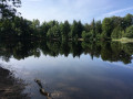
(4) Continue along the edge of the pond (Yellow Ring) and read the information board. At the far end of the pond, follow the path to the right (unmarked). Here you’ll find a second pond with a simple shelter in case of a storm, followed by a third. A photo exhibition trail is available around the ponds (White Arrows – allow an extra half an hour).
Continue along the path, which leads onto a logging track; follow this straight on. You’ll come across the Blue Ring markings again and, after a gentle climb, reach a large junction with the RD57.
(5) Turn left and follow the road towards Remiremont.
(6) At the first right-hand bend, turn left onto the unmarked path which, after 50 metres, joins an almost straight track (marked with a Yellow Triangle).
(7) A little further on, do pop off to ‘l’Eau Bénitier’ (a pierced stone), situated 80 metres along the Henri Maurice path (marked with a Red Triangle), and back again. Return to the crossroads.
(7) Continue along the path, lined with blueberry bushes and strewn with small flint pebbles that have broken away from the puddingstone. Don’t miss the right-hand turn that leads to a tarmac road.
(8) Turn left and, a little further on, turn right to continue along the path known as the ‘Grand Nord’ towards Ruines, Roche Fendue and Glacière (marked with a Yellow Triangle and a Red Ring).
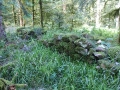
(9) Pass through the ruins of the Vieilles Abbayes, which were likely built here in the early 12th century.
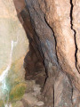
(10) A little further on, leave the path and follow the sign for Roche Fendue – Glacière. A narrow track descends steeply and requires the utmost caution, especially in wet weather. The Roche Fendue rises up alongside the path, and the more daring will certainly be tempted to venture a few metres onto it.
A little further down is the ‘glacière’, a sort of small chasm 60 cm in diameter. At the entrance, you can clearly feel a breath of cool air.
Retrace your steps a little, but do not go back up the path you came down. Continue straight on along the track that winds its way through the tall grass, initially on level ground, then rising slightly to the left to rejoin the main path you left earlier. Turn right and head down to the junction of two forest tracks.
(11) Take the forest track opposite, then immediately turn right onto the path (marked with a Yellow Triangle only) which continues to descend, cluttered with roots, leading to the Chalet de l’Empereur. (A lovely spot for a lunch break).
(12) Follow the forest track to the right, which climbs gently (Green Ring/Red Triangle).
(13) A little further on, take the time to walk up to the giant fir tree, which is 42 metres high and 1.25 metres in diameter (20 mins there and back).
Continue along the forest track, passing by the Sources des Tanchottes ponds, until you come out onto the road to the Prieuré d’Hérival at the far end of the pond.
(14) At the road, turn right and head up to the abbey.
After visiting the site and learning about the local history and the work of the Fleurot family – bone-setters for several generations who treated both common folk and royalty – continue along the road.
(15) At the end of the wall covered with a fresco, head left up the path marked ‘Red Cross’. It’s a steep climb. Cross the first logging track to come out onto a second one, 400 metres higher up.
(16) Then turn left and follow this track (marked with a Red Saltire signpost), which descends gently. At a hairpin bend, continue to the left until you reach another track. Turn right to join the tarmac road. Continue to the hamlet of Le Breuil. In the middle of the hamlet, turn left and walk past the forester’s house.
(17) Cross the Combeauté and head back towards the Chalet de l’Empereur.
(12) Take the tarmac road opposite (still following the ‘Red Saltire’ markings) towards the Cascade du Géhard, then take a path leading down to the right (‘Red Ring’) to the waterfall. Be sure to take a look at the small dry-stone bridge and wonder how it manages to hold up under the weight of passing vehicles.
(18) Walk back up alongside the stream, taking the time to read the information boards, then turn left.
(19) Cross the road and head uphill through the woods (Red Ring and Green Ring) to rejoin the same road 400 metres further on.
Turn right, then immediately left to return to a junction you passed on the way out.
(2) Follow the route taken in the morning in the opposite direction. After the bridge, turn left (Red Ring and Green Ring).
(1) Leave the outbound route and head straight up to the right (Red Ring only). The path, which is the steepest climb of the day, leads out onto a meadow at the far end of the car park (S/E).

 Visorando Member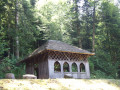

 Easy
Easy