Around the Grands Bassots with views over the Moselle valley

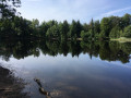
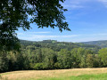
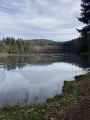
This walk features numerous sections through woodland, meadows offering some stunning views of the Moselle valley, six ponds, and a peat bog area.

Details

n°26814393
Creation:
Last update:
Last review:
  • Walking
    Activity: Walking
  • ↔
    Distance: 8.75 mi
  • ◔
    Average duration: 5h 00 
  • ▲
    Difficulty: Moderate

  • ⚐
    Back to start: Yes
  • ↗
    Ascent: + 1,129 ft
  • ↘
    Descent: - 1,129 ft

  • ▲
    Highest point: 2,552 ft
  • ▼
    Lowest point: 1,959 ft

Photos

Description of the walk

Park in Girmont Val d’Ajol; there is a car park next to the church.

(S/E) Take the small road leading down towards the Moulin Picard and follow this road as far as the Moulin Picard lodge. At this point, the tarmac ends.

(1) The path continues past the Mollière pond. You’ll come to a junction after the pond.

(2) Turn left onto the path that descends to the Plain Pré stream (a sign points to the Coke pond). Then head back up to join a forest track (Chemin du Plain Pré).

(3) Continue to the right along the Chemin du Plain Pré (Blue Ring) until you reach Coke Pond.

(4) Cross the road and carry on in the same direction, still following the Blue Ring markings, until you reach the Red Triangle. At this point, take the path on the right into the woods, following the Red Triangle markings. You’ll come to a large rock.

(5) Carry on, enjoying the superb view over the Moselle valley, then head down the small road to the left until you reach thethird hairpin bend. Note the two ponds along the road near the holiday chalets. You’ll reach theGR® junction.

(6) Carry on straight ahead and follow theGR® to two small houses in Larraye on either side of the path through the forest. Immediately afterwards, take the path marked with a Yellow Diamond, which climbs steeply to the right. You’ll reach another junction just before a left-hand bend.

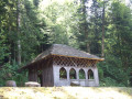
(7) Leave theGR® here, turn right and continue uphill to reach the Chalet de l’Impératrice.

(8) Continue along a wide track, join the road and turn right onto it. You’ll reach a crossroads by a small pond.

(9) Take the path on the left through an open area. It descends slightly and splits 100 metres further on. Leave the path on your left, which is signposted with two signs reading ‘Chasse gardée – La montagne’ and ‘Ski de fond Girault Faihy’

(10) Take care here: follow the route marked on the IGN map closely. The path climbs slightly and continues through a coniferous woodland. After about 500 metres, leave this path and take a less-travelled track that climbs to the right. Continue along the edge of the Grands Bassots peat bog. Please note: it is not advisable to leave the path (see note at the end of the description). After this more open area, continue along the main path which descends into a woodland and joins a wider forest track.

(11) Turn right and continue north-west across meadows for 500 metres until you reach the ‘Green Ring’ signpost at a crossroads marked by a cross, opposite which there is a picnic table and benches. Take the path on the right and follow it to the next crossroads.

(12) Turn left onto the path that descends alongside a meadow. At the Y-junction in the woodland, turn left and leave the ‘Green Ring’ signposting. Continuing along the path in the same direction, you’ll reach a small road at a place called ‘Les Envers’ in Girmont d’Amont. Turn right onto this road and follow it for 50 metres to reach the D 83, directly opposite the small road leading to the La Racine lodges. Turn left onto this county road.

(13) After about 100 metres, take thefirst path on the right and walk through the hamlet of Girmont d’Amont. Continue behind the houses, running parallel to the road. You’ll come to another junction just before La Molière d’Amont.

(14) Turn right onto the track, head down through the forest and join the Route du Moulin Picard not far from a pond. Turn left and head back up towards Girmont Val d’Ajol along the small road to reach the car park (S/E).

Waypoints

  1. S/E : mi 0 - alt. 2,044 ft - Car park at Girmont Val d’Ajol church
  2. 1 : mi 0.74 - alt. 1,995 ft - Moulin Picard – end of the tarmac road
  3. 2 : mi 1.27 - alt. 2,116 ft - Etang de la Molière
  4. 3 : mi 1.66 - alt. 1,995 ft - Plain Pré
  5. 4 : mi 2.34 - alt. 2,244 ft - Etang du Coke
  6. 5 : mi 2.74 - alt. 2,277 ft - Large rock. Viewpoint over the valley of the - Moselle (la)
  7. 6 : mi 3.76 - alt. 1,982 ft - GR
  8. 7 : mi 4.45 - alt. 2,244 ft - GR trail junction
  9. 8 : mi 4.85 - alt. 2,543 ft - Chalet de l’Impératrice
  10. 9 : mi 5.44 - alt. 2,448 ft - Petit Étang - Ruisseau de Méreille
  11. 10 : mi 5.79 - alt. 2,392 ft - Girault Faihy ski run junction
  12. 11 : mi 6.38 - alt. 2,405 ft - Junction with a major forest track
  13. 12 : mi 6.95 - alt. 2,411 ft - Path alongside meadows
  14. 13 : mi 7.33 - alt. 2,234 ft - Girmont d’Amont
  15. 14 : mi 7.81 - alt. 2,126 ft - La Mollière d’Amont
  16. S/E : mi 8.75 - alt. 2,044 ft - Car park at Girmont Val d’Ajol church

Notes

Thesecond half of the route is unmarked, mainly between (7) and (10). Follow the GPS track carefully; an IGN map is essential.
Food is available in Girmont only.
There is also an organic baker who sells excellent local produce.

Worth a visit

Between (10) and (12), Les Grands Bassots is a peat bog area that must be treated with respect for the following reasons.
This is a wetland area featuring characteristic vegetation (consisting mainly of sphagnum moss, a type of moss that retains large quantities of water, but also rare plants such as insectivorous Drosera).
It is the gradual accumulation of undecomposed organic matter (mainly plant matter) and its compaction that, over time, contributes to the formation of peat.
The peat bog is therefore characterised by soil with a very high content of organic matter of plant origin, which is either slightly decomposed or not decomposed at all. It is a unique and fragile ecosystem whose characteristics make it, despite methane emissions, a carbon sink.
It is therefore essential to stay on the paths in order to protect this environment. This is all the more important as the water contained in the sphagnum mosses can create a spongy surface similar to quicksand.

Always be cautious and plan ahead when you're outdoors. Visorando and the author of this route cannot be held responsible for any accidents occurring on this route.

The GR® and PR® markings are the intellectual property of the Fédération Française de Randonnée Pédestre.

Reviews and comments

3.7 / 5
Based on 2 reviews

Reliability of the description
3.5 / 5
Ease of following the route
3 / 5
Route interest
4.5 / 5
Pinky07
Pinky07

Overall rating : 4 / 5

Date of your route : Sep 17, 2025
Reliability of the description : ★★★★☆ Good
Ease of following the route : ★★★☆☆ Average
Route interest : ★★★★★ Very good
Very busy route : No

A very pleasant hike between lakes and some beautiful viewpoints.
No particular difficulties, except for the essential use of a map or GPS. Points 10, 13 and 14 are not easy to locate.
The return via point 14 was very marshy, but it is possible to reach the starting point easily by continuing along the road.
A few trees blocked the paths in three places. It is possible to get around them.

Machine-translated

irma70
irma70

Sorry, I don’t know how to use the website and, from memory, it’s hard for me to remember everything. I’d say that after the Empress’s Chalet, turn immediately right and, 100 metres further on, turn right again to reach the road and the little pond after 1 km. At point 8, turn left and then immediately right.As for the rest, I’m afraid I can’t remember all the details; if I do this walk again, I’ll be sure to take some notes. Best wishes – perhaps we’ll meet one day on a walk.

Machine-translated

CaGo
CaGo

Hello,
Thank you for this information about the walk.
As for the inaccuracy, this was only the second walk I’d posted. So I wasn’t used to it yet.
Would it be possible for you to add the missing details? What are they? Does the system allow for this? If so, it would be a great feature enabling everyone to improve the walks.
I’ve only been using Visorando since August, and whilst I think the programme is brilliant, I still sometimes find it difficult to make full use of all its features.

Machine-translated

irma70
irma70

Overall rating : 3.3 / 5

Date of your route : Nov 10, 2022
Reliability of the description : ★★★☆☆ Average
Ease of following the route : ★★★☆☆ Average
Route interest : ★★★★☆ Good
Very busy route : No

A lovely walk overall, though there are quite a few inaccuracies in the description. It’s perfect up to the Empress’s Chalet; after that, it gets a bit tricky, but with GPS it’s manageable.A few more details would enable walkers without a GPS to complete this walk without too much difficulty. Having done many walks in this area, I thought I’d seen it all, but I hadn’t – so thank you to the author for this new walk, which I’d recommend.

Machine-translated

Other walks in the area

For more walks, use our search engine .

The GPS track and description are the property of this route's author. Please do not copy them without permission.