Country:
 City:
City:


Car park near the town hall.
Yellow markings and “La Grande Boucle” signposts
(S/E) With your back to the town hall, head left and turn right onto Avenue de Kérincuff. Use the pedestrian crossing on the left-hand side of the road. Continue straight on until you reach the T-junction shortly after the sign marking the town’s boundary.
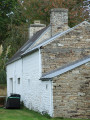
(1) Turn right at the signpost and continue along the road; take care, as the verges are narrow. At the recycling bins, first turn right then left onto Allée de Pouldiguy, a narrow, tree-lined road. Go round a whitewashed stone house and continue, on the edge of the woodland, along the narrow road which curves to the right and leads to a multi-way junction.
No signposting
(2) At the ‘give way’ sign, follow the Route de l’Odet, signposted ‘bourg’. Pass the sign marking the entrance to Gouesnach and continue straight on until the next junction near a school shelter.
Yellow markings and “La Grande Boucle” signpost
Rejoin the signposted route and continue along Route de l’Odet, following signs for ‘Gouesnach bourg’ (wide pavement on the left), until you reach the roundabout. Pass the sign for ‘Gouesnach bourg’ on your right, then first turn right then left onto the small road called Hent Ménez Lann Gras. At the next three-way junction, opposite a small stone house, turn right following the signposting and you’ll reach a T-junction.
(3) At the signpost, turn left, passing the sign marking the exit from Gouesnach. You are now in the countryside. Continue along this small road which runs alongside a wooded area, ignoring the various access roads to properties or farms, and after a sharp right-hand bend you will reach a T-junction.
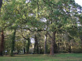
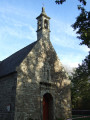
(4) Head downhill to the left (road sign for Pors Meillou, 1 km), follow this road which runs alongside the Domaine de Boutiguéry and its botanical garden (the château is not visible from the road). Opposite the park entrance, turn right towards the Notre-Dame du Vray Secours Chapel (1729), situated on an esplanade lined with tall trees. A pleasant spot for a break if you wish.
No signposts
Return to the small road and note the pastures on your left, where you can often see horses from a riding centre.
(5) Behind a house on the right, turn left and go through a gate to enter a woodland. Follow this wide path, noting that the final section of the route shown on the map is no longer accurate. Turn left then right at the edge of the field.
At the end, turn right onto a track suitable for vehicles (you’ll see the yellow markings again for a short while), pass near Ty Guen (a white house) – a beautifully renovated stone building – and reach a road.
(6) Follow this road to the right, leaving the signposted route to continue to the left. Carry on straight ahead, skirting the residential area under construction at Ménez Leuré, until you reach a Stop sign.
_Yellow markings and “La Grande Boucle” signpost__
(7) Take a hairpin bend to the right and carry on straight ahead along this road (signposted ‘Chapelle du Vray Secours’). Note the number of houses lining the road, several of which are nearing completion. At the three-way junction, carry on straight ahead along a much narrower road with a 30 km/h speed limit. This road (Hent Botdrez), running along the edge of the woods, leads to the hamlet of Botdrez.
_Yellow ‘La Grande Boucle’ signposting + blue ‘Pors Meillou route’ signposting__
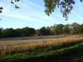
(8) Turn left at the gate to join a sunken track on the edge of the woods. Very soon, the track becomes a wide path with trees on the left and meadows on the right. Keep heading roughly south-west until you reach a gate.
_Yellow markings and “La Grande Boucle” signpost__
(4) Turn left, leaving the “Pors Meillou route” to head down to the right. Follow this road straight on, which leads back towards the village of Gouesnach, joining the D234. Cross the road carefully and follow it to the right, using the safe crossing on the left. Pass the sign marking the entrance to Gouesnach (picnic tables on the right) and arrive at a roundabout. Continue straight on, passing close to a protohistoric stele which was briefly Christianised by the addition of a cross.
Temporary diversion
(9) Carry on straight ahead despite a Yellow Cross. The signposted route has been diverted due to works behind the school (no end date). At the roundabout, turn left, walk past the “Notre-Dame des Victoires” school, then turn left again into the pedestrian access to the town hall and you’ll find the car park on the right (S/E).

 Visorando Member
 Moderate