Country:
 City:
City:


Start from the car park near the town hall.
(S/E) With your back to the car park, cross the flower-filled esplanade and take the Route de Bénodet towards the church. Go round it on the left (cross) and you’ll come out onto the Avenue des Sports.
(1) Turn left, walk alongside the sports grounds and you’ll reach a junction.
Green signposting
Carry on straight ahead along Rue de Pontnellis (sign for a dead end with the pedestrian logo). At the barrier (Pouldiguy signpost), continue along a wide dirt track lined with tree-lined embankments. When you reach a small road, turn right onto it and then keep right (sign for the hamlet of Kerguéon) until you reach a crossroads (sign saying ‘Give Way’).
Yellow markings
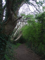
(2) Turn left onto the second road, leaving the green markings behind and following the yellow ones. Follow the sign for Porz Gwen (Guen) along the footpath. This path is actually a small road lined with imposing trees. Head down this road due south.
No Signposting (Yellow Cross)
(3) Turn right at the sign for ‘Porz-Garo botanical trail’ and follow this path along the edge of the wood. The botanical trail is no longer maintained: signs are broken or missing, and those that remain are often illegible. The path ends with an avenue of beech trees and a small, landscaped spring. You’ll emerge at Anse de Porz Garo.
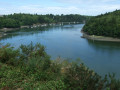
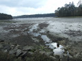
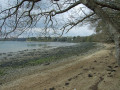
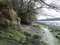
(4) ¹ Be aware of tide times: at high tide, the site is only accessible when the tidal coefficient is below 70. Follow the banks of the Odet along the left bank towards Anse de Porz Guen (with a view of the Cornouaille bridge in the background). Note the old oak trees leaning towards the river, as well as the old road sign (Gouesnach). At the junction with the road, take a short round trip to enjoy a view of the far end of the cove.
Yellow signposting (in the opposite direction)
(5) Head due north along the small road, flanked on the right by meadows where horses can often be spotted
(3) Continue straight on along the route you took on the way there.
(2) Turn right onto the small road (Hent Keranner), at the edge of the woodland, towards Pouldiguy. At the junction, turn left into Allée de Pouldiguy, a narrow, tree-lined road. When you reach the road leading to the hamlet of Roboliou, turn left and join a main road at the recycling bins.
(6) Continue to the right along this road – take care, as the verges are narrow. You’ll come to a junction with a signpost. Turn left towards the village of Gouesnach via Avenue de Kerincuff.
Unmarked
(7) At the first cul-de-sac, Les Ajoncs, turn left and, at the end, take the footpath on the right which crosses this entire residential area. Pass a roundabout with a street lamp and proceed to a gate. Cross a wooden bridge over a small stream.
Green signposting
(8) Turn left and continue along this well-marked path through the trees until you reach the gate leading onto Rue de Pontnellis. This section of the route does not appear on the base maps. Turn right here, then turn right onto Rue du Steir until you reach the junction with Rue des Oiseaux.
Unmarked
(9) Turn left into this street, which continues as a pedestrian walkway. Cross a road and continue straight ahead towards a large roundabout. Go round it on the left, then turn left again into the passageway alongside the town hall to reach the car park (S/E).

 Visorando Member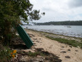
 Moderate