In the countryside around Battrans

A walk around a village in the Haut-Saône region of the Pays Graylois and its countryside.

Details

n°3132225
Creation:
Last update:
Last review:
  • Walking
    Activity: Walking
  • ↔
    Distance: 2.38 mi
  • ◔
    Average duration: 1h 10 
  • ▲
    Difficulty: Easy

  • ⚐
    Back to start: Yes
  • ↗
    Ascent: + 49 ft
  • ↘
    Descent: - 49 ft

  • ▲
    Highest point: 725 ft
  • ▼
    Lowest point: 656 ft
  • ⚐ Country: France
  • ⚐ City: Battrans (70100)
  • ⚑
    Start/End: N 47.428839° / E 5.63783°
  • ❏
    IGN map(s): Ref. 3222E
  • Hour-by-hour weather

Photos

Description of the walk

Park in the small car park on Grande Rue opposite the town hall.

(S/E) Head towards the bus shelter, then turn immediately left onto Rue des Planches.

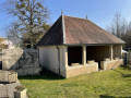
(1) At the Stop sign, turn right onto Rue de l’Église. Walk alongside the leisure ground – which you can also cross by turning right – and follow the road as it bends to the right towards the wash house. Walk past the wash house and then turn left onto Rue de la Fontaine (VC4 towards Cresancey). Walk for about 800 metres.

(2) Take the country lane on the right, which bends right further on (you can see the facilities of Gray-Saint Adrien aerodrome on the left) and continues straight on until you reach the RD178. Turn right and walk carefully alongside the road. When you reach the small copse, veer left and take a path leading towards a private meadow (access permitted), signposted on a green background. Walk for about a hundred metres.

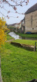
(3) Turn right into the Pré du Champ la Forge (L.P.O. nature reserve), then leave the meadow on the left via the turning area at the end of Rue des Perrières. Follow this street, turn right at the junction and head towards the Stop sign.

(4) Turn right onto the Grande Rue to return to the starting point (S/E).

Waypoints

  1. S/E : mi 0 - alt. 676 ft - Car park opposite the town hall
  2. 1 : mi 0.21 - alt. 666 ft - Rue de l’Église
  3. 2 : mi 1 - alt. 679 ft - Country lane on the right
  4. 3 : mi 1.85 - alt. 725 ft - Champ la Forge meadow
  5. 4 : mi 2.19 - alt. 659 ft - Grande Rue
  6. S/E : mi 2.38 - alt. 676 ft - Car park opposite the town hall

Worth a visit

(1) On the left, the Church of Saint-Pierre and Saint-Paul.
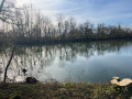
(3) Pré du champ la Forge (LPO nature reserve). Rue des Perrières: view of the Parc de l’Étang

Reviews and comments

4.7 / 5
Based on 1 review

Reliability of the description
5 / 5
Ease of following the route
5 / 5
Route interest
4 / 5
Gilbert Jeanguyot
Gilbert Jeanguyot

Thank you.
It’s true, the signage has suffered a bit over the winter at ‘Champ la Forge’...
I’ll take another look when the weather improves. :

Machine-translated

Marc Moissat
Marc Moissat

Machine-translated

vero and Cie
vero and Cie

Overall rating : 4.7 / 5

Date of your route : Mar 13, 2022
Reliability of the description : ★★★★★ Very good
Ease of following the route : ★★★★★ Very good
Route interest : ★★★★☆ Good
Very busy route : No

Thank you for suggesting this walk; we did the route in reverse; we were just a little unsure when, after the turning point, we crossed the property to reach the Pré du Champ la Forge.

Machine-translated

Other walks in the area

For more walks, use our search engine .

The GPS track and description are the property of this route's author. Please do not copy them without permission.