


Refine your search for walks in Croix du Pouey
Croix du Pouey walks


 Ascent of Hautacam from Geu
 Visorando Member
 9.15 mi
 +4,321 ft
 -4,321 ft
 8h 00
8h 00
 Very difficult
 Departure from Geu (Hautes-Pyrénées)
This is a physically demanding hike, reserved for experienced hikers or trail runners. The elevation gain is very significant over a relatively short distance. It is advisable to bring plenty of water and protection from the sun, as a significant part of the route is exposed. Protection from wind and rain is also strongly recommended.
Exploring Castelloubon around the Tuquet de Lhési
 11.49 mi
+3,022 ft
-3,025 ft
7h 55
11.49 mi
+3,022 ft
-3,025 ft
7h 55
 Difficult
Departure from Juncalas (Hautes-Pyrénées)
Difficult
Departure from Juncalas (Hautes-Pyrénées)
Near Lourdes, and dominated by the Pic du Montaigu (2,339 m), the Castelloubon offers a variety of landscapes that can be explored via nine hiking routes of varying lengths.
This circular route, starting from Juncalas, follows sections of these trails to explore the eastern part of this High Pyrenees region, featuring forests, pastures and ridges. You can thus admire the high mountain range, the foothills and the plain. It takes you up the Soum de Trées and the Tuquet de Lhési, and also allows you to visit the villages of Gazost, Ourdon, Lias and Ousté.
Walks near Croix du Pouey
The Henri IV Trail
 20.70 mi
+732 ft
-1,421 ft
10h 10
Difficult
Departure from Lourdes (Hautes-Pyrénées)
20.70 mi
+732 ft
-1,421 ft
10h 10
Difficult
Departure from Lourdes (Hautes-Pyrénées)
A beautiful route linking Lourdes to Pau along an ancient Roman road steeped in history. The Henri IV trail stretches across the Hautes-Pyrénées and Pyrénées-Atlantiques departments, along the foothills of the Pyrenees.
From the Col de Couraduque to the Col du Soulor via Lac de Soum
 5.01 mi
+1,083 ft
-738 ft
3h 15
5.01 mi
+1,083 ft
-738 ft
3h 15
 Moderate
Departure from Aucun (Hautes-Pyrénées)
Moderate
Departure from Aucun (Hautes-Pyrénées)
An easy walk with some lovely views. Using two cars (one at Couraduque and one at Soulor) makes this walk accessible to everyone. Otherwise, you can return via the same route in the opposite direction.
The valleys of Yerse and Aguée via Arriousec to Peyras
 10.62 mi
+4,695 ft
-4,678 ft
8 hrs
Very difficult
Departure from Asson (Pyrénées-Atlantiques)
10.62 mi
+4,695 ft
-4,678 ft
8 hrs
Very difficult
Departure from Asson (Pyrénées-Atlantiques)
On the forgotten trails of Saint-Pé-de-Bigorre No. 5A long journey from the Ouzom Valley, through Les Aoules, to the Génies Valley, in the unfathomable Saint-Pé massif.In all seasons, the landscapes and forests are impressive and majestic.Its main attraction lies in the beauty of the two valleys crossed from end to end: the Yerse and the Aguée, sites of ancestral pastoralism where shepherds and their flocks lived from June to October. There are still many traces of this to be found.
From Les Aoules to Ferrières via the Soum de Souste and the Soum d’Arangou
4.42 mi
+2,241 ft
-1,962 ft
4h 00
Moderate
Departure from Arthez-d'Asson (Pyrénées-Atlantiques)
This walk is only suitable for walkers who are comfortable with steep and long climbs. This rarely used route offers a peaceful walk in absolute silence in the shade of the Monbula woods. You must first leave a car at the finish point on the D126, on the left-hand side of the road, and then walk to the Aoules car park. The walk can be done in either direction, but the descent towards Ferrières will be easier.
Tournaboup - Bastan Refuge
 8.80 mi
+4,337 ft
-1,742 ft
7h 50
Difficult
Departure from Barèges (Hautes-Pyrénées)
8.80 mi
+4,337 ft
-1,742 ft
7h 50
Difficult
Departure from Barèges (Hautes-Pyrénées)
First stage of the Three Days in the Néouvielle Nature Reserve and its lakes.From the Tournaboup car park to the Bastan refuge.A fairly challenging hike due to its elevation gain and short distance.At point (6), it is possible to shorten the route and reduce the elevation gain. See Practical Information.At (7), it is possible to shorten the route and reduce the elevation gain slightly by taking a south-facing, balcony-style path.
Please note: the refuge has been closed by the authorities since May 2025
From Tournaboup to Lac de l’Oule
11.29 mi
+3,957 ft
-2,785 ft
8h 40
Difficult
Departure from Barèges (Hautes-Pyrénées)
First day of a three-day circular route, from the Tournaboup car park to Lac de l’Oule. The first section up to the Col de Madamète is quite stony and requires good footwear, but after that it’s a real pleasure to walk past the magnificent Néouvielle lakes, including, amongst others, Lac d’Aumar, Lac d’Aubert and Lac de l’Oule.
3 days in the Central Pyrenees Park from Cauterets
 30.88 mi
+10,197 ft
-10,226 ft
3 days
Difficult
Departure from Cauterets (Hautes-Pyrénées)
30.88 mi
+10,197 ft
-10,226 ft
3 days
Difficult
Departure from Cauterets (Hautes-Pyrénées)
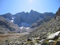
Explore the Pyrenees National Park (central section) with a trip to Spain, lakes and mountain passes at an altitude of 2,600 metres.
With an average elevation gain of ± 1,230 m and a distance of 17 km per day, this trip is, all in all, quite strenuous.
Please take into account the cumulative elevation gain and the distance to be covered.
The trip takes place between 1000 m and 2655 m altitude.
The start of this route is accessible by public transport (coaches and shuttle bus from Cauterets in summer).
From Cauterets to Ilhéou
 9.24 mi
+4,295 ft
-1,217 ft
8h 00
Moderate
Departure from Cauterets (Hautes-Pyrénées)
9.24 mi
+4,295 ft
-1,217 ft
8h 00
Moderate
Departure from Cauterets (Hautes-Pyrénées)
First day of a three-day route in the Central Pyrenees National Park.
This circular is best done from mid-June until the first cold spells.
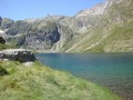
Ascent to Lac Noir, Col d'Ilhéou, Ilhéou Refuge and Lac d'Ilhéou.