Refine your search for walks in Croix des Suifs
Croix des Suifs walks


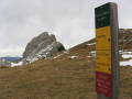
 Pic Saint-Michel via Croix des Suifs from the Barnets car park
 Visorando Member
 5.81 mi
 +2,274 ft
 -2,257 ft
 4h 40
 Moderate
 Departure from Lans-en-Vercors (Isère)
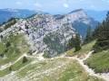
Overall, this is an easy hike with varied landscapes both uphill and downhill, offering a unique panorama at the summit. A must-see in the region.
For the Visorando moderator: hike inspired by two others:
1- Pic Saint-Michel via Croix des Suifs.
2- Pic Saint-Michel.
Very similar but, in my opinion, an improvement on the other two: it's up to you to decide whether it's publishable or not.
Pic Saint-Michel via the Croix des Suifs
 10.23 mi
+3,369 ft
-3,363 ft
7h 40
 Difficult
Departure from Lans-en-Vercors (Isère)
A beautiful hike, quite long and with a fair amount of elevation gain. Ascent to the Croix des Suifs (double panorama), Pic Saint-Michel (beautiful view of the Vercors, the Drac valley, and Grenoble). Descent via the Col de l'Arc, Font Froide, and the Rocher des Blancs paragliding site (panorama).
Walks near Croix des Suifs
Pic Saint-Michel via the Vertige des Cimes
6.58 mi
+2,110 ft
-2,474 ft
4h 50
Moderate
Departure from Lans-en-Vercors (Isère)
A very classic route that takes you to four remarkable viewpoints in succession, offering views of Grenoble and its valley, as well as the Vercors plateau, the Rocher de l’Ours and the Roc Cornafion. It’s a hike you should do at least once if you’re in the area.
Ideally, you should take two cars up and leave one at the finish, which is at the Parking des Barnets, two hairpin bends below the start point at the Lans-en-Vercors resort.
Roybon Hut – La Peyrouse Hut
 10.88 mi
+2,182 ft
-1,719 ft
6h 55
Difficult
Departure from Villard-de-Lans (Isère)
Day2 of a traverse of the Vercors via the balcony path.
Les Clôts – Refuge de la Soldanelle
 8.21 mi
+2,139 ft
-1,283 ft
5h 40
Moderate
Departure from Villard-de-Lans (Isère)
First stage of the hike. Set off from the Clôts car park towards the Refuge de la Soldanelle for an overnight stay.
Fauge Shelter - Jasse du Play Shelter
 15.97 mi
+2,552 ft
-1,575 ft
9h 35
Difficult
Departure from Villard-de-Lans (Isère)
This is the longest stage of this traverse, but also the one that marks the entrance to the high plateaus.
Saint-Nizier-du-Moucherotte - Cabane de Roybon
 12.38 mi
+4,573 ft
-3,652 ft
9h 40
Difficult
Departure from Saint-Nizier-du-Moucherotte (Isère)
First stage of the circular route from Saint Nizier to Corrençon en Vercors, with a stop at the Cabane de Roybon below the Col Vert.Whilst the first part is easy, the section between Col de l’Arc and Col Vertis challenging, with sections over a sheer drop!Take great care.
Saint-Nizier-du-Moucherotte - La Fauge Shelter
 12.57 mi
+2,559 ft
-2,070 ft
8h 00
Difficult
Departure from Saint-Nizier-du-Moucherotte (Isère)
The second stage of the Vercors crossing, offering stunning views of the villages of the Vercors.
 Saint-Nizier-du-Moucherotte – Lans-en-Vercors
 6.55 mi
+2,425 ft
-1,686 ft
6 hrs
Moderate
Departure from Saint-Nizier-du-Moucherotte (Isère)
Following theGR®9route connects Saint-Nizier-du-Moucherotte to the Lans-en-Vercors Ski Centre via Moucherotte. Two vehicles are required.
Crossing the Vercors from Engins to Saint-Gervais
21.71 mi
+5,394 ft
-7,323 ft
14h 40
 Extremely difficult
Departure from Engins (Isère)
This traverse of the northern Vercors links Engins to Saint-Gervais from east to west, passing over three peaks and through particularly wild sections. The route offers a wonderful variety of landscapes, ranging from forests to mountain pastures and the ridges typical of the Vercors. The higher ground offers stunning views over the Isère valley, the Chartreuse and the surrounding Alpine massifs. The route alternates between open stretches and more wooded sections, some of which are very remote.
⚠️ This route is intended solely for experienced and well-trained walkers. A GPX track is essential. See practical information.
Lac de la Moucherolle
 7.18 mi
+1,280 ft
-3,136 ft
4h 25
Moderate
Departure from Villard-de-Lans (Isère)
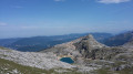
This walk leads to Lac de la Moucherolle and the Fauge valley.
This hike allows you to discover a multitude of landscapes ranging from a mineral world to pastures and forests with beautiful panoramic views of the entire northern Vercors.