Orgabidexka Ridge and Pass at the Iraty ski resort

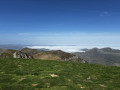
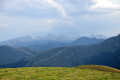
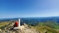
An easy walk offering superb panoramic views from the Organbidexka ridge, stretching from the Pic d’Orhy to the peaks of Béarn via the Pic d’Anie.

Details

2609999
Creation:
Last update:
Last review:
  • Walking
    Activity: Walking
  • ↔
    Distance: 1.95 mi
  • ◔
    Average duration: 1h 20 
  • ▲
    Difficulty: Easy

  • ⚐
    Back to start: Yes
  • ↗
    Ascent: + 538 ft
  • ↘
    Descent: - 538 ft

  • ▲
    Highest point: 4,711 ft
  • ▼
    Lowest point: 4,216 ft

Description of the walk

Park in the car park at the top of the Col de Bagargi at the Chalets d’Iraty.

(S/E) Cross the road and take the path opposite, which leads towards several chalets. Climb several hairpin bends to Chalet Europa 2.

(1) Above the chalet, take the wide track that branches off to the left, climbing gently through the trees heading due south-west. You’ll arrive overlooking a road and at the start of the Organbidexka ridge.

(2) Turn eastwards and take the grassy path which climbs and passes by some radio masts further on.

(3) Walk right along the cliff edge. To the right, there is a sheer drop and a magnificent view. Continue along the ridge, initially on level ground. The path narrows and, once you reach the end of the flat section, veer slightly to the right. A narrow track winds its way down steeply to the road at the Col d’Organbidexka. This descent is hard on the knees. Take it slowly to avoid twisting your ankles in the ruts hidden by tufts of heather.

(4) You then simply follow the road to the left uphill to reach the car park (S/E).

Waypoints

  1. S/E : mi 0 - alt. 4,360 ft - Car park at > - Col de Bagatgi (1330m)
  2. 1 : mi 0.28 - alt. 4,524 ft - Chalet Europa 2 - Iraty
  3. 2 : mi 0.88 - alt. 4,587 ft - Junction due east
  4. 3 : mi 1.11 - alt. 4,711 ft - Antennae
  5. 4 : mi 1.67 - alt. 4,219 ft - Road and Col d’Organbidexka
  6. S/E : mi 1.95 - alt. 4,360 ft - Bagarg Pass car park

Worth a visit

Reviews and comments

4.3 / 5
Based on 3 reviews

Reliability of the description
4.7 / 5
Ease of following the route
4.7 / 5
Route interest
3.7 / 5
MMH
MMH

Overall rating : 4 / 5

Date of your route : Jul 17, 2024
Reliability of the description : ★★★★☆ Good
Ease of following the route : ★★★★★ Very good
Route interest : ★★★☆☆ Average
Very busy route : Yes

We followed the route in the opposite direction, as indicated on site. A very short walk, even with a 5-year-old. Nice views from the ridges, but starting from Larrau, it’s not our favourite.

Machine-translated

cyspeo
cyspeo

Overall rating : 4.3 / 5

Date of your route : Jul 05, 2021
Reliability of the description : ★★★★★ Very good
Ease of following the route : ★★★★☆ Good
Route interest : ★★★★☆ Good
Very busy route : No

A lovely, gentle little walk. Suitable for children who enjoy a bit of a walk without having to tackle a ‘long’ hike. You can also set off from the Col d’Heguichouria, where there’s a large car park. It was bright and sunny the day we went, but very windy on the ridge. The D301, which winds its way down towards St Jean Pied de Port, is narrow but offers a magnificent view from the top of the plateau.

Machine-translated

FRANCIS86
FRANCIS86

Overall rating : 4.7 / 5

Date of your route : Sep 17, 2020
Reliability of the description : ★★★★★ Very good
Ease of following the route : ★★★★★ Very good
Route interest : ★★★★☆ Good
Very busy route : Yes

partly shaded route

Machine-translated

Other walks in the area

For more walks, use our search engine .

The GPS track and description are the property of this route's author. Please do not copy them without permission.