Country:

 City:
City:


Park at the end of the road leading to Cayolar d’Ibarrondoa, at the junction with the track (1,355 m).
(S/E) Follow the GRT10, which initially passes through a forest.
(1) Cross the first stream – which may be dry in summer – at a bend in the track.
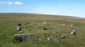
(2) At the stony bed of the Gaztarrietako Erreka stream, climb over a stile, leaving to your left the valley you’ll take on the descent on the way back. Cross over to the Spanish side and arrive at a grassy plateau (1,564 m), where you may wish to take a short break.
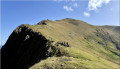
(3) Turn left, following the clear track along the south-western ridge of the Orhy; the climb is steep. Reach the southern outcrop of the Pic d’Orhy and join the normal route path coming from the Port de Larrau.
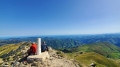
(4) Follow this path to the summit (2,017 m): a vast panorama.
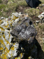
(5) Head right along the summit ridge to the secondary peak, where boundary marker no. 236 is located.
(6) Retrace your steps.
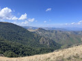
(5) Head straight ahead to descend the spectacular Alupegna ridge (or Alupina, depending on the map) to the Collet d’Alupeña (Alupinako Lepoa, 1,735 m), where the Zazpigain ridge begins. Right next to it is the Brêche d’Alupina. You can stop here for a picnic, comfortably settled in the sun on this flat outcrop with magnificent views.
(7) Descend southwards, on the Spanish side.
(8) Take a hairpin bend to the right and climb a small peak: Alupeña, 1,636 m.
(9) Descend north, then west down the steep gully, following a patchy track: it’s very steep but you can get through anywhere. At the bottom, rejoin the route you took on the way up, at the stream (Gaztarrietako Erreka).
(2) Follow the ascent track in the opposite direction to return to the car park S/E).
 Visorando Member

 Easy
Easy