Montsérieux Ridge from Venterol via the Col du Buissonnet

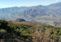
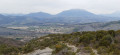
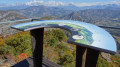
A walk starting from Venterol following the GR®653D (Way of St James) via the Col des Marmets and the Col du Buissonnet. You then climb up the ridge to the summit of Montsérieux, which offers a beautiful panorama of the Durance valley, the Champsaur, the Dévoluy and the Dormillouse massif.

Details

n°46077847
Creation:
Last update:
Last review:
  • Walking
    Activity: Walking
  • ↔
    Distance: 9.71 mi
  • ◔
    Average duration: 6h 30 
  • ▲
    Difficulty: Moderate

  • ⚐
    Back to start: Yes
  • ↗
    Ascent: + 2,313 ft
  • ↘
    Descent: - 2,283 ft

  • ▲
    Highest point: 5,180 ft
  • ▼
    Lowest point: 3,504 ft

Description of the walk

From Tallard, follow the D46, then the D346 and finally the D854 to the village of Venterol. Continue to the car park at the cross-country ski centre (south-east of the village).

(S/E) Return to the village via the Chemin du Pied du Bois, then the Rue de l’Apiculteur (heading north, north-west) and arrive at the junction at No. 92.

(1) Turn left (Chemin du Clos de l’Eau) and follow theGR®653D, heading south-west (the Way of St James) to a clearing at Le Grand Fau.

(2) Leave the path and the tracks branching off to the left, and continue straight on, slightly uphill. Pass close to the Fontaine des Prêtres and continue towards the Col des Marmets.

(3) Cross the Col des Marmets (elevation 1204, TV relay station) and head straight down towards the hamlet.

(4) Cross the hamlet of Les Marmets and follow the small Route du Quinson for 1.2 km towards Urtis. Pass the Ravin de la Combe and then the Ravin de Saint-Maime, ignoring the paths to the left and right, and arrive at the hamlet of Les Garcins.

(5) Continue left for about a hundred metres along a wide track until you reach a fork.

(6) Take the track on the left,the GR®653D, for 300 m (heading east).

(7) A few metres before a left-hand bend, leave the track and take a path on the right which climbs through the forest heading south. After a 200-metre climb, you’ll come to a track; cross it and head for the Col du Buissonnet.

(8) At the pass, leave theGR® and take the long ridge path on the left, which includes a few steep sections. Pass the summit of Serre Brouchon (1,477 m) and then Saint-Sagier (1,482 m) to reach the summit of Les Pluis or Tête Seillon (1,493 m). Continue along the ridge until you reach a track.

(9) Carry on straight ahead along the Crête de Montsérieux path until you reach a hairpin bend on a new track (elevation 1,493 m). Follow this for a short while, then continue along the path that runs along the ridge until you rejoin a forest track.

(10) Head straight on towards the summit of Montsérieux (south).

(11) At the summit, turn back.

(10) Descend to the right onto the forest track, taking five hairpin bends below the ridge, then reach a fork on the ridge (elevation 1,440).

(12) Continue to the right until you reach the next junction of tracks. Then turn left to return to the ridge one last time.

(13) Leave the track and take the PR® path (yellow markings) which branches off to the left (towards Les Faysses – Piégut), passing through a denser forest. Cross the Ruisseau du Grand Vallon and then the Ravin de Piégugier. Take care in winter, as there may be ice and crossing a small frozen waterfall can be dangerous. Reach a turning area and continue for a few metres along the track until you find the start of a path on the left just after the right-hand bend.

(14) Leave the track and take the path branching off to the left, continuing along the PR® route.

(15) Cross a forest track and continue along the path opposite to reach Les Faysses.

(16) At the junction, carry on straight ahead, ignoring the paths branching off to the left and right, and head for the Ravin des Faysses (elevation 1096).

(17) Leave the track on your right and carry on straight ahead (westwards) until you reach the Chemin du Pied du Bois. Carry on straight ahead towards the village of Venterol and the cross-country skiing centre (S/E).

Waypoints

  1. S/E : mi 0 - alt. 3,533 ft - Venterol cross-country ski centre
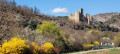
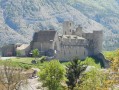
  2. 1 : mi 0.25 - alt. 3,520 ft - Venterol Castle
  3. 2 : mi 0.75 - alt. 3,865 ft - Clearing at Le Grand Fau
  4. 3 : mi 1.45 - alt. 3,970 ft - Col des Marmets (1204m)
  5. 4 : mi 1.85 - alt. 3,783 ft - The hamlet of Les Marmets - Col des Marmets (1204m)
  6. 5 : mi 2.62 - alt. 3,661 ft - Les Garcins
  7. 6 : mi 2.71 - alt. 3,711 ft - Junction at point 1131
  8. 7 : mi 2.98 - alt. 3,799 ft - Junction with GR°°®°°653D - Serre de Malmort
  9. 8 : mi 3.83 - alt. 4,514 ft - Col du Buissonnnet (1380m)
  10. 9 : mi 5.56 - alt. 4,708 ft - Montsérieux Ridge
  11. 10 : mi 6.05 - alt. 5,125 ft - Forest track. Junction. Return to the summit
  12. 11 : mi 6.22 - alt. 5,177 ft - Sommet de Montsérieux (1590m)
  13. 12 : mi 7.43 - alt. 4,711 ft - Point 1440
  14. 13 : mi 7.93 - alt. 4,619 ft - PR® trail along the ridge
  15. 14 : mi 8.62 - alt. 4,262 ft - PR® junction
  16. 15 : mi 8.84 - alt. 4,068 ft - Crossroads at 1,250
  17. 16 : mi 9.16 - alt. 3,806 ft - Les Faysses
  18. 17 : mi 9.37 - alt. 3,602 ft - Ravin des Faysses
  19. S/E : mi 9.71 - alt. 3,533 ft - Venterol cross-country ski centre

Notes

The best views are on the eastern slope of Montsérieux (the summit is a wooded plateau), so it is best to follow the route in the direction described to descend the slope along a wide, panoramic track.

There are a few challenging sections on the Crête de Monsérieux.

Worth a visit

Picnic table in the village of Venterol.

Always be cautious and plan ahead when you're outdoors. Visorando and the author of this route cannot be held responsible for any accidents occurring on this route.

The GR® and PR® markings are the intellectual property of the Fédération Française de Randonnée Pédestre.

Reviews and comments

5 / 5
Based on 1 review

Reliability of the description
5 / 5
Ease of following the route
5 / 5
Route interest
5 / 5
ddier raynal
ddier raynal

Overall rating : 5 / 5

Date of your route : Jun 02, 2025
Reliability of the description : ★★★★★ Very good
Ease of following the route : ★★★★★ Very good
Route interest : ★★★★★ Very good
Very busy route : No

A lovely walk with superb views of the Écrins mountain range and the Durance valley.
Very well-marked route; it’s impossible to go wrong if you follow the GPS track, as there are no signposts on the ridges (though there aren’t really any other options apart from following the path…). A few fairly steep climbs along the ridges.
Otherwise, the route is partly shaded, running alongside meadows in bloom. A break on the bench at Montserieux is a must!

Machine-translated

Other walks in the area

For more walks, use our search engine .

The GPS track and description are the property of this route's author. Please do not copy them without permission.