Summit of Montsérieux via the Crête de la Colle

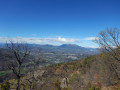
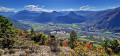
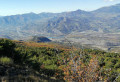
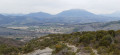
A beautiful walk starting from Piégut with views of the Écrins (to the north), the Ubaye (to the east) and the Dévoluy (to the north-west). The route passes via the Crête de la Colle before climbing to the summit of Montsérieux.

Details

19146816
Creation:
Last update:
Last review:
  • Walking
    Activity: Walking
  • ↔
    Distance: 7.65 mi
  • ◔
    Average duration: 5h 05 
  • ▲
    Difficulty: Moderate

  • ⚐
    Back to start: Yes
  • ↗
    Ascent: + 1,841 ft
  • ↘
    Descent: - 1,854 ft

  • ▲
    Highest point: 5,180 ft
  • ▼
    Lowest point: 3,406 ft

Description of the walk

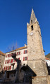
Park in the car park by the church in Piégut.

(S/E) Join the road, turn left to walk past the church and reach a three-way junction.

(1) Keep left towards the Crête de la Colle. Continue straight on along the dirt track, then, at the next three-way junction, turn right and walk for a few dozen metres.

(2) Turn left onto the path between the trees. Climb the fairly steep slope up to the Crête de la Colle.

(3) Turn right towards Les Faysses – Piégut.

(4) Leave thePR® and head straight on along the forest track towards the Sommet de Montsérieux (no signpost).

(5) Begin the actual ascent by turning right. Navigate five hairpin bends before reaching the summit.

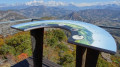
(6) Beautiful views of the Dévoluy and Écrins mountain ranges. After taking in this magnificent panorama, head back down the same route until you rejoin the PR®.

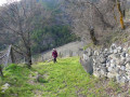
(4) Turn left towards Les Faysses – Piégut, passing through a denser forest. Take care in winter as you’ll be crossing a small waterfall which may be icy.

(7) Leave the forest track and take a small path branching off to the left, continuing along the PR®.

(8) Cross a forest track and go straight on to reach Les Faysses.

(9) Take the path branching off to the right. At the next junction, continue along thePR® by keeping to the right and carry on until you reach the fork at the water collection points.

(10) Keep right onto the PR®.

(2) Go straight on, then turn left to follow the route back along the same path as on the way there until you reach the car park (S/E).

Waypoints

  1. S/E : mi 0 - alt. 3,438 ft - Car park at Piégut Church
  2. 1 : mi 0.16 - alt. 3,409 ft - Crossroads towards Crête de la Colle
  3. 2 : mi 0.37 - alt. 3,478 ft - Les Auches, junction of the circular loop
  4. 3 : mi 1.24 - alt. 4,505 ft - Crête de la Colle
  5. 4 : mi 1.59 - alt. 4,619 ft - Junction for the outward and return routes to the Montsérieux summit
  6. 5 : mi 1.88 - alt. 4,646 ft - Ascent of Montsérieux
  7. 6 : mi 3.11 - alt. 5,180 ft - Sommet de Montsérieux (1590m)
  8. 7 : mi 5.32 - alt. 4,268 ft - Exit onto the forest track
  9. 8 : mi 5.53 - alt. 4,078 ft - Crossing the forest track
  10. 9 : mi 5.86 - alt. 3,799 ft - Les Faysses
  11. 10 : mi 6.8 - alt. 3,632 ft - Water sources
  12. S/E : mi 7.65 - alt. 3,435 ft - Car park at Piégut Church

Notes

From point (2) to point (4), follow the yellowPR® markings. From point (4) to (7), there are no markings; there is just a sign marked ‘Montsérieux’. From point (7), follow the yellow markings again.

Always be cautious and plan ahead when you're outdoors. Visorando and the author of this route cannot be held responsible for any accidents occurring on this route.

The GR® and PR® markings are the intellectual property of the Fédération Française de Randonnée Pédestre.

Reviews and comments

4.7 / 5
Based on 2 reviews

Reliability of the description
5 / 5
Ease of following the route
5 / 5
Route interest
4 / 5
User 9248242

Overall rating : 5 / 5

Date of your route : Apr 14, 2026
Reliability of the description : ★★★★★ Very good
Ease of following the route : ★★★★★ Very good
Route interest : ★★★★★ Very good
Very busy route : No

An easy walk, well worth doing for its magnificent views and lovely stretches through the woods.

Machine-translated

Claraazimut
Claraazimut

Overall rating : 4.3 / 5

Date of your route : Feb 17, 2024
Reliability of the description : ★★★★★ Very good
Ease of following the route : ★★★★★ Very good
Route interest : ★★★☆☆ Average
Very busy route : No

We did this walk with our dogs, going in the opposite direction. The descent we took was quite steep, but apart from that section, there were no difficulties; the path mainly follows the road. The scenery is lovely and the walk is easy.

Machine-translated

Other walks in the area

For more walks, use our search engine .

The GPS track and description are the property of this route's author. Please do not copy them without permission.