Country:

 City:
City:


Between Tallard and Lettret, head towards Venterol and park just before the Durance bridge or just after the motorhome service area.
(S/E) Head south to Rue du Barry. Turn left, cross the bridge, walk past the Centre Médical la Durance, following the red and white markings ofthe GR® 653D to reach the hamlet of Les Boulongeons.
(1) Cross the road at the pedestrian crossing, then turn right; a few hundred metres further on, you’ll find a path on the left, the Chemin de Gastinel.
(2) Leave the road and take this path, which is also theGR®635D. Cross the Torrent de Gustinel. Continue uphill until you reach the Riou Pierroux stream.
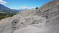
(3) Cross it and take the path that climbs up through the marl and over slabs (which can be slippery when wet). Continue uphill until you reach a junction of several paths, where there is also a high-voltage pylon.
(4) Leave theGR® here and take the most clearly marked track opposite. Continue the climb to reach a lovely viewpoint at the foot of the Tête de Boussac.
(5) Turn right onto the tarmac road and easily reach the hamlet of Les Marmets. Here, rejoin theGR®653D.
(6) Turn sharply left and complete the climb to the Col des Marmets, marked by a TV relay station.
(7) Start a gentle descent opposite, pass close to the Fontaine des Prêtres, then reach the junction with a wider track.
(8) Carry on straight ahead along theGR®, ignoring this track. Continue down the slope to reach the village of Venterol, at the crossroads marked by a cross and a picnic table.
(9) Keep left on theGR® and you’ll soon reach the first junction in the hamlet of Abrachy.
(10) Leave theGR® here and turn 90° to the right, cross the hamlet of Le Villar to reach that of Le Blanchet and cross it.
(11) Take the tarmac lane which descends steeply; at the end of the tarmac, take the path opposite, then another dirt track. After a short climb, you’ll reach the main road. Continue down the tarmac road until you reach a small bridge.
(12) Just after the bridge, turn onto a path and descend in a zigzag, occasionally following a telephone line. At the bottom of this descent, pass under the high-voltage power line again and, 50 m further down, take the path/stream to return to the initial junction you passed on the way there.
(1) Continue in the opposite direction along the same route as on the way there to return to the car park at the Durance bridge (S/E).

 Visorando Member

 Tourist office
 Easy
Easy 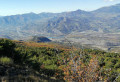

 Association / Club / Walk leader